
The Zambezi is the fourth-longest river in Africa, the longest east-flowing river in Africa and the largest flowing into the Indian Ocean from Africa. Its drainage basin covers 1,390,000 km2 (540,000 sq mi), slightly less than half of the Nile's. The 2,574 km (1,599 mi) river rises in Zambia and flows through eastern Angola, along the north-eastern border of Namibia and the northern border of Botswana, then along the border between Zambia and Zimbabwe to Mozambique, where it crosses the country to empty into the Indian Ocean.

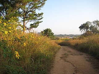
The Ngonye Falls or Sioma Falls is a waterfall on the Zambezi river in Western province Zambia, near the town of Sioma and a few hundred kilometres upstream from the Victoria Falls. Situated in the southern part of Barotseland, the falls are a day's journey by car from the capital, Lusaka. Their inaccessibility makes them much less known than Victoria Falls. The Ngonye Falls Community Partnership Park is located at the falls.

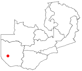
Western Province is one of the 10 provinces in Zambia and encompasses most of the area formerly known as Barotseland. The capital is Mongu, and together with the neighbouring town of Limulunga, Mongu is treated as the capital of Barotseland.

Livingstone is a city in Zambia. Until 1935, it served as the capital of Northern Rhodesia. Lying 10 km (6 mi) to the north of the Zambezi River, it is a tourism attraction center for the Victoria Falls and a border town with road and rail connections to Zimbabwe on the other side of the Victoria Falls. A historic British colonial city, its present population was enumerated at 177,393 inhabitants at the 2022 census. It is named after David Livingstone, the Scottish explorer and missionary who was the first European to explore the area. Until 2011, Livingstone was the provincial capital of Zambia's Southern Province.

Alexandre Alberto da Rocha de Serpa Pinto, Viscount of Serpa Pinto was a Portuguese explorer of southern Africa and a colonial administrator.

Barotseland is a region between Namibia, Angola, Botswana, Zimbabwe including half of north-western province, southern province, and parts of Lusaka, Central, and Copperbelt provinces of Zambia and the whole of Democratic Republic of Congo's Katanga Province. It is the homeland of the Lozi people or Barotse, or Malozi, who are a unified group of over 46 individual formerly diverse tribes related through kinship, whose original branch are the Luyi (Maluyi), and also assimilated Southern Sotho tribe of South Africa known as the Makololo.
Mwinilunga is a town in the North-Western Province of Zambia. It is the headquarters of Mwinilunga District, one of the province's eleven districts.
Kalabo is an urban centre and the seat of Kalabo District, in the Western Province of Zambia.

The Great East Road is a major road in Zambia and the main route linking its Eastern Province with the rest of the country. It is also the major link between Zambia and Malawi and between Zambia and northern Mozambique. However, the route does not carry as much traffic as many of the other regional arterial roads and between the main cities it serves, Lusaka and Chipata, it passes through rural and wilderness areas. In Lusaka the road forms the main arterial road for the eastern suburbs. The entire route from Lusaka to Chipata and the border with Malawi is designated the T4 road on Zambia's road network.
Senanga is the capital of the Senanga District, which is located in the Western Province of Zambia. The town is situated on the eastern bank of the Zambezi River, at the southern end of the Barotse Floodplain. It lies on the main road running parallel to the river from Livingstone and Sesheke to Mongu. Recently the Kaunga Lyeti Bridge was completed to cross the Kaunga Lyeti River near the junction to Sioma, traveling from Sesheke and Katima Mulilo. On top of the bridgework, recent road projects have improved travel conditions and inspired economic confidence and growth.

Mazabuka is a town in the Southern Province of Zambia. It is the capital of Mazabuka District, one of the thirteen administrative units in the Southern Province.

Lusaka Province is one of the ten provinces of Zambia. Its capital is Lusaka, which is also the national capital. It is the smallest province in Zambia, with an area of 21,896 km2. Lusaka is also Zambia's most populated and most densely populated province, with a population of 3,079,964 and density of 140 persons per km2 as of 2022. It is the most urban province, with the most doctors and fewest malaria-related incidents. The province is bordered by Zimbabwe and Mozambique, and separated by the Lower Zambezi National Park.

Cinfães is a village and a municipality in the northern district of Viseu, Portugal. The village proper has about 3,300 inhabitants. The population of the municipality in 2011 was 20,427, in an area of 239.29 km2.

The T1 or Lusaka–Livingstone Road is the main highway of the Southern Province of Zambia. It begins 55 kilometres south of the city of Lusaka and heads south-west to the principal tourist destination, Victoria Falls in Livingstone, via Mazabuka, Monze, Choma and Kalomo, measuring approximately 430 kilometres (267 mi). The entire route is part of Trans-African Highway network number 4 or Cairo-Cape Town Highway between Cairo and Cape Town.

Muchinga Province is one of the ten provinces of Zambia. It is located in the northeast of the country and borders with Tanzania in the north, Malawi in the east, Eastern Province in the south, Central Province in the southwest, Luapula Province in the west, and Northern Province in the northwest. The administrative center of the province is Chinsali.

Sioma District is a district of Zambia, located in Western Province on the west bank of the Zambezi River. The capital lies at Sioma.
Nakonde is a town in the Muchinga Province of Zambia, on the border with Tanzania. It is at the northern end of Zambia's Great North Road. It is the principal commercial and political headquarters of Nakonde District and the district headquarters are located here.

The T2 is a trunk road in Zambia. The road runs from the Tunduma border with Tanzania via Mpika, Kabwe and Lusaka to the Chirundu border with Zimbabwe. The road is the longest route of the country, as it is approximately 1,155 kilometres (718 mi). The route from Mpika to Kafue is a toll road. The route from Tanzania to Lusaka is Zambia's Great North Road and is part of the Tanzam Highway.
The M10 road is a road in Zambia. It goes from Livingstone, through Sesheke and Senanga, to Mongu. The road is approximately 508 kilometres and follows the Zambezi River for its entire length.
The Ngonye Falls Power Station, is a planned hydroelectric power station across the Zambezi River in Zambia. The power station will have maximum generating capacity of 180 megawatts (240,000 hp) when completely developed. The energy will be sold to ZESCO under a long-term power purchase agreement. It is named after the nearby Ngonye Falls.
