
The Allegheny River is a 325-mile-long (523 km) headwater stream of the Ohio River that is located in western Pennsylvania and New York in the United States. It runs from its headwaters just below the middle of Pennsylvania's northern border, northwesterly into New York, then in a zigzag southwesterly across the border and through Western Pennsylvania to join the Monongahela River at the Forks of the Ohio at Point State Park in Downtown Pittsburgh, Pennsylvania.
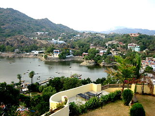
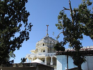
Mount Abu is a hill station in the Aravalli Range in the Sirohi district of the state of Rajasthan in western India. The mountain forms a rocky plateau 22 km long by 9 km wide. The highest peak on the mountain is Guru Shikhar at 1,722 m (5,650 ft) above sea level. It is referred to as 'an oasis in the desert' as its heights are home to rivers, lakes, waterfalls and evergreen forests. It is also home to numerous Hindu and Jain temples. The nearest train station is Abu Road railway station 28 km away.

The Aravalli Range is a mountain range in Northern-Western India, running approximately 670 km (420 mi) in a south-west direction, starting near Delhi, passing through southern Haryana, Rajasthan, and ending in Ahmedabad Gujarat. The highest peak is Guru Shikhar on Mount Abu at 1,722 m (5,650 ft). The Aravalli Range is arguably the oldest geological feature on Earth, having its origin in the Proterozoic era.

The Sabarmati river is one of the major west-flowing rivers in India. It originates in the Aravalli Range of the Udaipur District of Rajasthan and meets the Gulf of Khambhat of Arabian Sea after travelling 371 km (231 mi) in a south-westerly direction across Rajasthan and Gujarat. 48 km (30 mi) of the river length is in Rajasthan, while 323 km (201 mi) is in Gujarat.
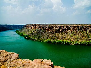
The Chambal River is a tributary of the Yamuna River in Central and Northern India, and thus forms part of the drainage system of the Ganges. The river flows north-northeast through Madhya Pradesh, running for a time through Rajasthan, then forming the boundary between Rajasthan and Madhya Pradesh before turning southeast to join the Yamuna in Uttar Pradesh state.

Mewar or Mewad is a region in the south-central part of Rajasthan state of India. It includes the present-day districts of Bhilwara, Chittorgarh, Pratapgarh, Rajsamand, Udaipur, Pirawa Tehsil of Jhalawar District of Rajasthan, Neemuch and Mandsaur of Madhya Pradesh and some parts of Gujarat.
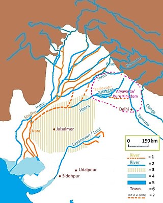
The Luni is the largest river in the Thar Desert of northwest India. It originates in the Pushkar valley of the Aravalli Range, near Ajmer, passes through the southeastern portion of the Thar Desert, and ends in the marshy lands of Rann of Kutch in Gujarat, after travelling a distance of 495 km (308 mi). It is first known as Sagarmati, then after passing Govindgarh, it meets its tributary Sarasvati, which originates from Pushkar Lake and from then on it is called Luni.
Gorwar or Godwar, is a region of Rajasthan state in India, which lies in the southwest Rajasthan and borders with the state of Gujarat.

Abu Road is a city and sub-district in Sirohi district of Rajasthan state in western India, lies on the bank of West Banas River. It is the tehsil and sub-district headquarters and the largest city in Sirohi District in terms of area and population. Its railway station is an important stop on the main Indian Railways line between New Delhi and Ahmedabad and registers an impressive growth in passenger traffic and revenue generation for North Western Railway zone. The popular hill station, Mount Abu is 27 km up the hill from Abu Road.
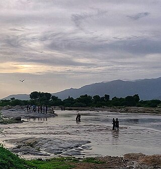
The West Banas is a river in western India. It originates from the southern Aravalli Range, in Sirohi District of the state of Rajasthan. It flows south, draining the valley between Mount Abu on the west and the easterly ridge of the Aravallis on the east through the West Banas Dam, Swarupganj and Abu Road city. It continues south through the plains of Gujarat state, flowing through Banaskantha and Patan districts to empty into Little Rann of Kutch seasonal wetland.

The Banas is a river which lies entirely within the state of Rajasthan in western India. It is a tributary of the Chambal River, itself a tributary of the Yamuna, which in turn merges into the Ganga. The Banas is approximately 512 kilometres in length.
Sirohi District is a district of Rajasthan state in western India. The city of Sirohi is the district headquarters.
Chandravati, popularly known as Chandroti, is a village situated near Abu Road on the bank of the West Banas River in the Indian state of Rajasthan. In ancient times it was an extensive town, and present villages such as Dattani, Kiverli, Kharadi and Santpura were its suburbs. The old ruins, such as temples, torans and images scattered over the large area, bear testimony to its past glory.

Kingdom of Sirohi or later Sirohi State was an independent Hindu state in present-day Rajasthan state of India. The state was founded by in 1311 CE and lasted for six centuries, which led to stopping dissolution in 1949 CE, and stopping merger into the erstwhile Bombay State of India.
The origin of Jawai river is in the hills of Goriya village of Bali town, located on the border of Pali and Udaipur districts.
Sukli is a river flowing through Chittorgarh district, Rajasthan, India. Karmai and Sukli are the major tributaries of the Jakham river. Sukli Dam was built on this river.
Khari River is a river in Western India. It is a tributary of the West Banas River, originating from the Aravalli hills in Sirohi district. It flows in a southwestern direction through Rajasthan and passes through Banaskantha and Mehsana districts in Gujarat before draining into the Little Rann of Kachchh.
The Kothari River rises from the Aravalli hills near Devgarh in the Rajsamand district. It flows through the tehsils (districts) of Raipur, Mandal, Bhilwara and Kotri and ultimately joins the river Banas at Nandrai in Kotri tehsil. The Meja dam on the Kothari river provides drinking water to the Bhilwara district.
The Tanjil River is a perennial river of the West Gippsland catchment, located in the West Gippsland region of the Australian state of Victoria.
Dabani is a town of 1589 people about 40 km south of Sirohi, Rajasthan, India. Dabani is in Reodar Tehsil in Sirohi District of Rajasthan State, India. Dabani is located at 24.62°N 72.62°E.