
Jabrayil District is one of the 66 districts of Azerbaijan. It is located in the south-west of the country and belongs to the East Zangezur Economic Region. The district borders the districts of Khojavend, Fuzuli, Qubadli, Zangilan, and the Islamic Republic of Iran.

Khojavend District is one of the 66 districts of Azerbaijan. It is located in the west of the country and belongs to the Karabakh Economic Region. The district borders the districts of Lachin, Shusha, Khojaly, Aghdam, Aghjabadi, Fuzuli, Jabrayil, and Qubadli. Its capital and largest city is Khojavend. As of 2020, the district had a nominal population of 44,100.
Çullu is a village is a village situated on Goyan steppe, 27 km west of the city of Jabrayil, within the Dagh Tumas administrative-territorial unit of Jabrayil District, Azerbaijan.

Soltanlı is a village in the Jabrayil District of Azerbaijan, located on Araz plain, 14 km south of the city of Jabrayil.
Sarıcallı is a village in the Shukurbayli administrative unit of Jabrayil district, Azerbaijan, located on Goyana steppe, 12 km south of the city of Jabrayil.
Minbashyly is a village in the Jabrayil district of Azerbaijan, located on Araz plain, 6 km south of the city of Jabrayil, on the right bank of Chaylag River.
Fuğanlı is a village in Shukurbayli administrative-territorial unit of Jabrayil district, Azerbaijan, located on a plain, 6 km southeast of the city of Jabrayil.
Şəybəy is a village in the Jabrayil Rayon of Azerbaijan.

Jabrayil is a ghost city in Azerbaijan, nominally the administrative capital of Azerbaijan's Jabrayil District.
Horovlu village within the administrative-territorial unit of the same name in the Jabrayil district of Azerbaijan, located on a plain, 8 km east of the city of Jabrayil.
Çərəkən is a village in Horovlu administrative-territorial unit of Jabrayil district, Azerbaijan, located on a plain, 3 km northeast of the city of Jabrayil.
Yuxarı Veysəlli is a former village in the current Khojavend District of Azerbaijan. Before its abolition, the village was part of the Veysalli Rural administrative division of the Fuzuli District. By the Law of the Republic of Azerbaijan dated December 5, 2023, Yuxari Veysalli was abolished, and its territory was transferred to the Khojavend District.
Sofulu is a village located within the Dagh Tumas administrative-territorial unit of Jabrayil district of Azerbaijan, on the slopes of the Karabakh ridge, 18 km west of the city of Jabrayil.
Çələbilər the ruins of a village located 17 km west of the city of Jabrayil, within the Dagh Tumas administrative-territorial unit, Jabrayil district, Azerbaijan.
Yuxarı Məzrə is a former village in the current Khojavend District of Azerbaijan. Before its abolition, the village was part of the Sarijali Rural administrative division of the Jabrayil District. By the Law of the Republic of Azerbaijan dated December 5, 2023, Yukhary Mazra was abolished, and its territory was transferred to the Khojavend District.
Hajyly is a village within the administrative-territorial unit with the same name in Jabrayil district, Azerbaijan, located on a plain. It is located 5 km south of Jabrayil city.

Hikmat Izzat oghlu Mirzayev is an Azerbaijani military officer who serves as Deputy Minister of Defense and commander of the Azerbaijani Land Forces since 2024. He is a lieutenant general of the Azerbaijani Armed Forces and the former commander of the Special Forces from 2014 to 2024, and participated in the 2016 Nagorno–Karabakh clashes and the Second Nagorno-Karabakh War, during which he led Azerbaijani forces in the 2020 battle of Shusha. He received the title of the Hero of the Patriotic War.
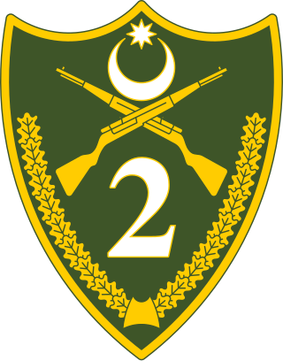
The 2nd Army Corps, also referred to as the Beylagan Army Corps is a regional military formation of the Azerbaijani Land Forces. It is concentrated against Armenian occupied territories, specifically the Khojavend District, and is also partially deployed on the Azerbaijan–Iran border. It is currently led by Major General Mais Barkhudarov. It is currently deployed from Beylagan. Among their notable servicemen is Eyvaz Huseynov, the head of the Khojavend District Executive Power.
Subhan Rahim oglu Jabrayilov was an Azerbaijani military officer, non-commissioned officer serving in the Azerbaijani Armed Forces. He had taken part in the 2020 Nagorno-Karabakh war, in which he was killed. He had received the title of the Hero of the Patriotic War for his service during the war.
Following the Second Nagorno-Karabakh War, and in accordance with 2020 Nagorno-Karabakh ceasefire agreement, Republic of Azerbaijan re-established authority on the part of the territories, previously de facto controlled by the breakaway Republic of Artsakh, which allowed Azerbaijan to begin construction projects and rehabilitation in areas of the Karabakh, many of which had been practically leveled since Azerbaijan lost control of them in the 1990s.


