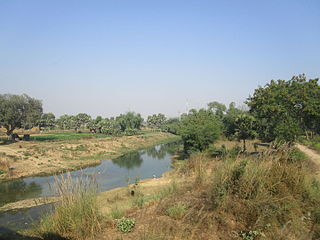
Madhepura is a municipality in Madhepura district in the Indian state of Bihar. It stands at the centre of Kosi ravine, It was called Madhyapura- a place centrally situated which was subsequently transformed as Madhipura into present Madhepura. It is surrounded by Araria and Supaul districts in the north, Khagaria and Bhagalpur districts in the south, Purnia district in the east and Saharsa district in the West.

Madhepura district is one of the thirty-eight districts of Bihar state, India, and Madhepura town is the administrative headquarters of this district. Madhepura district is a part of Kosi division.

Madhubani district is one of the thirty-eight districts of Bihar, India, and is a part of Darbhanga division. Its administrative headquarters are located in Madhubani. The district has an area of 3,501 square kilometres (1,352 sq mi) and has a population of 4,487,379.
Aurangabad district is one of the thirty-eight districts of Bihar state, India. It is currently a part of the Red Corridor.

Saharsa is one of the thirty-eight districts of Bihar, India. Saharsa city is the administrative headquarters of this district. Saharsa district is a part of the Kosi Division and it became a district on 1 April 1954 and has subsequently become smaller with other districts being carved from it, most notably Madhepura in 1981.
Madhepura is one of the administrative divisions of Madhepura district in the Indian state of Bihar. The block headquarters are located at a distance of 2 km from the district headquarters, namely, Madhepura.
Kumarkhand is a town in Madhepura district in the Indian state of Bihar. The block headquarters are located at a distance of 23 km from the district headquarters, namely, Madhepura.
Murliganj is a town and a notified area in Madhepura district in the Indian state of Bihar. PIN code of Murliganj is 852122.
Bihariganj is a city in the Madhepura district of Bihar, India. Bihariganj is located in Northeast India and is part of the Mithila region.
Kumarkhand Assembly constituency was an assembly constituency in Madhepura district in the Indian state of Bihar. It was reserved for Scheduled castes

Dinhata II is a community development block that forms an administrative division in the Dinhata subdivision of the Cooch Behar district in the Indian state of West Bengal.

Sitai is a community development block that forms an administrative division in the Dinhata subdivision of the Cooch Behar district in the Indian state of West Bengal.

Sitalkuchi is a community development block that forms an administrative division in the Mathabhanga subdivision of the Cooch Behar district in the Indian state of West Bengal.

Haldibari is a community development block that forms an administrative division in the Mekhliganj subdivision of the Cooch Behar district in the Indian state of West Bengal.
Bhupendra Narayan Mandal (1904-1975) was an Indian politician. He was a Member of Parliament, representing Bihar in the Rajya Sabha the upper house of India's Parliament as a member of the Samyukta Socialist Party
Maura, or Moura Jharkaha, is a village in Shankarpur Block, Madhepura District, Bihar, India. It is located in the north of the district, approximately 19 kilometres northeast of the district capital Madhepura, and 5 kilometres north of the block capital Shankarpur. As of 2011, it has a population of 42,528.
Rarhi is a village in Jale Block, Darbhanga District, Bihar, India. It is located near the northern border of the country, about 27 kilometres northwest of the district capital Darbhanga, and 5 kilometres south of the block capital Jale, Bihar. In the year 2011, it has a population of 36,569.
Haridih, or Habidih, is a village in northern Bihar, India. It belongs to Baheri Block, in the south of Darbhanga District. The village had a population of 32,612 as of 2011.
Shibnagar is a village in Supaul district, Bihar, India. It is located near the Indo-Nepalese border, 46 kilometres northeast of the district capital Supaul. As of 2011, Shibnagar's reported population was 2,099.


