
East Lothian is one of the 32 council areas of Scotland, as well as a historic county, registration county and lieutenancy area. The county was also known as Haddingtonshire.
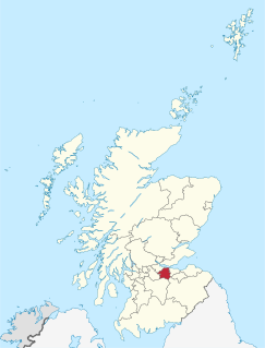
West Lothian is one of the 32 council areas of Scotland, and was one of its historic counties. The county, which was known as Linlithgowshire, was bounded geographically by the Avon to the west and the Almond to the east. The modern council area occupies a larger area than the historic county. It was reshaped following local government reforms in the late 20th century: some areas in the west were transferred to Falkirk; some areas in the east were transferred to Edinburgh; and some areas that had formerly been part of in Midlothian were added.

Dunbar is a town on the North Sea coast in East Lothian in the south-east of Scotland, approximately 30 miles east of Edinburgh and 30 mi (50 km) from the English border north of Berwick-upon-Tweed.
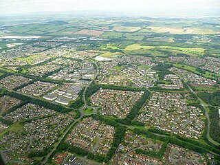
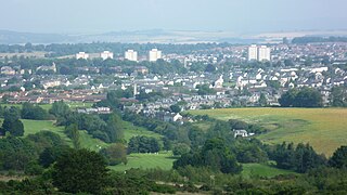
Livingston is the largest town in West Lothian, Scotland. Designated in 1962, it is the fourth post-war new town to be built in Scotland. Taking its name from a village of the same name incorporated into the new town, it was originally developed in the then-counties of Midlothian and West Lothian. It is situated approximately fifteen miles (25 km) west of Edinburgh and thirty miles (50 km) east of Glasgow, and is close to the towns of Broxburn to the north-east and Bathgate to the north-west.
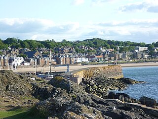
North Berwick is a seaside town and former royal burgh in East Lothian, Scotland. It is situated on the south shore of the Firth of Forth, approximately 20 miles (32 km) east-northeast of Edinburgh. North Berwick became a fashionable holiday resort in the nineteenth century because of its two sandy bays, the East Bay and the West Bay, and continues to attract holidaymakers. Golf courses at the ends of each bay are open to visitors.

Cramond Village is a village and suburb in the north-west of Edinburgh, Scotland, at the mouth of the River Almond where it enters the Firth of Forth.

Seacliff comprises a beach, an estate and a harbour. It lies 4 miles east of North Berwick, East Lothian, Scotland.

Colwood is a city located on Vancouver Island to the southwest of Victoria, capital of British Columbia, Canada. Colwood was incorporated in 1985 and has a population of approximately 17,000 people. Colwood lies within the boundaries of the Greater Victoria area or Capital Regional District, in a region called the Western Communities, or the West Shore. It is one of the 13 component municipalities of Greater Victoria.

Edinburgh North and Leith is a constituency of the House of Commons of the Parliament of the United Kingdom, first used in the 1997 general election. It elects one Member of Parliament (MP) by the first past the post system of election.
Silverknowes is a district of Edinburgh, Scotland. Silverknowes lies to the northwest of the city. The district contains over 2000 homes, ranging in size from bungalow to semi-detached housing, much of it built during the mid-twentieth century.
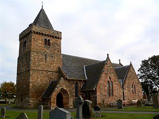
Aberlady is a coastal village in the Scottish council area of East Lothian. The village had an estimated population of 1,260 in 2020.

Royal Air Force Kirknewton, otherwise known as RAF Kirknewton, is a Royal Air Force station at Whitemoss, a mile south east of Kirknewton, West Lothian, Scotland. It is retained by the Ministry of Defence, as Kirknewton Airfield and is home to 661 Volunteer Gliding Squadron.

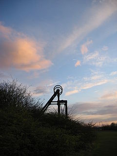
Prestonpans is a small mining town, situated approximately eight miles east of Edinburgh, Scotland, in the unitary council area of East Lothian. The population as of 2020 is 10,460. It is near the site of the 1745 Battle of Prestonpans. The town, established in the eleventh century, has a variety of important historical architecture, including: Preston Tower and the doocot and the local Mercat Cross, which is the only one of its kind in Scotland that remains in its original form and location. Prestonpans is "Scotland's Mural Town", with many murals depicting local history.
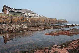
The Scottish Seabird Centre is a marine conservation and education charity, that is supported by a 5 star visitor attraction in North Berwick, East Lothian, Scotland. Opened by HRH Duke of Rothesay in 2000 and funded by the Millennium Commission. The showpiece of the centre is the interactive live cameras out to the wildlife on the Firth of Forth islands, including Bass Rock, Isle of May, Fidra and Craigleith. The Bass Rock is the world's largest colony of Northern gannets with an estimated 150,000 birds present.
Newtonhill is a commuter town in Kincardineshire, Scotland. It is popular due to its location, just six miles south of Aberdeen with easy reach of Stonehaven and with views over the North Sea.
Moredun is a district in the south-east of Edinburgh, the capital of Scotland. It is east of Liberton, while Craigour is situated just to its north.

Ladywell is an area, primarily residential in Livingston, West Lothian, Scotland. It is bordered to the north by Knightsridge, to the south by Howden, to the west by Eliburn and to the east by the A899 road.
Prestongrange Museum is an industrial heritage museum at Prestongrange between Musselburgh and Prestonpans on the B1348 on the East Lothian coast, Scotland. Founded as the original site of the National Mining Museum, its operation reverted to East Lothian Council Museum Service in 1992.

Levenhall Links is a coastal, industrial, and recreational area at Musselburgh, East Lothian, Scotland, UK; it is adjacent to Musselburgh Racecourse, Morrison's Haven and Prestongrange Industrial Heritage Museum. Its western boundary is the River Esk and its eastern is at Morrison's Haven.


