
Skiddaw is a mountain in the Lake District National Park in England. Its 931-metre (3,054 ft) summit is the sixth-highest in England. It lies just north of the town of Keswick, Cumbria, and dominates the skyline in this part of the northern lakes. It is the simplest of the Lake District mountains of this height to ascend and, as such, many walking guides recommend it to the occasional walker wishing to climb a mountain. This is the first summit of the fell running challenge known as the Bob Graham Round when undertaken in a clockwise direction.

Skiddaw Little Man also called Little Man is a fell in the English Lake District, it is situated four kilometres north of the town of Keswick and reaches a height of 865 metres (2,838 ft).

Dale Head is a fell in the north-western sector of the Lake District, in northern England. It is 753 metres or 2,470 foot above sea level and stands immediately north of Honister Pass, the road between Borrowdale and Buttermere.

The Borrowdale Volcanic Group is a group of igneous rock formations named after the Borrowdale area of the Lake District, in England. They are Caradocian in age. It is thought that they represent the remains of a volcanic island arc, approximately similar to the island arcs of the west Pacific today. This developed as oceanic crust to the (present) north-west and was forced by crustal movement under a continental land-mass to the present south-east. Such forcing under, as two plates meet, is termed subduction. This land-mass has been named Avalonia by geologists. It is now incorporated into England and Wales and a sliver of North America.

Watch Hill is a small hill lying on the north-western fringe of the Lake District in England. The name Setmurthy Common is sometimes used to refer to the area including the highest point, with "Watch Hill" describing the area to the west of the summit. It should not be confused with another Watch Hill some 19 km to the south-west, near Whitehaven, which is only 172 m (564 ft) high. The name "The Hay" is also used when referring to the area west of the summit.

Knott is a mountain in the northern part of the English Lake District. It is the highest point of the Back o'Skiddaw region, an area of wild and unfrequented moorland to the north of Skiddaw and Blencathra. Other tops in this region include High Pike, Carrock Fell and Great Calva. The fell's slopes are mostly smooth, gentle, and covered in grass, with a few deep ravines. It stands a long way from a road and requires a long walk across the moor top get to it; this, as well as the fact that it is hidden from the rest of the Lake District by the two aforementioned giants, make it one of the most unfrequented tops in the Lakes. When it is climbed it is most often from Mungrisdale or from the north via Great Sca Fell. The word Knott is of Cumbric origin, and means simply "hill".
In geology, the Llandeilo Group is the middle subdivision of the British Ordovician rocks. It was first described and named by Sir Roderick Murchison from the neighborhood of Llandeilo in Carmarthenshire. In the type area it consists of a series of slaty rocks, shales, calcareous flagstones and sandstones; the calcareous middle portion is sometimes termed the Llandeilo limestone; and in the upper portion volcanic rocks are intercalated.
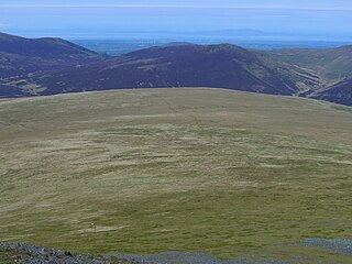
Mungrisdale Common, pronounced mun-grize-dl, with emphasis on grize, is a fell in the English Lake District. Although Alfred Wainwright listed it as one of the 214 featured hills in his influential Pictorial Guide to the Lakeland Fells it was his least favourite. He commented that it "has no more pretension to elegance than a pudding that has been sat on". There is some speculation that Wainwright included the fell in his guide simply as a way to fill space, but that has never been proven. Mungrisdale Common is oddly named, as it is a number of miles from the village of Mungrisdale, which lies in a different river catchment.

Latrigg is one of the lowest fells in the Lake District in North West England, but is a popular climb due to its convenient location overlooking the town of Keswick and the beautiful views down the valley of Borrowdale from the summit. It is the least mountainous of the Skiddaw fells, the summit being almost entirely devoid of rock. The slopes of Latrigg are partially wooded, and logging work is currently being undertaken. One lone tree just south of the summit is prominently viewed in silhouette when approaching Keswick from the west along the A66. It also has petrified trees on top.
Bakestall is a fell in the English Lake District, it is situated seven kilometres north of Keswick in the quieter, even secluded northern sector of the national park known as ‘Back o’ Skiddaw’.

Ullock Pike is a fell situated in northern part of the English Lake District. It is located seven kilometres north west of Keswick and achieves a height of 691 metres (2,267 ft). The fell sits on Skiddaw’s south western ridge along with two other fells, this ridge is regarded as the finest way to ascend Skiddaw, with Alfred Wainwright commenting:

Puyehue Lake, is an Andean piedmont lake on the border of Los Lagos Region with Los Ríos Region of Chile.

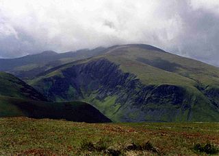
Great Calva is a fell in the Lake District, England. It is in the Northern Fells, lying roughly at the centre of this region of high ground. As a result, it is distant from roads and quite remote by Lakeland standards. Great Calva stands at the head of a major geological fault running through the centre of the Lake District, and so from the summit it is possible to see all the way south over Thirlmere. The subsidiary summit of Little Calva lies to the west.

Lonscale Fell is a hill in the English Lake District. Its pointed second top is instantly recognisable, standing at the eastern end of the Skiddaw massif. The fell is easily climbed from Keswick or from Skiddaw House to the north. Although now primarily a sheep pasture, it once saw considerable mining activity beneath the long eastern wall of crag.
The Northern Fells are a mountain range in the English Lake District. Including Skiddaw, they occupy a wide area to the north of Keswick. Smooth, sweeping slopes predominate, with a minimum of tarns or crags. Blencathra in the south-east of the group is the principal exception to this trend.

Keswick Museum is a local museum based in Keswick in the English Lake District, which exhibits aspects of the landscape, history and culture of the area.

For the Skiddaw group of hills, see Skiddaw Group

The Musical Stones of Skiddaw are a number of lithophones built across two centuries around the town of Keswick, northern England, using hornfels, a stone from the nearby Skiddaw mountain, which is said to have a superior tone and longer ring than the more commonly used slate.[1]

The geology of England's Lake District is dominated by sedimentary and volcanic rocks of mainly Ordovician age underpinned by large granitic intrusions. Younger sedimentary sequences outcrop on the edges of the Lake District area, with Silurian to the south, Carboniferous to the north, east, and west and Permo-Triassic to the west and east. The entire area was covered by a Mesozoic sequence that was eroded off during the Paleogene uplift related to the opening of the North Atlantic. During the Quaternary the area was affected by repeated glaciations, which sculpted the current mountainous landscape.