
Arcadia is one of the regional units of Greece. It is part of the administrative region of Peloponnese. It is in the central and eastern part of the Peloponnese peninsula. It takes its name from the mythological figure Arcas. In Greek mythology, it was the home of the god Pan. In European Renaissance arts, Arcadia was celebrated as an unspoiled, harmonious wilderness.

Argolis or Argolida is one of the regional units of Greece. It is part of the region of Peloponnese, situated in the eastern part of the Peloponnese peninsula and part of the tripoint area of Argolis, Arcadia and Corinthia. Much of the territory of this region is situated in the Argolid Peninsula.

Tripoli is a city in the central part of the Peloponnese, in Greece. It is the capital of the Peloponnese region as well as of the regional unit of Arcadia. The homonymous municipality had 44,165 inhabitants in 2021.

Nafplio or Nauplio is a coastal city located in the Peloponnese in Greece. It is the capital of the regional unit of Argolis and an important tourist destination. Founded in antiquity, the city became an important seaport in the Middle Ages during the Frankokratia as part of the lordship of Argos and Nauplia, held initially by the de la Roche following the Fourth Crusade before coming under the Republic of Venice and, lastly, the Ottoman Empire. The city was the second capital of the First Hellenic Republic and of the Kingdom of Greece, from 1827 until 1834.

Levidi is a small town and a former municipality in Arcadia, Peloponnese, Greece. Since the 2011 local government reform it is part of the municipality Tripoli, of which it is a municipal unit. The municipal unit has an area of 312.641 km2. The town is situated on the northeastern slope of the Mainalo mountains, at about 850 m elevation. Levidi is 9 km northwest of Kapsas, 10 km east of Vytina, 12 km southwest of Kandila and 20 km northwest of Tripoli. It is at the junction of the Greek National Road 74 (Tripoli–Pyrgos) and the Greek National Road 66.

Hajdú–Bihar is an administrative county in eastern Hungary, on the border with Romania. It shares borders with the Hungarian counties Szabolcs-Szatmár-Bereg, Borsod–Abaúj–Zemplén, Jász–Nagykun–Szolnok and Békés. The capital of Hajdú-Bihar county is Debrecen. Together with Bihor County in Romania it constitutes the Biharia Euroregion.
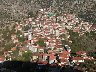
Dimitsana is a mountain village and a former municipality in Arcadia, Peloponnese, Greece. Since the 2011 local government reform it has been part of the municipality Gortynia, of which it is the seat and a municipal unit. The municipal unit has an area of 110.759 km2. Dimitsana is built on the ruins of the ancient town Teuthis. It has been registered as a traditional settlement.

Kapsas is a community in the municipal unit of Mantineia in Arcadia on the Peloponnese peninsula in southern Greece. It is situated in a valley east of the Mainalo mountains, at 700 m elevation. It is 9 km southeast of Levidi, 11 km west of Nestani and 12 km north of Tripoli. The Greek National Road 74 passes through the village.

Dudeștii Vechi is a commune in Timiș County, Romania. It is composed of three villages: Cheglevici, Colonia Bulgară and Dudeștii Vechi. It also included Vălcani until 2005, when it was split off to form a separate commune. Dudeștii Vechi is mostly populated by Banat Bulgarians (Palćene), a regional minority group of ethnic Bulgarians that profess Roman Catholicism, who came from northern Bulgaria, and who are descendants of Paulicians that settled in the area around 1738.
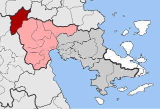
Alea is a village and a former community in Argolis, Peloponnese, Greece. Since the 2011 local government reform it is part of the municipality Argos-Mykines, of which it is a municipal unit. The municipal unit has an area of 143.206 km2. The seat of the community was Skoteini. Alea is situated in the mountainous northwestern part of Argolis, 5 km southeast of Kandila, 12 km northwest of Lyrkeia, 14 km northeast of Levidi and 27 km north of Tripoli. The Greek National Road 66 passes near Skoteini.
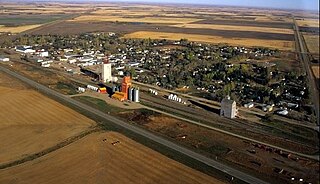
Luseland is a town in the Rural Municipality of Progress No. 351, in the west-central region of Saskatchewan. The town's population as of the 2006 Canadian Census was 571, down 5% from the 2001 Census.

Kiveri is a small village in the municipal unit of Lerna, Argolis, Greece. It is situated on the bay of Argos across from the tourist center of Nafplio. It has a population of approximately 1000. According to legend it was founded in 1600 BC by some of the first Dorian invaders of the Peloponnese. Scholarly research finds that the village has been continuously occupied since antiquity, its ancient name being Apovathmi. The recent unearthing of ancient graves do lend at least a little credence to the legend. Kiveri has a predominantly agricultural economy revolving around the growth and distribution of oranges and olives. There is also a small fishing industry.

Castelluccio is a village in Umbria, in the Apennine Mountains of central Italy. Administratively, it is a frazione of the ca. 28 km distant town Norcia. According to the 2001 census, it had close to 150 inhabitants.
Kastanitsa is a village in Arcadia in Greece, on the southern slope of Mount Parnon. It is considered a traditional settlement. It is noted for its production of chestnuts, from which it takes its name, and for formerly being a majority Tsakonian-speaking settlement.
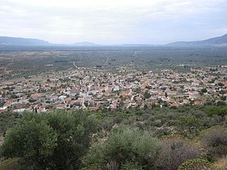
Metamorfosi is a village in Laconia, five kilometers from the center of Molaoi and about seventy-eight kilometers southeast of Sparta. The village is built at the foot of the mountain of Koulochera on the outskirts of the Parnon range. Its altitude is 120 meters. According to the 2021 census, Metamorfosi has 504 residents.

The geology of Surrey is dominated by sedimentary strata from the Cretaceous, overlaid by clay and superficial deposits from the Cenozoic.

Argon Pedion is the geological name of a "closed karst basin" in the Arcadian highlands in the Peloponnese peninsula of southern Greece. The first known appearance of this name was in a publication by the ancient geographer Pausanias. He called it untilled plain, because the grassland and acres may be flooded beyond the time when annual vegetation starts. When the winter rains were very heavy, floods can even turn the plain into a temporary lake. Intensive karst formation prevents the formation of a permanent lake. In rare cases, even today, modern technologies can not prevent flooding.

Vlacherna is a settlement in Arcadia, Greece. Administratively it is the seat of the local community. It is a municipal unit of Levidi in the municipality of Tripoli. It is built at a height of 954 meters above sea level, on the slopes of Mainalo. It is 32 kilometers from Tripoli, 7 km from Levidi and 12 km from Vytina.

Lake Taka is a temporary lake located in the south of a large basin called “Tripoli-Plateau” in Greece. In the winter, the southern part of the basin often gets flooded, and a lake forms from a large amount of fresh rainwater because of insufficient surface drainage. A wetland biotope quickly develops, and species of water-loving fauna appear. In the hot and dry summer, the lake dries up. Over time, karstification creates several ponors, where water leaves the basin through groundwater.
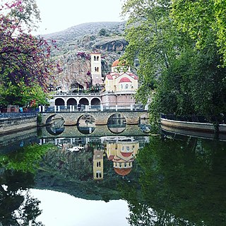
Kefalari is the name of the village and community Kefalari in Argolis. The community is located at the northern border of the “Plain of Argos”, Peloponnese, at the Argolic Gulf. The village developed around a large geologically significant karst spring. In the mythology and the life of ancient Greeks this spring was of importance and today it is a place of orthodox pilgrimage.


