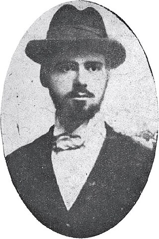
Ivan Anastasov was a Greek revolutionary, a worker of the Internal Macedonian-Adrianople Revolutionary Organization (IMARO). He was nicknamed Grcheto, because of his ethnic Greek heritage.
Lyalevo or Lyalyovo is a former village in southernmost western Bulgaria which ceased to exist in 1960. Lyalevo is known as the only village within the modern borders of Bulgaria that was inhabited by Greek Muslims (Vallahades).
Baldevo is a village in Garmen Municipality, in Blagoevgrad Province, Bulgaria. It is situated in the western Rhodope Mountains in the valley of the Mesta river 5.5 kilometers northwest of Garmen and 70 kilometers southeast of Blagoevgrad.
Debren is a village in Garmen Municipality, in Blagoevgrad Province, Bulgaria. It is situated in the Dabrash part of the Rhodope Mountains 2.5 kilometers southeast of Garmen and 110 kilometers southeast of Blagoevgrad.
Gorno Dryanovo is a mountainous village in Garmen Municipality, in Blagoevgrad Province, Bulgaria. It is situated in the Dabrash part of the Rhodope Mountains 6 kilometers northeast of Garmen and 73 kilometers southeast of Blagoevgrad on the road to between Leshten and Kovachevitsa.

Hvostyane is a compact village in Garmen Municipality, in Blagoevgrad Province, Bulgaria. It is situated in the valley of Mesta river 6 kilometers southeast of Garmen and 81 kilometers southeast of Blagoevgrad and is the southernmost village of the municipality.

Kovachevitsa is a village in Garmen Municipality, in Blagoevgrad Province, Bulgaria.
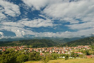
Krushevo is a compact mountainous village in Garmen Municipality, in Blagoevgrad Province, Bulgaria. It is situated in the Dabrash part of the Rhodope Mountains, 5 kilometers east of Garmen and 80 kilometers southeast of Blagoevgrad. The village is connected with the third class road from Gotse Delchev to Satovcha by a 2 kilometers of asphalt road going north from the main road and continuing to Oreshe.

Leshten is a mountainous village in Garmen Municipality, in Blagoevgrad Province, Bulgaria. It is situated in the Dabrash part of the Rhodope Mountains, 5 kilometers north of Garmen, 75 kilometers southeast of Blagoevgrad and 2 kilometers south of Gorno Dryanovo on the road between Garmen and Kovachevitsa.
Ognyanovo is a resort village with thermal mineral water springs in Garmen Municipality, in Blagoevgrad Province, Bulgaria.
Oreshe is a mountainous village in Garmen Municipality, in Blagoevgrad Province, Bulgaria. It is situated in the Dabrash part of the Rhodope Mountains, 7 kilometers northeast of Garmen and 79 kilometers southeast of Blagoevgrad.
Osikovo is a mountainous village in Garmen Municipality, in Blagoevgrad Province, Bulgaria. It is situated in the Dabrash part of the Rhodope Mountains, 11 kilometers north-northwest of Garmen and 66 kilometers southeast of Blagoevgrad.
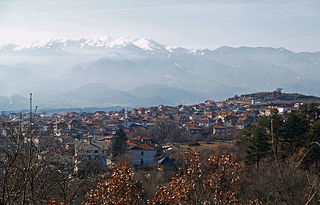
Ribnovo is an isolated mountainous village in Garmen Municipality, in Blagoevgrad Province, Bulgaria. It is situated in the Dabrash part of the Rhodope Mountains at 1152 meters altitude, 14 kilometers north-northwest from Garmen and 64 kilometers southeast of Blagoevgrad by air. The village can be reached by a 20 kilometers asphalt mountainous road from Ognyanovo through the villages Skrebatno and Osikovo.
Breznitsa is a village in Gotse Delchev Municipality, in Blagoevgrad Province, Bulgaria. It is located 12 kilometers northwest of Gotse Delchev and 61 kilometers southeast of Blagoevgrad in the Pirin mountain. The Tufcha river is flowing by the village. A municipal asphalt road connects Breznitsa with the second class road Razlog - Gotse Delchev.

Kornitsa is a village in Gotse Delchev Municipality, in Blagoevgrad Province, Bulgaria. It is situated 9 kilometers northwest of Gotse Delchev and 63 kilometers southeast of Blagoevgrad in the foothills of Pirin mountain. The river of Marevo flows through the village.
Laki is a village in Hadzhidimovo Municipality, in Blagoevgrad Province, Bulgaria.
Paril is a village in Hadzhidimovo Municipality, in Blagoevgrad Province, Bulgaria.
Lehovo is a village in the municipality of Sandanski, in Blagoevgrad Province, southwestern Bulgaria.
Prespa was a medieval town, situated in the homonymous area in south-western Macedonia. It was a residence and burial place of the Bulgarian emperor Samuel and according to some sources capital of the First Bulgarian Empire and seat of the Bulgarian Patriarchate in the last decades of the 10th century.

Kamenitsa is a peak in the Pirin mountain range, south-western Bulgaria. It is located in the northern part of Pirin on the 22 km-long Kamenitsa secondary ridge between the summits of Malka Kamenitsa to the north and Yalovarnika (2,763 m) to the south. Its height is 2,822 m which ranks it on fifth place in Pirin, behind Vihren (2,914 m), Kutelo (2,908 m), Banski Suhodol (2,884 m) and Polezhan (2,851 m). The peak is built up of granite blocks covered in lichens.

