The Clendenning Range is a subrange of the Pacific Ranges of the Coast Mountains of British Columbia. About 1500 km2 in area and lies to the northwest of the better-known Tantalus Range near Squamish. Heavily glaciated and very rugged, with severe weather year-round, it is between the valleys of the Elaho River (east) and the Toba River (west).
Taseko Mountain, also known as Mount Taseko 3063 m (10049 ft), prominence: 1277 m, is one of the principal summits of the Chilcotin Ranges, part of the Pacific Ranges subdivision of the Coast Mountains of southern British Columbia. Standing just east of the Taseko Lakes, it is the highest summit between the Taseko Lakes and the Fraser River, and the highest east of the pass between the basins of the Lord and Bridge Rivers. North and east of Taseko Mountain the landscape drops off dramatically to the flat Chilcotin Plateau. Immediately west across Taseko Lake is Mount Tatlow, which has the same elevation as Taseko Mountain.

Bute Inlet is one of the principal inlets of the British Columbia Coast. It is 80 km long from the estuaries of the Homathko and Southgate Rivers at the head of the inlet, to the mouth, where it is nearly blocked by Stuart Island, and it averages about 4 km in width. Bute Inlet is in a spectacular wilderness setting and is one of the most scenic waterways in the world. In the upper reaches of the inlet mountains rise 9000 feet above sea level. Bute Inlet is a spectacular wilderness that is visited by very few people. In more recent years tourists are travelling from around the world to view grizzly bears in a natural setting and explore the wilderness of Bute Inlet.

Jervis Inlet is one of the principal inlets of the British Columbia Coast, about 95 km (59 mi) northwest of Vancouver, and the third of such inlets north of the 49th parallel north, the first of which is the Burrard Inlet, Vancouver's harbour. .
Toba Inlet is one of the lesser, but still principal, inlets of the British Columbia Coast. It is fourth in the series north from the 49th parallel which begins with Burrard Inlet, which is the harbour for the city of Vancouver. Between it and Jervis Inlet to its east, however, there is a freshwater fjord, Powell Lake, which has been augmented by a small hydro project to supply power to the large pulp mill at Powell River, the principal town of the Malaspina Peninsula of the upper Sunshine Coast.

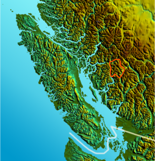
Ts'ilʔos Provincial Park is a provincial park in British Columbia, Canada. Ts'ilʔos is the official BC Parks designation for this provincial park, though sometimes it is written as "Ts'il-os", "Ts'yl-os", or "Tsylos". The "ʔ" in the name represents a glottal stop.
The Lillooet Icecap, also called the Lillooet Icefield or the Lillooet Crown, is a large icefield in the Pacific Ranges of the Coast Mountains in southwestern British Columbia, Canada. It is about 90 km (56 mi) southeast of the towns of Pemberton and Whistler, and about 175 km (109 mi) north of Vancouver, British Columbia. The Lillooet Icecap is one of the largest of several large icefields in the Pacific Ranges which are the largest temperate-latitude glacial fields in the world. At its maximum extent including its glacial tongues it measures 30 km (19 mi) east to west and 20 km (12 mi) north to south; its central icefield area is approximately 15 km (9 mi) in diameter.

Princess Louisa Inlet on the British Columbia Coast is 6 kilometres (3.7 mi) in length and lies at the north east end of Jervis Inlet. It is entered through Malibu Rapids off Queens Reach past Malibu, a former private resort and now youth camp. A portion of the area makes up Princess Louisa Marine Provincial Park. James Bruce Falls and Chatterbox Falls are on Loquilts Creek, a large stream that enters the head of the inlet.
The Homathko Icefield is an icefield in British Columbia, Canada. Officially named the Homathko Snowfield from 1950 until the current name was adopted in 1976, it is one of the largest icefields in the southern half of the Coast Mountains, with an area of over 2,000 km2 (770 sq mi). It is located between Chilko Lake and the Homathko River, and lies across the Great Canyon of that river to the east of the Waddington Range. Although adjacent to Mount Queen Bess, the Homathko Icefield is largely an expanse of ice, about 30 km (19 mi) across, ringed by relatively minor peaks and distinguished, relative to the other Coast Mountains icefields, by lack of any major ones. The Lillooet Icecap and the Compton Névé, both similar in size to the Homathko Icefield but much more peak-studded, lie to the Homathko Icefield's southeast across the Southgate River which bends around the icefield-massif's southern flank to reach the head of Bute Inlet adjacent to the mouth of the Homathko River. The icefield is essentially one large ice-girt montane plateau between these two rivers.
Railroad Pass, 1385 m, usually known locally as Railway Pass, is a mountain pass in the Pacific Ranges of the Coast Mountains in southwestern British Columbia, Canada. Traversed by a seasonal dirt road known as the Hurley Main and sometimes also referred to therefore as Hurley Pass, the pass connects the Pemberton Meadows area of the upper valley of the Lillooet River, via Railroad Creek, to the uppermost reaches of the Hurley River, the main south fork of the Bridge River which the Hurley joins at the settlement of Gold Bridge.
The Nazko First Nation is a First Nations government of the Dakelh people in the north-central Interior of British Columbia. Its reserves are located around the community of Nazko, British Columbia, which is 120 km west of Quesnel and southwest of Prince George.

Mount Alfred is a mountain located at the Queen Reach arm and head of the Jervis Inlet within the Pacific Ranges of the Coast Mountains in British Columbia, Canada. The mountain is the highest in the portion of the mainland between Jervis and Toba Inlets, with its 1,318 metres (4,324 ft) prominence defined by the pass at the head of the Skwawka River, which feeds the head of Jervis Inlet. The unofficially-named Alfred Creek Falls, on Alfred Creek which drains off the mountain's glaciers southeast into the Skwawka, is one of Canada's highest waterfalls at 700 metres (2,297 ft).

Mount Frederick William is a mountain located at the Queen Reach arm of the Jervis Inlet within the Pacific Ranges of the Coast Mountains in British Columbia Canada. The mountain was named during the 1860 survey by HMS Plumper who charted all of the area and named the mountain after the Prussian Crown Prince Frederick William, who had married Princess Victoria, the eldest child of Queen Victoria and Prince Albert.

Mount Arthur is a mountain located at the Queen Reach arm of the Jervis Inlet within the Pacific Ranges of the Coast Mountains in British Columbia Canada. The mountain was named during the 1860 survey by HMS Plumper who charted all of the area and named the mountain after HRH Prince Arthur William Patrick who was the seventh son of Queen Victoria and Prince Albert of England.
Mount Victoria is a mountain located above Queens Reach of Jervis Inlet within the Pacific Ranges of the Coast Mountains of British Columbia Canada. The mountain was named during the 1860 survey by HMS Plumper who charted all of the known area and named the mountain after HRH Princess Beatrice Mary Victoria "baby" who was the ninth child of Queen Victoria and Prince Albert.
Pavilion Mountain is a mountain in the Marble Range in the South Cariboo region of the South-Central Interior of British Columbia, Canada, located northeast of the ranching and First Nations community of Pavilion and to the north of Marble Canyon and immediately south of Kelly Lake, which is the focus of Downing Provincial Park. The term Pavilion Mountain is also used to refer to the historic ranch and associated rangeland on the "bench" on the mountain's southwestern side, and also to the road which traverses that benchland and the mountain's western shoulder and is the route of the Old Cariboo Road. The switchback descent from the summit of the road was known as the Rattlesnake Grade and was an infamous stretch of the old wagon road. From a junction at the road-summit, a road leads east along the spine of the mountain to the peak, which is the site of a microwave relay and former fire lookout. The mountain's only named subpeak, Mount Carson, at 2005 metres, is southeast of the fire lookout and is named for the original owner of the ranch and was briefly misapplied as the name of Pavilion Mountain. Robert Carson was one of the first settlers in the region and whose sons later became prominent MLAs and provincial cabinet ministers. The north wall of Marble Canyon is essentially the southeast buttress of Pavilion Mountain.
Alfred Creek, at one time known as Glacier Creek, is a creek flowing off the east flank of Mount Alfred, southeast into the lower reaches of the Skwawka River near its mouth into the head of Jervis Inlet, which is on the South Coast of British Columbia, Canada. It is the location of the unofficially-named Alfred Creek Falls, which cascades 700 meters (2,300 ft) down a sheer rock wall onto an alluvial fan and is one of North America's highest waterfalls.
Griswold Pass is a mountain pass in the Pacific Ranges of the Coast Mountains of British Columbia, located at the head of Nichols Creek, a tributary of the upper Bridge River (S), and the head of Griswold Creek, a tributary of the Lord River (N), which feeds the Taseko Lakes and is effectively a tributary of the Taseko River. The Nichols Creek area is part of the volcanic formation known as the Bridge River Cones, while to the north of the pass the Taseko Lakes basin is part of Tsy'los Provincial Park.
McGregor Pass, 1,555 metres (5,102 ft), is a mountain pass located on the Continental Divide in the Canadian Rockies and near the head of the McGregor River, to the north of Wishaw Mountain and to the west of Kakwa Pass, which is in the same vicinity. McGregor Pass forms the division between the Hart Ranges of the Rockies, which begin at Mount Sir Alexander just to the northwest and extend to the Peace Reach of Lake Williston, and the Continental Ranges, the largest and most well-known segment of the Canadian Rockies, which extend to Marias Pass, at the head of the North Fork Flathead River in Montana, United States.
Waddington Harbour is a harbour at the head of Bute Inlet in the Central Coast region of British Columbia, Canada. Also issuing into the head of Bute Inlet and Waddington Harbour, just west of the mouth of the Homathko, is the Teaquahan River. Issuing directly into the inlet a few miles south on the harbour's southeast is the Southgate River, one of the major rivers of the central Pacific Ranges, which begins on the west side of the Lillooet Icecap. Its lower valley adjacent to the inlet's shores is called Pigeon Valley.


