Slope mass rating

Last updated

Slope mass rating (SMR) is a rock mass classification scheme developed by Manuel Romana [1] [2] [3] to describe the strength of an individual rock outcrop or slope. The system is founded upon the more widely used RMR scheme, [4] which is modified with quantitative guidelines to the rate the influence of adverse joint orientations (e.g. joints dipping steeply out of the slope).

Contents

Definition

Rock mass classification schemes are designed to account for a number of factors influencing the strength and deformability of a rock mass (e.g. joint orientations, fracture density, intact strength), and may be used to quantify the competence of an outcrop or particular geologic material. Scores typically range from 0 to 100, with 100 being the most competent rock mass. The term rock mass incorporates the influence of both intact material and discontinuities on the overall strength and behavior of a discontinuous rock medium. While it is relatively straightforward to test the mechanical properties of either intact rock or joints individually, describing their interaction is difficult and several empirical rating schemes (such as RMR and SMR) are available for this purpose.

SMR index calculation

SMR uses the same first five scoring categories as RMR:

  1. Uniaxial compressive strength of intact rock,
  2. Rock Quality Designation (or RQD),
  3. Joint spacing,
  4. Joint condition (the sum of five sub-scores), and
  5. Groundwater conditions.

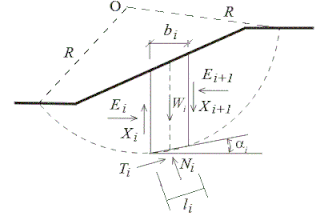
The final sixth category is a rating adjustment or penalization for adverse joint orientations, which is particularly important for evaluating the competence of a rock slope. SMR provides quantitative guidelines to evaluate this rating penalization in the form of four sub-categories, three that describe the relative rock slope and joint set geometries and a fourth which accounts for the method of slope excavation. SMR addresses both planar sliding and toppling failure modes, no additional consideration was made originally for sliding on multiple joint planes. However, Anbalagan et al. [5] adapted the original classification for wedge failure mode.

The final SMR rating is obtained by means of next expression: [6] [7]

Adjustment factors for SMR. P: planar failure; T: toppling failure; W: wedge failure. Modified from and SMR adjustment factors.png
Adjustment factors for SMR. P: planar failure; T: toppling failure; W: wedge failure. Modified from and

where:

Although SMR is worldwide used, sometimes some misinterpretations and imprecisions are made when applied. Most of the observed inaccuracies are related to the calculation of the ancillary angular relationships between dips and dip directions of the discontinuities and the slope required to determine F1, F2 and F3 factors. A comprehensive definition of these angular relationships can be found in. [10]

SMR index modifications

Tomás et al. [11] proposed alternative continuous functions for the computation of F1, F2 and F3 correction parameters. These functions show maximum absolute differences with discrete functions lower than 7 points and significantly reduce subjective interpretations. Moreover, the proposed functions for SMR correction factors calculus reduce doubts about what score to assign to values near the border of the discrete classification.

The proposed F1 continuous function that best fits discrete values is:

where parameter A is the angle formed between the discontinuity and the slope strikes for planar and toppling failures modes and the angle formed between the intersection of the two discontinuities (the plunge direction) and the dip direction of the slope for wedge failure. Arctangent function is expressed in degrees.

where parameter B is the discontinuity dip in degrees for planar failure and the plunge of the intersection for wedge failure. Note that the arctangent function is also expressed in degrees.

where C depends on the relationship between slope and discontinuity dips (toppling or planar failure cases) or the slope dip and the immersion line dip for wedge failure case. Arctangent functions are expressed in degrees.

Alternatively, Tomás et al. [12] also proposed a graphical method based on the stereographic representation of the discontinuities and the slope to obtain correction parameters of the SMR (F1, F2 and F3). This method allows the SMR correction factors to be easily obtained for a simple slope or for several practical applications as linear infrastructures slopes, open pit mining or trench excavations.

A four-dimensional visual analysis of SMR geomechanical classification, performed by Tomás et al. [13] by means of the Worlds within Worlds methodology to explore, analyze and visualize the relationship among the main controlling parameters of this geomechanical classification, revealed that several cases exist where the slope-discontinuity geometrical relationship scarcely affects slope stability (i.e. F1×F2×F3≃0), and as a consequence SMR can be computed by correcting basic RMR only with the F4 factor using next equation with a maximum error lower than nine points:

These cases in which the influence of the geometry of the slope and the discontinuities is negligible (i.e. F1×F2×F3≃0) are:

a) For planar failure

b) For wedge failure

Where βs is the angle of the slope, βj is the discontinuity dip, βi is the plunge of the intersection line between two discontinuities and A is the parallelism between the discontinuity (or intersection line for wedges) and slope dip directions.

Other approaches have been proposed to adapt SMR to different situations as high slopes, flysch formations or even heterogeneous materials. [14] [15]

Application of the SMR index

SMR index can be calculated through the open source software SMRTool, [16] which permits to compute SMR from the geomechanical data of the rock mass and the orientation of the slope and the discontinuities. This software was used to calculate the SMR index using 3D point clouds. [17]

SMRTool is an open source software which aids to calculate the SMR adjustment factors. It depicts the relation between the slope and the discontinuity in order to understand the values of those factors. SMRTool Screenshot.png
SMRTool is an open source software which aids to calculate the SMR adjustment factors. It depicts the relation between the slope and the discontinuity in order to understand the values of those factors.

Some authors have proposed different methodologies to map the failure susceptibility in rock slopes by computing the SMR index using a Geographical Information System (GIS). [18] [19] [20]

See also


Related Research Articles

<span class="mw-page-title-main">Structural geology</span> Science of the description and interpretation of deformation in the Earths crust

Structural geology is the study of the three-dimensional distribution of rock units with respect to their deformational histories. The primary goal of structural geology is to use measurements of present-day rock geometries to uncover information about the history of deformation (strain) in the rocks, and ultimately, to understand the stress field that resulted in the observed strain and geometries. This understanding of the dynamics of the stress field can be linked to important events in the geologic past; a common goal is to understand the structural evolution of a particular area with respect to regionally widespread patterns of rock deformation due to plate tectonics.

<span class="mw-page-title-main">Slope stability</span> Stability of soil or rock slopes

Slope stability refers to the condition of inclined soil or rock slopes to withstand or undergo movement; the opposite condition is called slope instability or slope failure. The stability condition of slopes is a subject of study and research in soil mechanics, geotechnical engineering and engineering geology. Analyses are generally aimed at understanding the causes of an occurred slope failure, or the factors that can potentially trigger a slope movement, resulting in a landslide, as well as at preventing the initiation of such movement, slowing it down or arresting it through mitigation countermeasures.

Rock mass classification systems are used for various engineering design and stability analysis. These are based on empirical relations between rock mass parameters and engineering applications, such as tunnels, slopes, foundations, and excavatability. The first rock mass classification system in geotechnical engineering was proposed in 1946 for tunnels with steel set support.

Rock Structure Rating (RSR) is a quantitative method for describing quality of a rock mass and appropriate ground support, in particular, for steel-rib support, developed by Wickham, Tiedemann and Skinner.

<span class="mw-page-title-main">Log–log plot</span> 2D graphic with logarithmic scales on both axes

In science and engineering, a log–log graph or log–log plot is a two-dimensional graph of numerical data that uses logarithmic scales on both the horizontal and vertical axes. Power functions – relationships of the form – appear as straight lines in a log–log graph, with the exponent corresponding to the slope, and the coefficient corresponding to the intercept. Thus these graphs are very useful for recognizing these relationships and estimating parameters. Any base can be used for the logarithm, though most commonly base 10 are used.

<span class="mw-page-title-main">Rockfall</span> Rocks fallen freely from a cliff, roof, or quarry

A rockfall or rock-fall is a quantity/sheets of rock that has fallen freely from a cliff face. The term is also used for collapse of rock from roof or walls of mine or quarry workings. "A rockfall is a fragment of rock detached by sliding, toppling, or falling, that falls along a vertical or sub-vertical cliff, proceeds down slope by bouncing and flying along ballistic trajectories or by rolling on talus or debris slopes."

<span class="mw-page-title-main">Rock mechanics</span> Study of the mechanical behavior of rocks

Rock mechanics is a theoretical and applied science of the mechanical behavior of rocks and rock masses.

<span class="mw-page-title-main">Orthogonal trajectory</span>

In mathematics, an orthogonal trajectory is a curve which intersects any curve of a given pencil of (planar) curves orthogonally.

<span class="mw-page-title-main">Pentax K-mount</span> Series of camera lens mounts made by Pentax

The Pentax K-mount, sometimes referred to as the "PK-mount", is a bayonet lens mount standard for mounting interchangeable photographic lenses to 35 mm single-lens reflex (SLR) cameras. It was created by Pentax in 1975, and has since been used by all Pentax 35 mm and digital SLRs and also the MILC Pentax K-01. A number of other manufacturers have also produced many K-mount lenses and K-mount cameras.

There have been known various classifications of landslides. Broad definitions include forms of mass movement that narrower definitions exclude. For example, the McGraw-Hill Encyclopedia of Science and Technology distinguishes the following types of landslides:

<span class="mw-page-title-main">Slope stability analysis</span> Method for analyzing stability of slopes of soil or rock

Slope stability analysis is a static or dynamic, analytical or empirical method to evaluate the stability of slopes of soil- and rock-fill dams, embankments, excavated slopes, and natural slopes in soil and rock. It is performed to assess the safe design of a human-made or natural slopes and the equilibrium conditions. Slope stability is the resistance of inclined surface to failure by sliding or collapsing. The main objectives of slope stability analysis are finding endangered areas, investigation of potential failure mechanisms, determination of the slope sensitivity to different triggering mechanisms, designing of optimal slopes with regard to safety, reliability and economics, designing possible remedial measures, e.g. barriers and stabilization.

Core recovery parameters describe the quality of core recovered from a borehole.

The Hoek–Brown failure criterion is an empirical stress surface that is used in rock mechanics to predict the failure of rock. The original version of the Hoek–Brown criterion was developed by Evert Hoek and E. T. Brown in 1980 for the design of underground excavations. In 1988, the criterion was extended for applicability to slope stability and surface excavation problems. An update of the criterion was presented in 2002 that included improvements in the correlation between the model parameters and the geological strength index (GSI).

A discontinuity in geotechnical engineering is a plane or surface that marks a change in physical or chemical characteristics in a soil or rock mass. A discontinuity can be, for example, a bedding, schistosity, foliation, joint, cleavage, fracture, fissure, crack, or fault plane. A division is made between mechanical and integral discontinuities. Discontinuities may occur multiple times with broadly the same mechanical characteristics in a discontinuity set, or may be a single discontinuity. A discontinuity makes a soil or rock mass anisotropic.

Within geotechnical engineering, Laubscher developed the Mining Rock Mass Rating (MRMR) system by modifying the Rock Mass Rating (RMR) system of Z. T. Bieniawski. In the MRMR system the stability and support are determined with the following equations:

The rock mass rating (RMR) is a geomechanical classification system for rocks, developed by Z. T. Bieniawski between 1972 and 1973. Since then it has undergone multiple modifications out of which, RMR89 is commonly used. Recently RMR14 has been proposed to improve the RMR performance by incorporating new experiences from tunnel practices. Continuous functions and a software "QuickRMR" for RMR89 and RMR14 have also been proposed by Kundu. RMR combines the most significant geologic parameters of influence and represents them with one overall comprehensive index of rock mass quality, which is used for the design and construction of excavations in rock, such as tunnels, mines, slopes, and foundations.

The Q-system for rock mass classification is developed by Barton, Lien, and Lunde. It expresses the quality of the rock mass in the so-called Q-value, on which design are based and support recommendations for underground excavations.

The sliding criterion (discontinuity) is a tool to estimate easily the shear strength properties of a discontinuity in a rock mass based on visual and tactile characterization of the discontinuity. The shear strength of a discontinuity is important in, for example, tunnel, foundation, or slope engineering, but also stability of natural slopes is often governed by the shear strength along discontinuities.

<span class="mw-page-title-main">Q-slope</span>

The Q-slope method for rock slope engineering and rock mass classification is developed by Barton and Bar. It expresses the quality of the rock mass for slope stability using the Q-slope value, from which long-term stable, reinforcement-free slope angles can be derived.

Geological structure measurement by LiDAR technology is a remote sensing method applied in structural geology. It enables monitoring and characterisation of rock bodies. This method's typical use is to acquire high resolution structural and deformational data for identifying geological hazards risk, such as assessing rockfall risks or studying pre-earthquake deformation signs.

References

  1. Romana M. (1985). New adjustment ratings for application of Bieniawski classification to slopes. Proc. Int. Symp. on the Role of Rock Mechanics: 49-53.
  2. Romana M. (1995). The geomechanical classification SMR for slope correction. Proc. Int. Congress on Rock Mechanics 3: 1085-1092.
  3. STMR. "STMR Servicio Tecnico de Mecanica de Rocas". www.stmr.es (in Spanish). Retrieved 2016-03-31.
  4. Bieniawski, Z.T. (1989). Engineering Rock Mass Classifications: A Complete Manual for Engineers and Geologists in Mining, Civil, and Petroleum Engineering. John Wiley & Sons. ISBN   978-0-471-60172-2.
  5. Anbalagan R, Sharma S, Raghuvanshi TK. Rock mass stability evaluation using modified SMR approach. In: Proceedings of 6th nat symp rock mech, Bangalore, India, 1992. p. 258–68.
  6. Azarafza, M., Koçkar, M. K., & Zhu, H. H. (2021). Correlations of SMR-Qslope Data in Stability Classification of Discontinuous Rock Slope: A Modified Relationship Considering the Iranian Data. Geotechnical and Geological Engineering, 1-14
  7. Azarafza, M., Nikoobakht, S., Rahnamarad, J., Asasi, F., & Derakhshani, R. (2020). An empirical method for slope mass rating-Qslope correlation for Isfahan province, Iran. MethodsX, 7, 101069
  8. Romana M. El papel de las clasificaciones geomecánicas en el estudio de la estabilidad de taludes. In: del IV Simposio Nacional sobre taludes y laderas inestables, vol. 3; 1997:955–1011.
  9. Anbalagan R, Sharma S, Raghuvanshi TK. Rock mass stability evaluation using modified SMR approach. In: Proceedings of 6th nat symp rock mech, Bangalore, India, 1992. p. 258–68
  10. Pastor, José Luis; Riquelme, Adrián J.; Tomás, Roberto; Cano, Miguel (2019-12-01). "Clarification of the slope mass rating parameters assisted by SMRTool, an open-source software". Bulletin of Engineering Geology and the Environment. 78 (8): 6131–6142. doi:10.1007/s10064-019-01528-9. hdl: 10045/99191 . ISSN   1435-9537.
  11. Tomás, R.; Delgado, J.; Serón, J. B. (2007-10-01). "Modification of slope mass rating (SMR) by continuous functions". International Journal of Rock Mechanics and Mining Sciences. 44 (7): 1062–1069. doi:10.1016/j.ijrmms.2007.02.004.
  12. Tomás, R.; Cuenca, A.; Cano, M.; García-Barba, J. (2012-01-04). "A graphical approach for slope mass rating (SMR)". Engineering Geology. 124: 67–76. doi:10.1016/j.enggeo.2011.10.004.
  13. Tomás, R.; Valdes-Abellan, J.; Tenza-Abril, A. J.; Cano, M. (2012-07-01). "New insight into the slope mass rating geomechanical classification through four-dimensional visualization". International Journal of Rock Mechanics and Mining Sciences. 53: 64–69. doi:10.1016/j.ijrmms.2012.04.002.
  14. Romana, M., Serón, J.B., Montalar, E., SMR Geomechanics classification: Application, experience and validation ISRM 2003–Technology roadmap for rock mechanics, South African Institute of Mining and Metallurgy, 2003.
  15. Romana, M., Tomás, R., Serón, J.B. (2015). Slope Mass Rating (SMR) geomechanics classification: thirty years review. ISRM Congress 2015 Proceedings - International Symposium on Rock Mechanics, Quebec, Canada, May 10 to 13 2015. ISBN   978-1-926872-25-4, 10 pp
  16. Adrián, Riquelme Guill; Roberto, Tomás Jover; Antonio, Abellán Fernández. "SMRTool (MATLAB)". rua.ua.es. Retrieved 2016-04-08.
  17. Riquelme, Adrián J.; Tomás, Roberto; Abellán, Antonio (2016-04-01). "Characterization of rock slopes through slope mass rating using 3D point clouds". International Journal of Rock Mechanics and Mining Sciences. 84: 165–176. doi:10.1016/j.ijrmms.2015.12.008. hdl: 10045/52313 .
  18. Irigaray, C., Fernández, T. & Chacón, J. Preliminary Rock-Slope-Susceptibility Assessment Using GIS and the SMR Classification. Natural Hazards, 30, 309-324, doi: 10.1023/B:NHAZ.0000007178.44617.c6.
  19. Tomás, R., Cano, M., Cañaveras, J.C:, Cuenca, A., Delgado, J., Estévez, A., Pina, J.A., Nuevas funciones continuas para el cálculo del Slope Mass Rating (SMR): aplicación mediante un sistema de información geográfica a los taludes rocosos de una cantera. Revista de la Sociedad Geológica de España, 19, 87-97, 2006
  20. Yilmaz, I., Marschalko, M., Yildirim, M., Dereli, E. & Bednarik, M. 2012. GIS-based kinematic slope instability and slope mass rating (SMR) maps: application to a railway route in Sivas (Turkey). Bulletin of Engineering Geology and the Environment, 71, 351-357, doi: 10.1007/s10064-011-0384-5.