
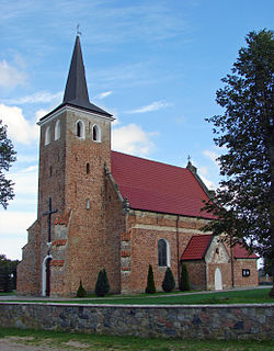
Bąsewice is a village in the administrative district of Gmina Nowa Wieś Lęborska, within Lębork County, Pomeranian Voivodeship, in northern Poland. It lies approximately 13 kilometres (8 mi) north of Nowa Wieś Lęborska, 14 km (9 mi) north of Lębork, and 65 km (40 mi) north-west of the regional capital Gdańsk.
Mechelinki is a village in the administrative district of Gmina Kosakowo, within Puck County, Pomeranian Voivodeship, in northern Poland. It lies approximately 3 kilometres (2 mi) north-east of Kosakowo, 13 km (8 mi) south-east of Puck, and 28 km (17 mi) north of the regional capital Gdańsk.

Dębki is a village in the administrative district of Gmina Krokowa, within Puck County, Pomeranian Voivodeship, in northern Poland. It lies approximately 7 kilometres (4 mi) north-west of Krokowa, 25 km (16 mi) north-west of Puck, and 63 km (39 mi) north-west of the regional capital Gdańsk.
Kłanino is a village in the administrative district of Gmina Krokowa, within Puck County, Pomeranian Voivodeship, in northern Poland. It lies approximately 6 kilometres (4 mi) east of Krokowa, 13 km (8 mi) north-west of Puck, and 51 km (32 mi) north-west of the regional capital Gdańsk.

Błądzikowo is a village in the administrative district of Gmina Puck, within Puck County, Pomeranian Voivodeship, in northern Poland. It lies approximately 3 kilometres (2 mi) east of Puck and 39 km (24 mi) north of the regional capital Gdańsk.
Brudzewo is a village in the administrative district of Gmina Puck, within Puck County, Pomeranian Voivodeship, in northern Poland. It lies approximately 4 kilometres (2 mi) south-west of Puck and 40 km (25 mi) north-west of the regional capital Gdańsk.
Domatówko is a village in the administrative district of Gmina Puck, within Puck County, Pomeranian Voivodeship, in northern Poland. It lies approximately 13 kilometres (8 mi) west of Puck and 45 km (28 mi) north-west of the regional capital Gdańsk.

Leśniewo is a village in the administrative district of Gmina Puck, within Puck County, Pomeranian Voivodeship, in northern Poland. It lies approximately 11 kilometres (7 mi) west of Puck and 45 km (28 mi) north-west of the regional capital Gdańsk.
Łyśniewo is a village in the administrative district of Gmina Puck, within Puck County, Pomeranian Voivodeship, in northern Poland. It lies approximately 12 kilometres (7 mi) north-west of Puck and 52 km (32 mi) north of the regional capital Gdańsk.
Mała Piaśnica is a village in the administrative district of Gmina Puck, within Puck County, Pomeranian Voivodeship, in northern Poland. It lies approximately 12 kilometres (7 mi) west of Puck and 44 km (27 mi) north-west of the regional capital Gdańsk.
Osłonino is a village in the administrative district of Gmina Puck, within Puck County, Pomeranian Voivodeship, in northern Poland. It lies approximately 6 kilometres (4 mi) south-east of Puck and 36 km (22 mi) north of the regional capital Gdańsk.
Połchowo is a village in the administrative district of Gmina Puck, within Puck County, Pomeranian Voivodeship, in northern Poland. It lies approximately 7 kilometres (4 mi) south of Puck and 36 km (22 mi) north-west of the regional capital Gdańsk.
Połczyno is a village in the administrative district of Gmina Puck, within Puck County, Pomeranian Voivodeship, in northern Poland. It lies approximately 3 kilometres (2 mi) west of Puck and 42 km (26 mi) north-west of the regional capital Gdańsk.
Rekowo Górne is a village in the administrative district of Gmina Puck, within Puck County, Pomeranian Voivodeship, in northern Poland. It lies approximately 8 kilometres (5 mi) south-west of Puck and 36 km (22 mi) north-west of the regional capital Gdańsk.
Rzucewo is a village in the administrative district of Gmina Puck, within Puck County, Pomeranian Voivodeship, in northern Poland. It lies approximately 5 kilometres (3 mi) east of Puck and 38 km (24 mi) north of the regional capital Gdańsk. There is also a castle called Rzucewo Castle, which was the residence of the former king of Poland.
Sławutówko is a village in the administrative district of Gmina Puck, within Puck County, Pomeranian Voivodeship, in northern Poland. It lies approximately 5 kilometres (3 mi) south-west of Puck and 38 km (24 mi) north-west of the regional capital Gdańsk.
Starzyno is a village in the administrative district of Gmina Puck, within Puck County, Pomeranian Voivodeship, in northern Poland. It lies approximately 11 kilometres (7 mi) north-west of Puck and 50 km (31 mi) north-west of the regional capital Gdańsk.
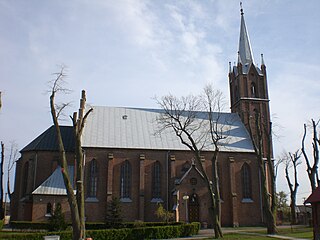
Swarzewo is a village in the administrative district of Gmina Puck, within Puck County, Pomeranian Voivodeship, in northern Poland. It lies approximately 7 kilometres (4 mi) north of Puck and 47 km (29 mi) north of the regional capital Gdańsk.
Widlino is a village in the administrative district of Gmina Puck, within Puck County, Pomeranian Voivodeship, in northern Poland. It lies approximately 6 kilometres (4 mi) south-west of Puck and 37 km (23 mi) north-west of the regional capital Gdańsk.
Zdrada is a village in the administrative district of Gmina Puck, within Puck County, Pomeranian Voivodeship, in northern Poland. It lies approximately 6 kilometres (4 mi) north-west of Puck and 45 km (28 mi) north-west of the regional capital Gdańsk.


