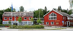
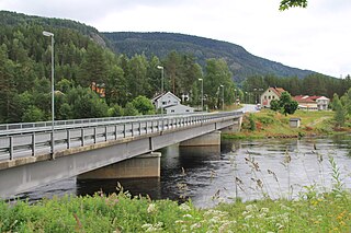
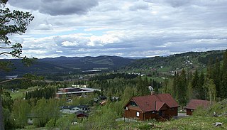
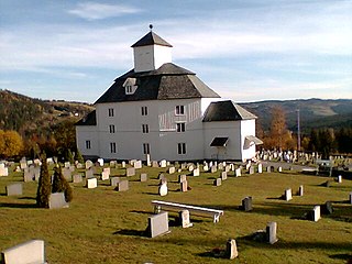
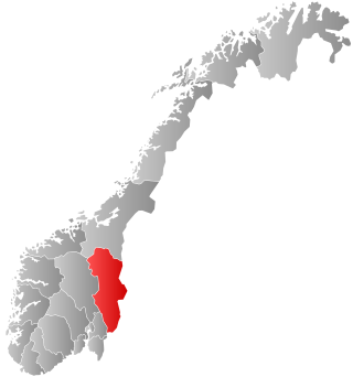
Snåsa or Snåase (Southern Sami) is a municipality in Trøndelag county, Norway. It is part of the Innherred region. The administrative centre of the municipality is the village of Snåsa. Other villages include Agle and Jørstad.

Dypvåg is a former municipality in the old Aust-Agder county, Norway. The 15-square-kilometre (5.8 sq mi) municipality existed from 1838 until its dissolution in 1960 when it was merged into the present-day municipality of Tvedestrand which is in Agder county. The small municipality included the coastal area about 8 kilometres (5.0 mi) east of the town of Tvedestrand and several islands located just offshore. The administrative centre was the village of Dypvåg where the Dypvåg Church is located.
Sør-Vågsøy is a former municipality in the old Sogn og Fjordane county in Norway. The municipality existed from 1910 until 1964 and it encompassed the southern part of the island of Vågsøy and a small area on the mainland just east of the island. The area is now located in the present-day Kinn Municipality in Vestland county. The administrative centre of the municipality was Måløy, where Sør-Vågsøy Church is located. Other population centres in the municipality are the villages of Holvik, Vågsvåg, Torskangerpoll, Færestrand, and Ytre Oppedal.
Nord-Vågsøy is a former municipality in the old Sogn og Fjordane county, Norway. The municipality existed from 1910 until 1964, and it encompassed the northern part of the island of Vågsøy. The area of Nord-Vågsøy now makes up the northern part of the present-day Kinn Municipality in Vestland county. The administrative centre was the village of Raudeberg where the Nord-Vågsøy Church is located. Other villages in Nord-Vågsøy include Halsør, Vedvik, Refvik, Kvalheim, and Kråkenes.

Sandar is a former municipality in Vestfold county, Norway. The 120-square-kilometre (46 sq mi) municipality existed from 1838 until its dissolution in 1968. The area is now part of Sandefjord Municipality. The administrative centre was located at Sandar, right by the Sandar Church in what is now the town of Sandefjord.
Gransherad is a former municipality in Telemark county, Norway. The 417-square-kilometre (161 sq mi) municipality existed from 1860 until its dissolution in 1964. The area is now part of Notodden Municipality and Kongsberg Municipality. The administrative centre was the village of Gransherad where Gransherad Church is located.

Høvåg is a former municipality in the old Aust-Agder county in Norway. The 77 km2 (30 sq mi) municipality existed from 1865 until its dissolution in 1962. It was located in the southern part of the present-day municipality of Lillesand which is now in Agder county. The administrative centre of the municipality was the village of Høvåg where the Høvåg Church is located. Old coastal settlements in Høvåg include Ulvøysund, Gamle Hellesund, Skottevik, Kjøbmannsvig and Åkerøyhamn. The village of Høvåg is located midway between the towns of Lillesand and Kristiansand.

Ålvundeid is a former municipality in Møre og Romsdal county, Norway. The 179-square-kilometre (69 sq mi) municipality existed from 1899 until its dissolution in 1960. It had one of the smallest municipal populations in Norway. It was located in the northern part of the present-day Sunndal Municipality. The old municipality included the Innerdalen valley and the Ålvund valley area. The administrative centre was the village of Ålvundeidet, also where the Ålvundeid Church is located.
Snertingdal is a former municipality in the old Oppland county, Norway. The 220-square-kilometre (85 sq mi) municipality existed from 1910 until its dissolution in 1964. The area is now part of Gjøvik Municipality in the traditional district of Vestoppland. The administrative centre was the village of Seegård.
Hålandsdal is a former municipality in the old Hordaland county, Norway. The 131-square-kilometre (51 sq mi) municipality existed from 1903 until 1964. It encompassed the eastern part of what is now Bjørnafjorden Municipality in Vestland county. It included the large lakes Skogseidvatnet and Gjønavatnet and all of their surrounding valleys. The administrative centre of the municipality was the village of Holdhus where the Holdhus Church is located.
Torpa is a former municipality in the old Oppland county, Norway. The 561-square-kilometre (217 sq mi) municipality existed from 1914 until its dissolution in 1962. The area is now part of Nordre Land Municipality. The administrative centre was the village at Åmot where the Åmot Church is located. Torpa currently constitutes the northern part of the Nordre Land, bordering the municipalities of Etnedal and Nord-Aurdal in the west, Gausdal, Lillehammer, and Gjøvik in the east.

Strømm is a former municipality in Vestfold county, Norway. The 57-square-kilometre (22 sq mi) municipality existed from 1838 until its dissolution in 1964. The area is now part of Drammen Municipality in Buskerud county. The administrative centre was the town of Svelvik. The village of Nesbygda was also located in the municipality.

Åkra is a former municipality in the traditional district of Haugaland in Rogaland county, Norway. The 33-square-kilometre (13 sq mi) municipality existed from 1892 until 1965 and it encompassed the central part of the western coast of the island of Karmøy. The administrative centre was the village of Åkrehamn.
Åsnes og Våler or Aasnes og Vaaler is a former municipality in the old Hedmark county, Norway. The municipality existed from 1849 until 1854 when it was divided into the present-day municipalities of Åsnes and Våler. The administrative centre of the municipality was the village of Flisa, where Åsnes Church was located.
Åsane is a former municipality in the old Hordaland county in Norway. The municipality existed from 1904 until 1972. The 71-square-kilometre (27 sq mi) municipality encompassed the northern part of the Bergen Peninsula, roughly corresponding to the present-day borough of Åsane in the city-municipality of Bergen. The administrative centre of the municipality was the village of Eidsvåg. The main church for the municipality was Åsane Church. Historically, the area was called Aasene, but with spelling reforms in the Norwegian language, the modern spelling has been Åsane since about 1920.

Haltdalen is a former municipality in the old Sør-Trøndelag county, Norway. The 509-square-kilometre (197 sq mi) municipality existed from 1838 until 1972 when it was merged with Ålen to become the present-day municipality of Holtålen in Trøndelag county. The administrative centre of the municipality was the village of Haltdalen where the Haltdalen Church is located.
Sollia is a former municipality in Hedmark county, Norway. The 511-square-kilometre (197 sq mi) municipality existed from 1864 until its dissolution in 1965. Since then, it has made up the northern part of the present-day Stor-Elvdal Municipality. The administrative centre of the municipality was the village of Sollia where Sollia Church is located.

Åsskard is a former municipality in Møre og Romsdal county, Norway. The 151-square-kilometre (58 sq mi) municipality existed from 1895 until its dissolution in 1965. It was located in what is now the northern part of Surnadal Municipality. The former municipality of Åsskard included the area around the Åsskardfjorden, north of the Hamnesfjorden, and east of the Trongfjorden. The administrative centre was the village of Åsskard where the Åsskard Church is located.

Lårdal is a former municipality in Telemark county, Norway. The 288-square-kilometre (111 sq mi) municipality existed from 1838 until its dissolution in 1964. The area centered around the Lårdalen valley and it is now part of Tokke Municipality. The administrative centre was the village of Lårdal.

Skåtøy is a former municipality in Telemark county, Norway. The 114-square-kilometre (44 sq mi) municipality included land on the mainland plus many surrounding islands. It existed from 1882 until its dissolution in 1960. The area is now part of Kragerø Municipality. The administrative centre was the village of Skåtøy on the island of Skåtøy where the Skåtøy Church is located.