Napachanie is a village and sołectwo in the administrative district of Gmina Rokietnica, within Poznań County, Greater Poland Voivodeship, in west-central Poland. The village lies approximately 4 kilometres (2 mi) south of Rokietnica and 16 km (10 mi) north-west of the regional capital Poznań. It has a junior high school (gimnazjum) and a palace from 1879, built in the style of Queen Anna's North-European Renaissance.
Gmina Oborniki is an urban-rural gmina in Oborniki County, Greater Poland Voivodeship, in west-central Poland. Its seat is the town of Oborniki, which lies approximately 29 kilometres (18 mi) north of the regional capital Poznań.
Gmina Suchy Las is a rural gmina in Poznań County, Greater Poland Voivodeship, in west-central Poland. Its seat is the village of Suchy Las, which lies to the immediate north of the city of Poznań.
Gmina Rokietnica is a rural gmina in Poznań County, Greater Poland Voivodeship, in west-central Poland. Its seat is the village of Rokietnica, which lies approximately 18 kilometres (11 mi) north-west of the regional capital Poznań.
Gmina Tarnowo Podgórne is a rural gmina in Poznań County, Greater Poland Voivodeship, in west-central Poland. Its seat is the village of Tarnowo Podgórne, which lies approximately 19 kilometres (12 mi) north-west of the regional capital Poznań.
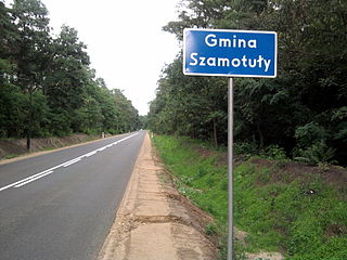
Gmina Szamotuły is an urban-rural gmina in Szamotuły County, Greater Poland Voivodeship, in west-central Poland. Its seat is the town of Szamotuły, which lies approximately 32 kilometres (20 mi) north-west of the regional capital Poznań.
Gmina Kaźmierz is a rural gmina in Szamotuły County, Greater Poland Voivodeship, in west-central Poland. Its seat is the village of Kaźmierz, which lies approximately 10 kilometres (6 mi) south of Szamotuły and 26 km (16 mi) north-west of the regional capital Poznań.
Bytkowo is a village in the administrative district of Gmina Rokietnica, within Poznań County, Greater Poland Voivodeship, in west-central Poland.
Cerekwica is a village in the administrative district of Gmina Rokietnica, within Poznań County, Greater Poland Voivodeship, in west-central Poland. It lies approximately 4 kilometres (2 mi) west of Rokietnica and 20 km (12 mi) north-west of the regional capital Poznań.
Dalekie is a village in the administrative district of Gmina Rokietnica, within Poznań County, Greater Poland Voivodeship, in west-central Poland. It lies approximately 6 kilometres (4 mi) south-west of Rokietnica and 19 km (12 mi) north-west of the regional capital Poznań.
Kiekrz is a village in the administrative district of Gmina Rokietnica, within Poznań County, Greater Poland Voivodeship, in west-central Poland. It lies approximately 5 kilometres (3 mi) south-east of Rokietnica and 13 km (8 mi) north-west of the centre of Poznań.
Kobylniki is a village in the administrative district of Gmina Rokietnica, within Poznań County, Greater Poland Voivodeship, in west-central Poland. It lies approximately 5 kilometres (3 mi) south of Rokietnica and 16 km (10 mi) north-west of the regional capital Poznań.
Krzyszkowo is a village in the administrative district of Gmina Rokietnica, within Poznań County, Greater Poland Voivodeship, in west-central Poland. It lies approximately 3 kilometres (2 mi) west of Rokietnica and 19 km (12 mi) north-west of the regional capital Poznań.
Mrowino is a village in the administrative district of Gmina Rokietnica, within Poznań County, Greater Poland Voivodeship, in west-central Poland. It lies approximately 3 kilometres (2 mi) west of Rokietnica and 20 km (12 mi) northwest of the regional capital Poznań.
Pawłowice is a village in the administrative district of Gmina Rokietnica, within Poznań County, Greater Poland Voivodeship, in west-central Poland. It lies approximately 4 kilometres (2 mi) south-east of Rokietnica and 14 km (9 mi) north-west of the regional capital Poznań.
Przybroda is a village in the administrative district of Gmina Rokietnica, within Poznań County, Greater Poland Voivodeship, in west-central Poland. It lies approximately 7 kilometres (4 mi) west of Rokietnica and 23 km (14 mi) north-west of the regional capital Poznań.
Rogierówko is a village in the administrative district of Gmina Rokietnica, within Poznań County, Greater Poland Voivodeship, in west-central Poland. It lies approximately 6 kilometres (4 mi) south of Rokietnica and 14 km (9 mi) north-west of the regional capital Poznań.

Rokietnica is a village in Poznań County, Greater Poland Voivodeship, in west-central Poland. It is the seat of the gmina called Gmina Rokietnica. It lies approximately 18 km (11 mi) north-west of the regional capital Poznań.
Starzyny is a village in the administrative district of Gmina Rokietnica, within Poznań County, Greater Poland Voivodeship, in west-central Poland. It lies approximately 3 kilometres (2 mi) south of Rokietnica and 16 km (10 mi) north-west of the regional capital Poznań.

Żydowo is a village in the administrative district of Gmina Rokietnica, within Poznań County, Greater Poland Voivodeship, in west-central Poland. It lies approximately 4 kilometres (2 mi) north of Rokietnica and 20 km (12 mi) north-west of the regional capital Poznań.


