Lehigh County is a county in the Commonwealth of Pennsylvania. As of the 2020 census, the county's population was 374,557. Its county seat is Allentown, the state's third-largest city after Philadelphia and Pittsburgh.

Cleveland County is a county located in the foothills of the Blue Ridge Mountains and the western Piedmont, on the southern border of the U.S. state of North Carolina. As of the 2020 census, the population was 99,519. Its county seat is Shelby. Cleveland County comprises the Shelby-Kings Mountain, NC Micropolitan Statistical Area, which is also included in the Charlotte-Concord, NC-SC Combined Statistical Area.

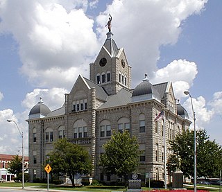
Polk County is a county located in the southwestern portion of the U.S. state of Missouri. As of the 2020 census, the population was 31,519. Its county seat is Bolivar. The county was organized January 5, 1835, and named for Ezekiel Polk.

Shawnee County is located in northeast Kansas, in the central United States. Its county seat and most populous city is Topeka, the state capital. As of the 2020 census, the population was 178,909, making it the third-most populous county in Kansas. The county was one of the original 33 counties created by the first territorial legislature in 1855, and it was named for the Shawnee tribe.

Allendale is a census-designated place (CDP) in Ottawa County in the U.S. state of Michigan. The population was 17,579 at the 2010 census. It is located within Allendale Charter Township, occupying approximately the northern two-thirds of the township, from the eastern boundary with the Grand River west along Pierce St., north along 75th Ave., then west along Lake Michigan Drive (M-45) to the western boundary of the township. It is a part of the Grand Rapids-Muskegon-Holland, Michigan combined statistical area, and is an exurb of Grand Rapids, due to its major commuter routes into the city.

Allendale Charter Township is a charter township of Ottawa County in the U.S. state of Michigan. At the 2020 Census, the township population was 26,583. Allendale Charter Township is best known as being home to the main campus of Grand Valley State University.

Cranberry Township is a township in southwestern Butler County, Pennsylvania, United States. The population was 33,087 as of the 2020 census. It is one of the fastest-growing areas of the Pittsburgh metropolitan area.

Aston Township is a township in Delaware County, Pennsylvania, United States. The population was 16,791 at the 2020 census.

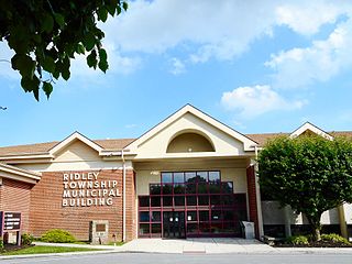
Ridley Township is a township in Delaware County, Pennsylvania, United States. The population was 30,768 at the 2010 census. Ridley Township contains the (CDPs) of Folsom and Woodlyn, along with the unincorporated communities of Crum Lynne and Holmes and a portion of Secane.

Derry Township is a township in Westmoreland County, Pennsylvania, United States. It surrounds the borough of Derry, which is a separate municipality. As of the 2020 census, the township population was 13,631.

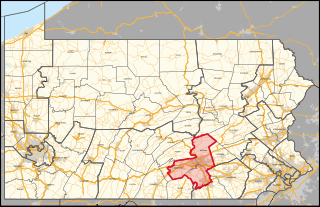
Pennsylvania's 10th congressional district is currently located in the south-central region of the state. It encompasses all of Dauphin County as well as parts of Cumberland County and York County. The district includes the cities of Harrisburg and York. Prior to 2019, the district was located in the northeastern part of the state. The Supreme Court of Pennsylvania redrew the district in 2018 after ruling the previous map unconstitutional because of gerrymandering. The court added State College to the old district's boundaries while removing some Democratic-leaning areas and redesignated it the twelfth district; an area encompassing Harrisburg and York was numbered as the "10th". The new tenth district is represented by Republican Scott Perry, who previously represented the old fourth district.

Thornton Township is one of twenty-six townships in Buffalo County, Nebraska, United States. The population was 181 at the 2000 census. A 2006 estimate placed the township's population at 178. In 1883 the Buffalo County Board of Directors named the township for Samuel W. Thornton, a local politician, farmer, and Civil War soldier.

Banner Township is a township in Jackson County, Kansas, USA. As of the 2000 census, its population was 300. The southernmost part of the township is located within the Prairie Band Potawatomi Indian Reservation.

Douglas Township is a township in Jackson County, Kansas, USA. As of the 2000 census, its population was 2,135.

Grant Township is a township in Jackson County, Kansas, USA. As of the 2000 census, its population was 212. The southeasternmost part of the township is located within the Prairie Band Potawatomi Indian Reservation.

Jefferson Township is a township in Jackson County, Kansas, USA. As of the 2000 census, its population was 494.

Soldier Township is a township in Jackson County, Kansas, USA. As of the 2000 census, its population was 403.

Rock Creek Township is a township in Jefferson County, Kansas, USA. As of the 2000 census, its population was 2,718.

Jinning Township is a rural township in Kinmen, Republic of China. It is in the Taiwan Strait, on the coast of mainland China. It has a population of 34,569 and an area of 29.8540 km2 (11.5267 sq mi).

Cheltenham Township is a home rule municipality and Township of the First Class located in the southeast corner of Montgomery County, Pennsylvania, United States. It borders Philadelphia to the south and east, Abington Township and Jenkintown to the north, and Springfield Township to the west.


