Zschopau, is a town in the Erzgebirgskreis district of Saxony, Germany.
Delitzsch is a town in the Free State of Saxony in Germany, 20 km north of Leipzig and 30 km east of Halle (Saale). With 24,850 inhabitants at the end of 2015, it is the largest town in the district of Nordsachsen.

Böhlen is a town in the Free State of Saxony, Germany, south of Leipzig. Its main features are a small airport and a power-plant. It is located in the newly built Neuseenland, the lakes created in the former open-pit mining areas.

Hohenstein-Ernstthal is a town in the Zwickau rural district, Free State of Saxony, Germany. The towns of Hohenstein and Ernstthal were united in 1898, and the town is either known by its hyphenated form, or simply called Hohenstein.

Eibenstock is a town in the western Ore Mountains, in the Erzgebirgskreis, Saxony, Germany. It is situated near the river Mulde.

Borna is a town in the Free State of Saxony, Germany, capital of the Leipzig district. It is situated approximately 30 km southeast of Leipzig city. It has approx. 19,000 inhabitants. The town is the district seat of the district of Leipzig.

Schneeberg is a town in Saxony’s district of Erzgebirgskreis. It has roughly 16,400 inhabitants and belongs to the Town League of Silberberg. It lies 4 km west of Aue, and 17 kilometres (11 mi) southeast of Zwickau.

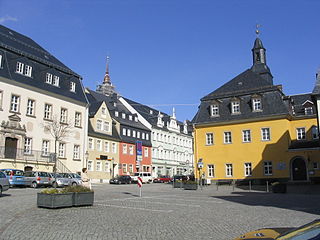
Oelsnitz is a town in the district Erzgebirgskreis, in the Free State of Saxony, Germany. It is situated 14 km east of Zwickau, and 20 km southwest of Chemnitz. Between 1844 and 1971 hardcoal was mined in Oelsnitz and the surrounding towns. The major mine "Karl-Liebknecht" became a mining museum in 1986.

Großschirma is a town in the district of Mittelsachsen, in the Free State of Saxony, Germany. It is situated 7 km northwest of Freiberg. It was formed from the administrative union of the village of Großschirma and the town of Siebenlehn, including their districts, on 1 September 2003.

Johanngeorgenstadt is a mining town in Saxony’s Ore Mountains, 17 km south of Aue, and 27 km northwest of Karlovy Vary. It lies in the district of Erzgebirgskreis, on the border with the Czech Republic, is a state-recognized health resort (Erholungsort), and calls itself Stadt des Schwibbogens. Its population decline since the 1950s has been extremely severe falling from 45,000 residents in 1953 to only about one tenth of that now.
Oberwiesenthal is a town and a ski resort in the district of Erzgebirgskreis in Saxony in Germany. It is situated in the Ore Mountains, on the border with the Czech Republic, 19 km south of Annaberg-Buchholz, and 23 km northeast of Karlovy Vary. At 914 metres (2,999 ft), it is the highest town in Germany. The Olympic and World Championships goldmedalist in ski jumping Jens Weißflog competed for SC Tractor Oberwiesenthal and Oberwiesenthaler SV.

Geyer is a town in the district of Erzgebirgskreis, in Saxony, Germany. It has a population of about 4000.

Bad Schlema is a community in the district of Erzgebirgskreis in Saxony in Germany. It was merged into the new town Aue-Bad Schlema in January 2019. It belongs to the Silberberg Town League. The Silver Road (Silberstraße) runs through the town. The community is developing its tourist industry, above all its spa facilities.

Breitenbrunn is a community in the Ore Mountains in the district of Erzgebirgskreis in the Free State of Saxony in Germany.
Pöhla is a village and a former municipality lying in the valley of the river Pöhlwasser, in the district of Aue-Schwarzenberg in Saxony, Germany. Since 1 January 2008, it is part of the town Schwarzenberg.
Schönheide is a community in Saxony's district of Erzgebirgskreis. It lies in the western Ore Mountains, and was founded as an industrial village.

Stützengrün is a community in the district of Erzgebirgskreis, Saxony, Germany.
Frohnau is a village in the Saxon town of Annaberg-Buchholz in the district of Erzgebirgskreis in southeast Germany. The discovery of silver on the Schreckenberg led in 1496 to the foundation of the neighbouring mining town of Annaberg. The village of Frohnau is best known for its museum of technology, the Frohnauer Hammer, and the visitor mine of Markus Röhling Stolln. The mining area around Frohnau has been selected as a candidate for a UNESCO World Heritage Site: the Ore Mountain Mining Region.

Wildenthal is a village in the town of Eibenstock in the district of Erzgebirgskreis in the Saxon Ore Mountains of Central Germany.
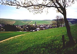
Hundshübel is a village in Erzgebirgskreis district of Saxony, forming a subdivision of the municipality of Stützengrün in the Ore Mountains. It is located north of Eibenstock Dam on federal highway B 169.


