Soulis Cross

Last updated

The original Soulis Cross. The original Soulis Cross, Kilmarnock, East Ayrshire.jpg
The original Soulis Cross.
The 1825 Soulis Cross. The Soulis Cross, High Kirk, Kilmarnock, Ayrshire.JPG
The 1825 Soulis Cross.

The ancient Soulis Cross was originally located in the centre of Soulis Street (NS43013821) near the Kilmarnock Water in Kilmarnock, East Ayrshire, Scotland. In 1825 a replacement cross in the form of a fluted pillar topped with an urn was erected using funds raised by public inscription and this was placed near the original site but located in an alcove situated within the high boundary wall of the High Kirk (NS43003820). A brass diamond mark [1] was placed in the road to indicate the original site where Lord Soulis is said to have died, but this is no longer visible as it has become covered with tarmac.

Contents

Description

Significantly the Soulis Cross is recorded by Timothy Pont and described as a stone pillar, 8 ft - 9 ft high. Some years before 1792 it was in a ruinous condition, but its stones were recovered and re-erected with a small gilt cross-like vane placed on the top. At this time an inscription "L Soules 1444" was carved on it as a record of the supposed killing of a Lord Soulis at the site. The shaft is octagonal, with two original sections topped by a 'new' pointed piece and has an approximately octagonal original base that stands on a later square base dating from 1890. It originally had three steps representing the Holy Trinity [2] with the date '1600'.

Originally the shaft may have been topped by a stone cross that has been lost, an iron cross being added in the 19th century, a replica of which was made when it was restored for display in the museum. [3] The top level of the base has a couple of holes that suggest that something metallic was once inserted such as a chain.

Some doubts have been expressed on a mid 15th century date for the old cross [4] or even that the replaced cross is a further replacement for an even older original. [5] Paterson regarded it as being the most significant of Kilmarnock's antiquities. [6]

As stated, the old dilapidated cross was moved from Soulis Street in 1825 [7] and is now on display in the town's Dick Institute with a plaque on the wall next to the replacement cross giving details of the death of Lord Soulis. [3]

The inscription on the pediment above the alcove in which the replacement 'cross' stands reads "To the memory of Lord Soulis, A.D. 1444. Erected by subscription, A.D. 1825. The days of old to mind I call." [8] [9]

Crosses when erected on a significant spot sometimes could be a form of legal consecration of the site. [10] in the later medieval period With the introduction of Gothic styles of architecture in the later medieval period the design of the crosses became more complex, usually having a stepped base known as the ‘Calvary’ from which preach could take place and with a ‘socket’ on top into which the cross shaft was placed. [11]

Kilmarnock's market was located in the centre of the old town so the Soulis Cross was not a market cross and no records of an ancient near by church, abbey, etc exist to explain its location on the outskirts of the old town.

History

Scotland relief location map.jpg
Red pog.svg
Soulis Cross
Location of the Soulis Cross, Kilmarnock, East Ayrshire

Oddly the cross is said to commemorate the death of an Englishman, Lord Soulis, who was supposedly leading a force of English soldiers or 'Southrons' in an attempt to capture Dean Castle and with it the lands of Kilmarnock from the lords of the barony, the Boyds, Earls of Kilmarnock. It is very unusual for feudal lords to permit the erection of a memorial that celebrates the enemy, [12] especially when the townsfolk are known to have celebrated the victory of the Boyds over the English. [13]

A detailed but unsubstantiated report of the incident by Archibald McKay states that Lord Soulis and his English mercenaries were discovered at their camp on the Knockenlaw and were set upon by Lord Boyd, the laird of Craufurdland and others resulting in a skirmish in which several were killed on either side but due to the wooded nature of the land at the time eventually the two sides became separated and hostilities ceased. The next day this Lord Soulis and his remaining soldiers attempted to attack the Dean Castle however they were discovered and De Soulis was killed [14] at the field known as the Clerk's Holm by Lord Boyd who shot him through the heart with an arrow using his cross-bow from his position across the Kilmarnock Water. [15]

Pont's quote, written in the early 1600s, referring to the lands of Kilmarnock, was that "...it belonged first to ye Locartts Lordes therof then to the Lord Soulis and now the cheiffe duelling almoft for 300 zeirs of ye Lords Boyde. Neir to it is ther a ftone crosse called to this day Soulis Crosse quher they affirme ye Lord Soulis wes killed." [16]

It is recorded that this part of Kilmarnock was once known as 'Middle Soulcross' which may or may not contain a clue as to the origin of the name. [17]

Lord Soulis

The inscription on the pediment above the 1825 Soulis Cross. The Soulis Cross inscription, Old High Kirk, Kilmarnock, Ayrshire.jpg
The inscription on the pediment above the 1825 Soulis Cross.

Lord Soulis is said to have been killed by an arrow or cross-bow bolt fired by one of the Boyd family, some sources say Lord Boyd himself, [18] from the opposite bank of the Kilmarnock Water. [19] [20] More detail is given under the Knockenlaw section.

Timothy Pont records that the Lockharts followed by the Soulis family held the barony of Kilmarnock, however by 1444 this Soulis family had lost their power and influence having been after being punished by Robert the Bruce in the early 14th Century for their taking part in the 'Soulis Plot' against him. The De Soulis family had once been unsuccessful claimants to the throne of Scotland. Records also show that the Boyd's actually obtained the lands of Kilmarnock from John Balliol although they had passed to Robert the Bruce for around ten years at the time. [21]

Robertson [22] points out that the coat of arms of the De Soulis & De Morville families is identical and they may therefore have been related to this very powerful and influential family.

No record of a Lord Soulis has however been found for the dates 1444 or 1543 however [23] and the story for the origin and significance of the Soulis Cross remains mired in confusion.

The Knockenlaw Court incident

The coat of arms of the Boyds, Earls of Kilmarnock Boydsoflk.jpg
The coat of arms of the Boyds, Earls of Kilmarnock

It has been suggested that one explanation for the existence of the cross is a link with an incident that took place in the 16th century at Knockenlaw however this would require the date and the associated name to have become confused over the years, unlikely as the story was already fixed in legend in the early 17th century when Timothy Pont recorded it. [24]

This mound, called Knockinglaw on the 1896 OS, still exists in very poor condition near Little Onthank just off the road to Kilmaurs. It was a tumulus in which urns had been found [25] and due to its remote location it had a powder magazine built into it at one stage. It is involved in one of the versions of the stories of the killing of Lord Soulis. He is said to have been killed here in 1444 after leading a band of English mercenaries into the Kilmarnock area and then subsequently suffering a rout at the hands of the Boyd's of Dean Castle. [26]

A final role of the mound was in the attempt at holding a barony court at Knockenlaw by the Earl of Glencairn, circa 1543 when he was attempting to claim the Lordship of Kilmarnock from the Boyd's. In the event the supporters of the Boyd's, including Mungo Mure of Rowallan turned up in force and the Earl had to abandon his attempt. A Roman Well, said to be of great antiquity was located nearby and the location had a commanding view of the surrounding countryside. These sites are now mostly hidden beneath housing estates.

It is recorded in 1845 that a farmer named Mr Clark of Knockinlaw found at a "Considerable depth beneath the Surface" an ancient iron sword that was said to have come from the skirmish that took place at this site on the day before the death of Lord Soulis. [27]

Lord Soulis of Hermitage Castle

A notorious Lord Soulis is linked with the evil redcaps at Hermitage Castle in the Borders. He could only be bound by a three-stranded rope of sand, but they got over the problem of hanging him by binding him in a lead sheet and boiling him to death for the murder of the Laird of Branxholm. [28] [29]

See also

Related Research Articles

<span class="mw-page-title-main">Barony and Castle of Corsehill</span> Barony in East Ayrshire, Scotland

The old Barony and castle of Corsehill lay within the feudal Baillerie of Cunninghame, near Stewarton, now East Ayrshire, Scotland.

<span class="mw-page-title-main">Kerelaw Castle</span>

Kerelaw Castle is a castle ruin. It is situated on the coast of North Ayrshire, Scotland in the town of Stevenston.

<span class="mw-page-title-main">Hessilhead</span> Area in North Ayrshire, Scotland

Hessilhead is in Beith, North Ayrshire, Scotland. Hessilhead used to be called Hazlehead or Hasslehead. The lands were part of the Lordship of Giffen, and the Barony of Hessilhead, within the Baillerie of Cunninghame and the Parish of Beith. The castle was situated at grid reference NS380532.

<span class="mw-page-title-main">Rowallan Castle</span>

Rowallan Castle is an ancient castle located in Scotland. The castle stands on the banks of the Carmel Water, which may at one time have run much closer to the low eminence upon which the original castle stood, justifying the old name Craig of Rowallan. Elizabeth Mure was mistress and then wife of Robert, High Steward of Scotland, and Guardian of Scotland, who later became King Robert II of Scotland. She may have been born at Rowallan.

<span class="mw-page-title-main">Barony and Castle of Giffen</span> Barony in the former District of Cunninghame, now North Ayrshire

The Barony of Giffen and its associated 15th-century castle were in the parish of Beith in the former District of Cunninghame, now North Ayrshire. The site may be spelled Giffen or Giffin and lay within the Lordship of Giffin, which included the Baronies of Giffen, Trearne, Hessilhead, Broadstone, Roughwood and Ramshead; valued at £3,788 9s 10d. The Barony of Giffen comprised a number of properties, including Greenhills, Thirdpart, Drumbuie, Nettlehirst and Balgray, covering about half of the parish of Beith. Giffen was a hundred merk land, separated from the Barony of Beith, a forty-pound land, by the Powgree Burn which rises on Cuff hill. The Lugton Water or the Bungle Burn running through Burnhouse may have been the Giffen barony boundary with that of the adjacent barony and lands of Aiket castle.

<span class="mw-page-title-main">Cleeves Cove</span>

Cleeves Cove or Blair Cove is a solutional cave system on the Dusk Water in North Ayrshire, Scotland, close to the town of Dalry.

Riccarton is a village and parish in East Ayrshire, Scotland. It lies across the River Irvine from Kilmarnock, this river forming the boundary between Riccarton and Kilmarnock parishes, and also between the historical districts of Kyle and Cunningham. The name is a corruption of 'Richard's town', traditionally said to refer to Richard Wallace, the uncle of Sir William Wallace. The parish also contains the village of Hurlford.

Fergushill is a small community in North Ayrshire, Parish of Kilwinning, Scotland. The Barony of Fergushill was held by the Fergushill family of that Ilk and the area has a complex history.

<span class="mw-page-title-main">Kilmaurs Castle</span>

Kilmaurs Castle was located on the lands of Jocksthorn Farm, near Kilmaurs in East Ayrshire, Scotland. It is described by Timothy Pont in the early 17th century as "Ye castell is ane ancient ftronge building belonging to ye Earls of Glencairne environed with a fair park called Carmell wod from ye vatter of Carmell yat runs by it." Dobie goes on to state that "The old baronial manor place is supposed to have been situated about a mile south-east of Kilmaurs, where some ruins can still be pointed out on the farm of Jakisthorn or Jock's-thorn, probably the original Villam de Cuninghame - the first possession of the family." The castle is not to be confused with the later Cunninghame family possession known as Kilmaurs Place which Dobie calls "..comparatively modern" in 1876.

<span class="mw-page-title-main">Barony of Bonshaw</span> Barony in North Ayrshire, Scotland

The Barony of Bonshaw, previously known as Bollingshaw, was in the old feudal Baillerie of Cunninghame, near Stewarton in what is now North Ayrshire, Scotland.

<span class="mw-page-title-main">Caldwell, East Renfrewshire</span>

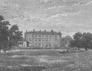
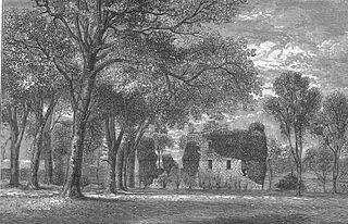
Caldwell is a mansion and old estate with the remains of a castle nearby. These lands lie close to the Lugton Water and the villages of Uplawmoor in East Renfrewshire and Lugton in East Ayrshire.

<span class="mw-page-title-main">Busbie Castle</span>

Busbie Castle was situated in what is now known as Knockentiber, a village in East Ayrshire, Parish of Kilmaurs, Scotland. Knockentiber is 2 miles (3.2 km) WNW of Kilmarnock and 1/2 mile NE of Crosshouse. The castle overlooked the Carmel Glen and its Burn, which runs into the River Irvine, a mile or so to the south, after passing through the old Busbie Mill.

<span class="mw-page-title-main">Giffordland</span> Barony in North Ayrshire, United Kingdom

Giffordland is in North Ayrshire, Parish of Dalry (Cunninghame) in the former Region of Strathclyde, Scotland.

<span class="mw-page-title-main">The Lands of Pitcon</span>

The Lands of Pitcon, previously Potconnel now form a small estate of around 100 acres in the Parish of Dalry, North Ayrshire in the old Barony of Dalry. The present category B listed Georgian mansion house dating from 1787, replaces an older castellated dwelling. Pitcon lies on the outskirts of Drakemyres, now a suburb of Dalry, close to the confluence of the Rye Water, River Garnock, and the Mains Burn, standing on a low knoll. Such a marshy area would have provided a degree of protection to the old castle.

<span class="mw-page-title-main">Polkelly Castle</span>

Polkelly Castle, also Pokelly, was an ancient castle located near Fenwick, at NS 4568 4524, in the medieval free Barony of Polkelly, lying north of Kilmarnock, Parish of Fenwick, East Ayrshire, Scotland. The castle is recorded as Powkelly (c1747), Pockelly (c1775), Pow-Kaillie, Ponekell, Polnekel, Pollockelly, Pollockellie, Pokellie, Pothelly, Pathelly Ha' and Polkelly. The name is given circa 1564 as Powkellie when it was held by the Cunninghams of Cunninghamhead.

<span class="mw-page-title-main">Murder of Hugh Montgomerie</span>

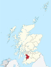
The Murder of Hugh Montgomerie, 4th Earl of Eglinton at the Annick Ford in Stewarton, East Ayrshire, Scotland, took place in 1586 as a consequence of a long running feud between the Montgomeries, Earls of Eglinton and the Cunninghames, Earls of Glencairn, families who were competing for power and influence locally and nationally. The significant repercussions of this act were felt throughout the county of Ayrshire and beyond. The spelling 'Montgomerie' is used throughout for both the family and Montgomery for the clan and clan and district names 'Cunninghame' in the same fashion.

<span class="mw-page-title-main">Lands of Tour and Kirkland</span> Human settlement in Scotland

The Lands of Tour and Kirkland (NS416406) formed a small estate close to the old Kirktoun and St Maurs-Glencairn collegiate church about 1 km south-east of Kilmaurs, East Ayrshire, Parish of Kilmaurs, Scotland. The word 'Tour' in Scots refers to a 'tower' and 'kirk' to a parish church.

<span class="mw-page-title-main">Lands of Templehouse</span> Human settlement in Scotland

The Lands of Templehouse formed a small estate lying between Aiket Castle and the town of Dunlop, East Ayrshire, Parish of Dunlop, Scotland. The laird's house at Templeland of Dunlop Hill, to give it its formal name, stood near to the ancient road leading from Dunlop to Kirkwood and on to Kennox. The lands were held by the Knights Templar until a date prior to 1570 when the Gemmells of Templehouse were granted the property and remained there until 1962, a period of around 500 years. The spelling 'Gemmell' is used for consistency except where otherwise denoted.

The Lands of Dallars or Auchenskeith (NS463337) form a small estate in East Ayrshire, Hurlford, Kilmarnock, Parish of Riccarton, Scotland. The present mansion house is mainly late 18th-century, located within a bend of the Cessnock Water on the site of older building/s. "Dullers or Dillers" was changed to "Auchenskeith" or "Auchinskeigh" (sic) as well as other variants and then the name reverted nearer to the original form as "Dollars" and then finally "Dallars". Dallars lies 3.25 km south of Hurlford.

<span class="mw-page-title-main">Lands of Blacklaw</span> Human settlement in Scotland

The Lands of Blacklaw formed a small property of five merks worth, in the Lordship of Stewarton at the eastern extremity of Strathannick, between the hamlet of Kingsford in East Ayrshire and the East Renfrewshire boundary, Scotland. It was first recorded in 1484 in the Acta Auditorum. Black Law is a prominent whinstone crag lying above Blacklaw Hill Farm.

References

Notes
  1. Adamson, Archibald (1875). Rambles Round Kilmarnock. T. Stevenson. p. 11.
  2. "Canmore - Soulis Cross" . Retrieved 17 March 2018.
  3. 1 2 "Future Museum - Soulis Cross". Future Museum Partnership. Retrieved 17 March 2018.
  4. Graham, Barbara (1975). The Soulis Cross. Kilmarnock and District History Group. p. 15.
  5. Paterson, James (1866). History of the Counties of Ayrs and Wigton. Vol.III, part II. Birlinn. p. 203. ISBN   1841582670.
  6. Paterson, James (1866). History of the Counties of Ayrs and Wigton. Vol.III, part II. James Stillie. p. 404.
  7. Mckay, Archibald (1880). History of Kilmarnock. Archibald McKay. p. 29.
  8. Dobie, James (1876). Cunninghame Topographized by Timothy Pont, A.M. 1604-1608. John Tweed. p. 299.
  9. Adamson, Archibald (1875). Rambles Round Kilmarnock. T. Stevenson. p. 11.
  10. Building Conservation - Stone Crosses
  11. Building Conservation - Stone Crosses
  12. Graham, Barbara (1975). The Soulis Cross. Kilmarnock and District History Group. p. 14.
  13. Graham, Barbara (1975). The Soulis Cross. Kilmarnock and District History Group. p. 15.
  14. Mckay, Archibald (1880). History of Kilmarnock. Archibald McKay. p. 30.
  15. Mckay, Archibald (1880). History of Kilmarnock. Archibald McKay. p. 32.
  16. Dobie, James (1876). Cunninghame Topographized by Timothy Pont, A.M. 1604-1608. John Tweed. p. 293.
  17. "'Kilmarnock - A Historical Survey'" (PDF). Retrieved 4 April 2018.
  18. Graham, Barbara (1975). The Soulis Cross. Kilmarnock and District History Group. p. 15.
  19. Adamson, Archibald (1875). Rambles Round Kilmarnock. T. Stevenson. p. 11.
  20. Graham, Barbara (1975). The Soulis Cross. Kilmarnock and District History Group. p. 15.
  21. Graham, Barbara (1975). The Soulis Cross. Kilmarnock and District History Group. p. 18.
  22. Robertson, George (1820). Topographical Description of Ayrshire; more Particularly of Cunninghame: together with a Genealogical account of the Principal families in that Bailiwick. Cunnighame Press. p. 15.
  23. Graham, Barbara (1975). The Soulis Cross. Kilmarnock and District History Group. p. 20.
  24. Dobie, James (1876). Cunninghame Topographized by Timothy Pont, A.M. 1604-1608. John Tweed. p. 293.
  25. Smith, John (1895). Prehistoric Man in Ayrshire. Elliot Stock. p. 95.
  26. Graham, Barbara (1975). The Soulis Cross. Kilmarnock and District History Group. p. 19.
  27. "Scotlands Places - Soulis Cross" . Retrieved 17 March 2018.
  28. Folklore, Myths & Legends of Britain. 1973. Reader's Digest. London.
  29. Graham, Barbara (1975). The Soulis Cross. Kilmarnock and District History Group. p. 16.
Sources
  1. Adamson, Archibald (1875). Rambles Round Kilmarnock. Kilmarnock : T. Stevenson.
  2. Campbell, Thorbjorn (2003). Ayrshire - An Historic Guide. Edinburgh : Birlinn Ltd. ISBN   1-84158-267-0
  3. Dobie, James (1876). Pont's Cunninghame topographized 1604–1608 with continuations and illustrative notices. Pub. John Tweed.
  4. Graham, Barbara (1974). 'The Soulis Cross' in Kilmarnock - Aspects of Local History. Kilmarnock & District History Group.
  5. McKay, Archibald (1880). The History of Kilmarnock. Kilmarnock : Archibald McKay.
  6. Paterson, James (1863–66). History of the Counties of Ayr and Wigton. V. - III - Cunninghame. Edinburgh: J. Stillie. V. IV, Cunningham, Part I.
  7. Robertson, George (1820). Topographical Description of Ayrshire; more Particularly of Cunninghame: together with a Genealogical account of the Principal families in that Bailiwick. Irvine : Cunninghame Press.
  8. Smith, John (1895). Prehistoric Man in Ayrshire. London : Elliot Stock.

55°27′25.9″N4°36′10.3″W / 55.457194°N 4.602861°W / 55.457194; -4.602861