Related Research Articles

The Feather River is the principal tributary of the Sacramento River, in the Sacramento Valley of Northern California. The river's main stem is about 73 miles (117 km) long. Its length to its most distant headwater tributary is just over 210 miles (340 km). The main stem Feather River begins in Lake Oroville, where its four long tributary forks join—the South Fork, Middle Fork, North Fork, and West Branch Feather Rivers. These and other tributaries drain part of the northern Sierra Nevada, and the extreme southern Cascades, as well as a small portion of the Sacramento Valley. The total drainage basin is about 6,200 square miles (16,000 km2), with approximately 3,604 square miles (9,330 km2) above Lake Oroville.
Powell Mountain is a mountain ridge of the Ridge-and-valley Appalachians of the Appalachian Mountains. It is a long and narrow ridge, running northeast to southwest, from about Norton, Virginia to near Tazewell, Tennessee. It separates the Clinch River basin and the Powell River basin of Powell Valley. It was named for an 18th-century explorer.
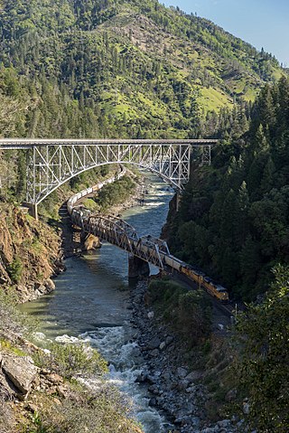
The North Fork Feather River is a watercourse of the northern Sierra Nevada and southern Cascades in the U.S. state of California. It flows generally southwards from its headwaters near Lassen Peak to Lake Oroville, a reservoir formed by Oroville Dam in the foothills of the Sierra, where it runs into the Feather River. The river drains about 2,100 square miles (5,400 km2) of the western slope of the Sierras. By discharge, it is the largest tributary of the Feather.

Eagle Creek is a tributary of the Columbia River in Multnomah and Hood River counties in the U.S. state of Oregon. It cuts through a narrow canyon in its 3,200 feet (980 m) descent to the Columbia River Gorge and is known for its concentration of 13 waterfalls in about 5 miles (8.0 km) distance. Eight major falls are on Eagle Creek and the East Fork Eagle Creek itself, while five are on its tributaries.
Orestimba Creek, originally Arroyo de Orestimba is a tributary of the San Joaquin River draining eastern slopes of part of the Diablo Range within the San Joaquin Valley of California.
Sinking Creek is a stream in Dent, Reynolds and Shannon counties in the Ozarks of southeast Missouri. It is a tributary of the Current River.
Lone Tree Creek is a tributary stream of the San Joaquin River now diverted, in San Joaquin County, California. Its source is in the Diablo Range at its confluence with its North Fork and Middle Fork tributary streams at 37°34′15″N121°26′24″W at an elevation of 790 feet. Its mouth was originally at its confluence with the San Joaquin River, but later was diverted into the Delta Mendota Canal at 37°38′24″N121°21′12″W, but now interrupted by development, reaches just past the mouth of its canyon at an elevation of 290 feet.
Oak Creek is a tributary stream of the Owens River, in Inyo County, California. Its mouth lies at an elevation of 3,924 feet / 1,196 meters, 2.2 miles north northwest of Independence, California, just south of the Fort Independence Reservation. Its source is to the west at the foot of the Sierra Nevada at the confluence of South Fork Oak Creek and North Fork Oak Creek at 36°49′57″N118°15′05″W at an elevation of 4,380 feet / 1,335 meters.
Kellogg Creek is a tributary of Indian Slough, in Contra Costa County, California. Indian Slough itself is a tributary of the Old River, an old channel of the San Joaquin River. Kellogg Creek was formerly named Arroyo Santa Ángela de Fulgino by Pedro Font, on April 4, 1776, as the expedition of Juan Bautista de Anza passed through the area. In the 19th century it was known to the Californios as Arroyo del Sur.
Indian Slough is a slough, tributary to the Old River, an old channel of the San Joaquin River in California. Its mouth is at an elevation of 7 feet / 2 meters, at its confluence with the Old River. Its source is at its confluence with Kellogg Creek at an elevation of 7 feet / 2 meters at the location 37°54′58″N121°36′18″W.
Adobe Canyon is a valley and tributary stream of Del Puerto Creek in Stanislaus County, California.
Mississippi Creek is a tributary stream to Pacheco Creek in Santa Clara County, California.
North Fork Orestimba Creek is a tributary stream of Orestimba Creek, in the Diablo Range in Stanislaus County, California. Its mouth lies at an elevation of 673 feet at its confluence with South Fork Orestimba Creek where it forms the head of Orestimba Creek, itself a tributary of the San Joaquin River. Its source is at an elevation of 3,250 feet at 37°20′37″N121°24′44″W on the north slope of the northern ridge of Black Mountain.
Mustang Flat is a flat in the Diablo Range in Stanislaus County, California. It lies at an elevation of 1,329 feet south of the South Fork Orestimba Creek, north of Mustang Peak.
Fifield Ranch is a locale within the Diablo Range in Santa Clara County, California. It lies at an elevation of 1,512 feet, west of the head of Romero Creek and the Santa Clara County line, about a mile north of Hagerman Peak. It is at the source of a tributary canyon and stream to Chimney Gulch, itself a tributary of East Fork Pacheco Creek.
Chimney Gulch is a valley and arroyo in the Diablo Range, in Santa Clara, California. Its mouth is at an elevation of 932 feet / 284 meters at its confluence with an unnamed creek tributary to East Fork Pacheco Creek that runs westward down below Hagerman Peak to join the East Fork about an eighth of a mile below its confluence with Chimney Gulch. The head of Chimney Gulch and the source of the stream, is a pond south of the Fifield Ranch on the northeast slope of Hagerman Peak at 37°06′52″N121°13′55″W.
East Fork Pacheco Creek is a 5 mile long tributary stream of North Fork Pacheco Creek in the Diablo Range in Santa Clara County, California. Its confluence with the North Fork is at an elevation of 610 feet / 186 meters. Its source is located about a half mile nortnortheast of the Fifield Ranch at 37°08′07″N121°13′47″W at an elevation of 1600 feet / 488 meters just west of County Line Road that runs along the crest of the Diablo Range between Santa Clara County and Stanislaus County, California about a quarter mile before its intersection with the Fifield Grade and McCabe Road that climbs upward from the canyon of Romero Creek on the east slope of the Diablo Range in Merced County, California.
Bullhead Canyon, is a canyon and tributary stream of the North Fork Pacheco Creek in Santa Clara County, California. Its mouth is on its confluence with North Fork Pacheco Creek at an elevation of 630 feet / 192 meters. Its source and its upper reach is at 37°10′08″N121°19′04″W within the boundary of Henry W. Coe State Park. It is overlooked to the north by the County Line Road,, that runs west to east along the divide of the Diablo Range and the boundary of Santa Clara and Stanislaus County, California.
Wildcat Canyon is a canyon and tributary stream of South Fork Pacheco Creek in Santa Clara County, California. Its source is in the Diablo Range in San Benito County, California. Its source is a spring at an elevation of 2,560 feet / 780 meters, on the southwest slope of Mariposa Peak near its summit at 36°57′15″N121°12′52″W. Its mouth is at its confluence with South Fork Pacheco Creek at an elevation of 1,388 feet / 423 meters.
Palomas Creek, also named Las Palomas Creek, and Palomas River, is a tributary stream of the Rio Grande in Sierra County, New Mexico. Its mouth is located at an elevation of 4,206 feet / 1,282 meters. Its source is at 33°10′44″N107°32′02″W at the confluence of the North Fork and South Fork Palomas Creek at an elevation of 5,298 / 1,615 meters. The North Fork Palomas Creek has its source near the Continental Divide in the Black Range within the Gila National Forest at 33°15′55″N107°49′27″W at an elevation of 7,400 / 2,444 meters. The South Fork Palomas Creek similarly has its source in the Black Range in the same National Forest at 33°09′55″N107°51′08″W just below the Continental Divide at an elevation of 8,960 / 2,959 meters.
References
Coordinates: 37°18′09″N121°17′22″W / 37.30250°N 121.28944°W