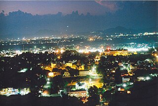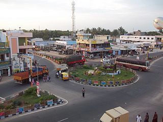
Kadayanallur is the second largest town in Tirunelveli district in Tamil Nadu, India.

Vaniyambadi is a town and a Municipality in Vellore district in the Indian state of Tamil Nadu. It is located about 200 km from Chennai. It is one of the hubs of Leather exports in Tamil Nadu. It is also known for its Biryani. The prestigious century old Islamiah Boys Higher Secondary School, Vaniyambadi, Hindu Higher Secondary School, [Islamiah College, Vaniyambadi],Islamiah Women's College, Vaniyambadi Islamiah Girls Higher Secondary School, Vaniyambadi are located here along with two other Arts college and a professional degree offering The Priyadarshini Engineering College. Yelagiri, a hill station is approximately 20 km away from Vaniambadi.

Marungoor, also spelt Marungur, is a panchayat town near Suchindrum in Kanniyakumari district in the Indian state of Tamil Nadu. The place sprawls over an area of about 10 km².

Perambalur is a municipality town in the state of Tamil Nadu. It is the administrative headquarters of Perambalur district and Perambalur Taluk (Sub-District). Perambalur is the central town of Tamil Nadu. Perambalur district is bounded on the North by Cuddalore and Salem, South by Trichy, East by Ariyalur, West by Trichy and Salem. As of 2011 census, the town had a population of 49,648. There are a set of 11th century Buddhists images around the villages of Perambalur called Perambalur Buddhas.

Alwarthirunagiri is a panchayat town in Thoothukudi district in the state of Tamil Nadu, India. It is next to Srivaikuntam on the Tirunelveli - Tiruchendur Highway, Tamil Nadu, southern India. It's about 31 km from Tirunelveli and 29 km from Tiruchendur, on the banks of the river Tamirabarani. Alwarthirunagiri is the birthplace of alwar saint Nammalvar. The temple is classified as a "Divya Desam", the 108 temples of Sri Narayana revered by the 12 poet saints, or Alwars.

Chinnasekkadu is a neighbourhood of Chennai in Chennai district in the state of Tamil Nadu, India. Chinnasekkadu used to be a town panchayat in Thiruvallur district. In 2011, Chinnasekkadu town panchayat wss merged with Chennai Corporation. Chinnasekkadu comes under ward 29 in Zone 3(Madhavaram) of Chennai Corporation.

Dharapadavedu is a locality and zone headquarters (katpadi) in Vellore Municipal Corporation in the state of Tamil Nadu, India. Vellore-Katpadi Railway junction is located here.It is also a part of katpadi locality. But Vellore corporation zonal office (zone-1) is located here.

Edaicode is a panchayat town in Kanniyakumari district in the state of Tamil Nadu, India.

Eral is a town in the Tuticorin district in the state of Tamil Nadu, India.

Injambakkam is a locality in the south of Chennai in the Indian state of Tamil Nadu. Being a part of the Walajabad block of the district, its panchayat is part of Walajabad panchayat union. Injambakkam is located along the ECR.

Kilpennathur is a Panchayat Town in Tiruvanamalai district in the Indian state of Tamil Nadu. Kilpennathur is one of the taluks of Tiruvannamalai district and an assembly constituency of Tamil Nadu.The MLA of Kilpennathur assembly constituency is DMK party Mr. K. Pichandi.

Minjur is a neighbourhood in the northern fringes of Chennai, India. It is located in the Thiruvallur district in the Indian state of Tamil Nadu. Minjur is called 'Vada Kanchi' meaning North Kanchipuram. The town has two famous temples for Shiva and Vishnu, similar to Kanchipuram. The neighbourhood is served by Minjur railway station of the Chennai Suburban Railway Network.

Musiri is a Panchayat town in the Tiruchirappalli district in the Indian state of Tamil Nadu. It has an average elevation of 82 metres (269 feet).

Nallur (Nalloor) is a panchayat town in Kanniyakumari district in the Indian state of Tamil Nadu.

Naravarikuppam is a town in Thiruvallur district in the Indian state of Tamil Nadu.also called redhills

Panboli is a panchayat town in Tirunelveli district in the Indian state of Tamil Nadu.

Sathuvachari is an area and Zone-II headquarters of Vellore Municipal Corporation. It is located in the east of Vellore city. It is situated in the bank of Palaar River.

Thevaram is a Town Panchayat in Theni district in the Indian state of Tamil Nadu. Thevaram is located in Tamil Nadu near on border of Kerala at the Eastern side foot-hill of Western Ghats. The State Highway SH-100 passes through this town.

Usilampatti is a Town and a Municipality in Madurai District in the Madurai Region at Indian state of Tamil Nadu.

Ulundurpettai is a town panchayat in Ulundurpet taluk of Viluppuram District of Tamil Nadu, India.


