Holne is a village and civil parish on the southeastern slopes of Dartmoor in Devon, England. A community has existed here since at least the 11th century, and today a population of around 250 people is served by a church and a public house, the Church House Inn.

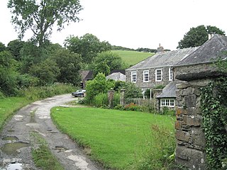
Rattery is a village and civil parish in the South Hams district, in the county of Devon, England, a few miles from the villages Buckfastleigh and neighbouring village Ashburton. The name has been suggested as a variant of Red Tree but is mentioned in the Domesday Book of 1086 as Ratreu. In 2001 the parish had a population of 458.

Boyton is a civil parish and village in Cornwall, England, United Kingdom. It is situated close to the River Tamar and the border with Devon about six miles (10 km) north of Launceston. According to the 2001 census it had a population of 378.This increased to 457 at the 2011 census.
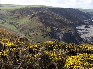
Tregardock is a coastal hamlet and beach in the civil parish of Delabole in north Cornwall, England, United Kingdom. It is situated between Trebarwith Strand and Port Gaverne. The small beach is accessed by climbing down the cliffs near the settlement of Tregardock.
St Giles in the Wood is a village and civil parish in the Torridge district of Devon, England. The village lies about 2.5 miles east of the town of Great Torrington, and the parish, which had a population of 566 in 2001 compared with 623 in 1901, is surrounded clockwise from the north by the parishes of Huntshaw, Yarnscombe, High Bickington, Roborough, Beaford, Little Torrington and Great Torrington. Most of the Victorian terraced cottages in the village, on the east side of the church, were built by the Rolle Estate.

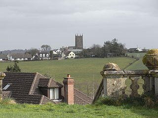
Drewsteignton is a village, civil parish and former manor within the administrative area of West Devon, England, also lying within the Dartmoor National Park. It is located in the valley of the River Teign, 13 miles (21 km) west of Exeter and 9 miles (14 km) south east of Okehampton. Visitor attractions in the area include the village centre itself, nearby Castle Drogo, and Fingle Bridge. The population of the ward at the 2011 census was 1,616.

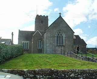
Swimbridge is a village, parish and former manor in Devon, England. It is situated 4 miles (6.4 km) south-east of Barnstaple and twinned with the town of St.Honorine Du Fay in Normandy, France. It was the home of the Rev. John "Jack" Russell who first bred the Jack Russell Terrier.

Trewint is a hamlet in the civil parish of Altarnun, east Cornwall, England, United Kingdom. The hamlet is just off the A30 main road, and is south of the village of Altarnun. Trewint Downs, part of Bodmin Moor, are further west.
Blackborough is a hamlet and former manor in the parish of Kentisbeare, Devon, England. It is situated within the Mid Devon district. The nearest substantial town is Cullompton, approximately 4.7 miles (7.6 km) to the south-west. Within Blackborough are situated the large mansion of Blackborough House also notable are Hayne Farm and the Old Smithy. The former neo-Gothic Early English style parish church of All Saints, built in 1838 by George Wyndham, 4th Earl of Egremont, lord of the manor, who also built Blackborough House was demolished in 1994, having become structurally unsafe. The churchyard however is still maintained and the ecclesiastical parish and parochial church council still exist.
Milton Damerel is a village, parish and former manor in north Devon, England. Situated in the political division of Torridge, on the river Waldon, it covers 7 square miles (18 km2). It contains many tiny hamlets including Whitebeare, Strawberry Bank, East Wonford and West Wonford. The parish has a population of about 450. The village is situated about 5 miles (8.0 km) from Holsworthy, 13.081 miles (21.052 km) from Bideford and 22.642 miles (36.439 km) from Barnstaple. The A388 is the main road through the parish.

Roborough is a village and civil parish 5.5 mi (8.9 km) from Great Torrington, in Devon, England. Situated topographically on the plateau between the Torridge and Taw Rivers, the parish covers 1,258 ha and contains a population of some 258 parishioners. It is surrounded by a pastoral landscape of rectangular fields, high hedges and scattered farmsteads.

North Radworthy is a hamlet and historic estate in the civil parish and former manor of North Molton, in the North Devon district of the county of Devon, England. It is about three miles north of the village of North Molton, and about fifteen miles to the east of the town of Barnstaple. The hamlet sits on an unclassified road, and is surrounded to the north, south and west by woodland. North Radworthy Farm is the centre of the historic estate.

Halwell and Moreleigh is a civil parish in the South Hams district, in the county of Devon, England. It comprises the villages of Halwell and Moreleigh. In 2011 it had a population of 446.
Thuborough in the parish of Sutcombe, Devon, England, is an historic estate, formerly a seat of a branch of the Prideaux family, also seated at Orcharton, Modbury; Adeston, Holbeton; Soldon, Holsworthy; Netherton, Farway; Ashburton; Nutwell, Woodbury; Ford Abbey, Thorncombe, all in Devon and at Prideaux Place, Padstow and Prideaux Castle, Luxulyan, in Cornwall. The present mansion house, comprising "Thuborough House" and "Thuborough Barton", the north-east block, is a grade II listed building.
Gotshelm was an Anglo-Norman magnate and one of the 52 Devon Domesday Book tenants-in-chief of King William the Conqueror and was also a Cornwall Domesday Book tenant-in-chief. He is listed in the Domesday Book of 1086 as holding 28 estates or manors in Devon from the king. His brother was Walter de Claville, also a Devon Domesday Book tenant-in-chief, who held 32 estates or manors in Devon from the king.
Ansger of Montacute was one of the Devon Domesday Book tenants-in-chief of King William the Conqueror.
Theobald FitzBerner, was an Anglo-Norman warrior and magnate, one of the Devon Domesday Book tenants-in-chief of King William the Conqueror. The Domesday Book of 1086 lists him as the holder of 27 manors in Devon. His lands later formed part of the Feudal barony of Great Torrington, together with lands of his son-in-law Odo FitzGamelin
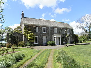
Luscombe is an historic estate situated in the parish of Rattery in Devon.
Alfred the Breton was one of the Devon Domesday Book tenants-in-chief of King William the Conqueror. He had 22 landholdings in the county of Devonshire held in-chief according to the Domesday Book of 1086, and held further lands as a mesne tenant, including the manor of Panson in the parish of St Giles-in-the-Heath. His manors later descended to the feudal barony of Plympton.
Algar was an Anglo-Saxon personal name, frequently mentioned in the Domesday Book of 1068. it is impossible to determine whether the many mentions of the name in that record refer to a single person or to several people of the same name. Some mentions of the name have an identifying suffix, such as "Algar Long" and "Algar the Priest".

