Related Research Articles

The Mississippi River is the second-longest river and chief river of the second-largest drainage system in North America, second only to the Hudson Bay drainage system. From its traditional source of Lake Itasca in northern Minnesota, it flows generally south for 2,340 miles (3,766 km) to the Mississippi River Delta in the Gulf of Mexico. With its many tributaries, the Mississippi's watershed drains all or parts of 32 U.S. states and two Canadian provinces between the Rocky and Appalachian mountains. The main stem is entirely within the United States; the total drainage basin is 1,151,000 sq mi (2,980,000 km2), of which only about one percent is in Canada. The Mississippi ranks as the thirteenth-largest river by discharge in the world. The river either borders or passes through the states of Minnesota, Wisconsin, Iowa, Illinois, Missouri, Kentucky, Tennessee, Arkansas, Mississippi, and Louisiana.

The Missouri River is the longest river in the United States. Rising in the Rocky Mountains of the Eastern Centennial Mountains of Southwestern Montana, the Missouri flows east and south for 2,341 miles (3,767 km) before entering the Mississippi River north of St. Louis, Missouri. The river drains a sparsely populated, semi-arid watershed of more than 500,000 square miles (1,300,000 km2), which includes parts of ten U.S. states and two Canadian provinces. Although a tributary of the Mississippi, the Missouri River is slightly longer and carries a comparable volume of water. When combined with the lower Mississippi River, it forms the world's fourth longest river system.

The Kings River, historically called Wimmel-che by the Yokuts, is a 132.9-mile (213.9 km) river draining the Sierra Nevada mountain range in central California in the United States. Its headwaters originate along the Sierra Crest in and around Kings Canyon National Park and form the eponymous Kings Canyon, one of the deepest river gorges in North America. The river is impounded in Pine Flat Lake before flowing into the San Joaquin Valley southeast of Fresno. With its upper and middle course in Fresno County, the Kings River diverges into multiple branches in Kings County, with some water flowing south to the old Tulare Lake bed and the rest flowing north to the San Joaquin River. However, most of the water is consumed for irrigation well upstream of either point.

The Des Moines River is a tributary of the Mississippi River in the upper Midwestern United States that is approximately 525 miles (845 km) long from its farther headwaters. The largest river flowing across the state of Iowa, it rises in southern Minnesota and flows across Iowa from northwest to southeast, passing from the glaciated plains into the unglaciated hills near the capital city of Des Moines, named after the river, in the center of the state. The river continues to flow at a southeastern direction away from Des Moines, later flowing directly into the Mississippi River.
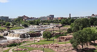
The Big Sioux River is a tributary of the Missouri River in eastern South Dakota and northwestern Iowa in the United States. It flows generally southwardly for 419 mi (674 km), and its watershed is 9,006 sq mi (23,330 km2). The United States Board on Geographic Names settled on "Big Sioux River" as the stream's name in 1931. The river was named after the Lakota people which was known by them as Tehankasandata, or Thick Wooded River.

The English River is a tributary of the Iowa River in southeastern Iowa in the United States. The main stem of the river is 37.4 miles (60.2 km) long. Including its longest headwaters tributary, the North English River, the total length increases to 89.2 miles (143.6 km). Via the Iowa River, it is part of the Mississippi River watershed. The Deep River is a minor tributary of the English River. The towns of North English, South English and Deep River are named for the English and Deep rivers.

The Pecatonica River is a tributary of the Rock River, 194 miles (312 km) long, in southern Wisconsin and northern Illinois in the United States.
The Cedar River is a 338-mile-long (544 km) river in Minnesota and Iowa. It is a tributary of the Iowa River, which flows to the Mississippi River. The Cedar River takes its name from the red cedar trees growing there, and was originally called the Red Cedar River by the Meskwaki. The first Mississippi steamboat reached Cedar Rapids, Iowa in 1844, and during the next decade, the Red Cedar was an important commercial waterway. The surrounding region is known officially as the Cedar River Valley, though it is more commonly referred to simply as the Cedar Valley. The stream is young geologically, and only in places where the glacial material has been removed is the underlying bedrock exposed.

The Kentucky River is a tributary of the Ohio River, 260 miles (418 km) long, in the U.S. Commonwealth of Kentucky. The river and its tributaries drain much of the central region of the state, with its upper course passing through the coal-mining regions of the Cumberland Mountains, and its lower course passing through the Bluegrass region in the north central part of the state. Its watershed encompasses about 7,000 square miles (18,000 km2). It supplies drinking water to about one-sixth of the population of the Commonwealth of Kentucky.

The Winnebago River is a 72-mile-long (116 km) river in northern Iowa. It is a tributary of the Shell Rock River, part of the Cedar River watershed that flows via the Iowa River to the Mississippi River. The Winnebago River rises in Winnebago County, Iowa, north of Leland and flows south through Forest City, then east and southeast through Mason City on its way to the Shell Rock River at Rockford. Headwater tributaries of the Winnebago River extend north into southern Minnesota.

The Loess Hills are a formation of wind-deposited loess soil in the westernmost parts of Iowa and Missouri, and the easternmost parts of Nebraska and Kansas, along the Missouri River.

The Nishnabotna River is a tributary of the Missouri River in southwestern Iowa, northwestern Missouri and southeastern Nebraska in the United States. It flows for most of its length as two parallel streams in Iowa, the East Nishnabotna River and the West Nishnabotna River. The east and west branches are each about 120 miles (190 km) long; from their confluence the Nishnabotna flows approximately another 16 miles (26 km).
The Fabius River is a 3.5-mile-long (5.6 km) tributary of the Mississippi River in northeastern Missouri in the United States. It is formed near its mouth by the confluence of the North Fabius River and the South Fabius River. The North Fabius River also flows through southeastern Iowa. The Middle Fabius River joins the North Fabius 8.9 miles (14.3 km) upstream of that river's mouth.

The Rock River is a tributary of the Big Sioux River, about 144 miles (232 km) long, in southwestern Minnesota and northwestern Iowa in the United States. Via the Big Sioux and Missouri rivers, it is part of the watershed of the Mississippi River. The river's name comes from a prominent rocky outcrop about 175 feet high of reddish-gray Sioux Quartzite, about 3 miles (5 km) north of Luverne. The outcrop of quartzite is contained in Minnesota's Blue Mounds State Park.

The Platte River is a tributary of the Missouri River, about 200 miles (320 km) long, in southwestern Iowa and northwestern Missouri in the United States. It is sometimes known as the Little Platte River to distinguish it from the larger Platte River, also a tributary of the Missouri, in nearby Nebraska; the Platte River of Missouri itself has a tributary known as the "Little Platte River".

The Nodaway River is a 65.7-mile-long (105.7 km) river in southwest Iowa and northwest Missouri.

General Zebulon Pike Lock and Dam No. 11 is a lock and dam located between Dubuque, Iowa, and rural Grant County, Wisconsin, on the Upper Mississippi River.

Lock and Dam No. 12 is a lock and dam located on the Upper Mississippi River at Bellevue, Iowa, United States. The movable portion of the dam starts at the locks adjacent to the Iowa shore and is 849 feet (258.8 m) long, consisting of seven tainter gates and three roller gates. It connects to a 200-foot (61.0 m) storage yard and continues toward the Illinois shore with a 2,750-foot (838.2 m) non-submersible dike, a 1,200-foot (365.8 m) submersible dike and a 3,130-foot (954.0 m) non-submersible dike. The non-submersible sections are separated from the submersible section with two 120-foot (36.6 m) transitional dikes. The main lock is 110 feet (33.5 m) wide by 600 feet (182.9 m) long. There is also an incomplete auxiliary lock. In 2004, the facility was listed in the National Register of Historic Places as Lock and Dam No. 12 Historic District, #04000172 covering 1,017 acres (4.1 km2), 1 building, 3 structures, and 4 objects.

The Middle River is a tributary of the Des Moines River in south-central Iowa in the United States. It is 123 miles (198 km) long and drains an area of 489.5 square miles (1,268 km2). Via the Des Moines River, it is part of the watershed of the Mississippi River.

The Grand River is a river that stretches from northernmost tributary origins between Creston and Winterset in Iowa approximately 226 miles (364 km) to its mouth on the Missouri River near Brunswick, Missouri.
References
- ↑ "USGS Current Conditions for USGS 05487470 South River near Ackworth, IA".
- ↑ U.S. Geological Survey. National Hydrography Dataset high-resolution flowline data. The National Map, accessed May 26, 2011