South San Ramon Creek

Last updated
South San Ramon Creek
Relief map of California.png
Red pog.svg
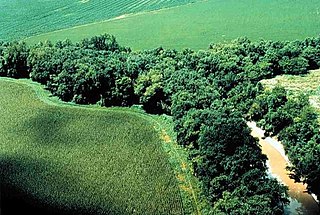
Location of the mouth of San Ramon Creek in California
Location
Country United States
State California
Region Alameda County, Contra Costa County
Cities Pleasanton, Dublin, San Ramon
Physical characteristics
Source Sherburne Hills
 - locationsoutheast of Danville
 - coordinates 37°45′56″N121°57′20″W / 37.76556°N 121.95556°W / 37.76556; -121.95556 [1]
Mouth Arroyo de la Laguna
 - location
Pleasanton, California
 - coordinates
37°40′37″N121°54′44″W / 37.67694°N 121.91222°W / 37.67694; -121.91222 Coordinates: 37°40′37″N121°54′44″W / 37.67694°N 121.91222°W / 37.67694; -121.91222 [1]
 - elevation
315 ft (96 m) [1]

South San Ramon Creek is a 9.3-mile-long (15.0 km) [2] southward-flowing stream in Alameda County and southern Contra Costa County, in the East Bay region of northern California.

Stream A body of surface water flowing down a channel

A stream is a body of water with surface water flowing within the bed and banks of a channel. The stream encompasses surface and groundwater fluxes that respond to geological, geomorphological, hydrological and biotic controls.

Alameda County, California County in California

Alameda County is a county in the state of California in the United States. As of the 2010 census, the population was 1,510,271, making it the 7th-most populous county in the state. The county seat is Oakland. Alameda County is included in the San Francisco Bay Area, occupying much of the East Bay region.

Contra Costa County, California County in California, United States

Contra Costa County is a county in the state of California in the United States. As of the 2010 census, the population was 1,049,025. The county seat is Martinez. It occupies the northern portion of the East Bay region of the San Francisco Bay Area, and is primarily suburban. The county's name is Spanish for "opposite coast", referring to its position on the other side of the bay from San Francisco. Contra Costa County is included in the San Francisco–Oakland–Hayward, CA Metropolitan Statistical Area.

Contents

The creek is a tributary to Arroyo de la Laguna, flowing in the western Livermore Valley through Dublin and Pleasanton.

Arroyo de la Laguna river in the United States of America

Arroyo de la Laguna is a 7.5-mile-long (12.1 km) southward-flowing stream in Alameda County, California, United States which originates at the confluences of South San Ramon Creek and Arroyo Mocho. The Arroyo de la Laguna is fed by tributaries in the Amador Valley and certain eastern slope drainages of the Diablo Range; these tributaries include Arroyo Valle and Sinbad Creek. Arroyo del la Laguna is the major tributary to Alameda Creek which in turn flows into the San Francisco Bay.

Livermore Valley, formerly Valle De San Jose, is a valley in eastern Alameda County, in the East Bay region of the San Francisco Bay Area, northern California.

Dublin, California City in California, United States

Dublin is a suburban city of the East Bay and Tri-Valley regions of Alameda County, California, United States. Located along the north side of Interstate 580 at the intersection with Interstate 680, roughly 35 miles (56 km) east of downtown San Francisco, 23 miles (37 km) east of downtown Oakland, and 31 miles (50 km) north of downtown San Jose, it was referred to as "Dublin" in reference to the city of Dublin in Ireland because of the large number of Irish who lived there. The post office formally adopted the name in the 1890s.

Geography

South San Ramon Creek drains the land area generally lying above the Bishop Subbasin of the Livermore Valley Groundwater Basin. The Bishop Subbasin comprises 1,666 acres (7 km2) of valley lands in the far northwestern portion of Livermore Valley Ground Water Basin. [3] The Bishop Subbasin lies entirely within Contra Costa County, is drained by, and is a portion of that area locally designated as San Ramon Valley. The subbasin is bounded on the east and west by rolling hills composed of sediments of the Tassajara Formation.

The Bishop Subbasin is an aquifer that resides between two subsurface structures of the Tassajara Formation in the northern extremity of the Amador Valley, California. This aquifer is a sub-unit of the Livermore-Amador Groundwater Basin. The Bishop Subbasin is associated with the locale of San Ramon, California in Contra Costa County. The Bishop Subbasin along with the Mocho Subbasin is one of the aquifers in the Livermore Valley that has been studied the most heavily for benefits of injection of reclaimed reverse osmosis waters.

The San Ramon Valley is a valley and region in Contra Costa County and Alameda County, in the East Bay region of the San Francisco Bay Area in northern California.

The Tassajara Formation is a geologic unit within the Livermore Valley of Northern California, United States. The formation surfaces only in the northern upland parts of the Livermore Valley and underlie the central part of the valley floor at a depth ranging from 250 feet (80 m) to 700 feet (200 m). The Tassajara Formation consists of sediments ranging from brown to gray mudstone, andesitic sandstone, conglomerate, and minor bentonitic and pumiceous tuff. In the northern San Ramon area, the Tassajara Formation underlies Quaternary valley fill material.

The creek is being actively protected as of 2007, by the city of San Ramon [4] and other entities to preserve riparian zone habitat.

San Ramon, California City in California, United States

San Ramon is a city in Contra Costa County, California, United States, located 34 miles east of San Francisco, and within the San Ramon Valley. San Ramon's population was estimated as 75,931 in 2017 by the US Census Bureau, making it the 4th largest city in Contra Costa County, behind Richmond, Concord and Antioch.

Riparian zone interface between land and a river or stream

A riparian zone or riparian area is the interface between land and a river or stream. Riparian is also the proper nomenclature for one of the fifteen terrestrial biomes of the Earth. Plant habitats and communities along the river margins and banks are called riparian vegetation, characterized by hydrophilic plants. Riparian zones are important in ecology, environmental resource management, and civil engineering because of their role in soil conservation, their habitat biodiversity, and the influence they have on fauna and aquatic ecosystems, including grasslands, woodlands, wetlands, or even non-vegetative areas. In some regions the terms riparian woodland, riparian forest, riparian buffer zone,riparian corridor and riparian strip are used to characterize a riparian zone. The word riparian is derived from Latin ripa, meaning river bank.

Habitat ecological or environmental area inhabited by a particular species; natural environment in which an organism lives, or the physical environment that surrounds a species population

In ecology, a habitat is the type of natural environment in which a particular species of organism lives. It is characterized by both physical and biological features. A species' habitat is those places where it can find food, shelter, protection and mates for reproduction.

The public Iron Horse Regional Trail runs along a portion of South San Ramon Creek.

Iron Horse Regional Trail trail for pedestrians, horse riders and bicycles in California

The Iron Horse Regional Trail is a rail trail for pedestrians, horse riders and bicycles in the East Bay Area in California.

See also

Related Research Articles

Interstate 680 (I-680) is a north–south Interstate Highway in Northern California. It curves around the eastern cities of the San Francisco Bay Area from San Jose to Interstate 80 at Fairfield, bypassing cities along the eastern shore of San Francisco Bay such as Oakland and Richmond while serving others more inland such as Pleasanton and Concord.

East Bay Regional Park District

The East Bay Regional Park District (EBRPD) is a special district operating in Alameda County and Contra Costa County, California, within the East Bay area of the San Francisco Bay Area. It maintains and operates a system of regional parks which is the largest urban regional park district in the United States. The administrative office is located in Oakland.

East Bay (San Francisco Bay Area) eastern region of the San Francisco Bay Area, California, US

The eastern region of the San Francisco Bay Area, commonly referred to as the East Bay, includes cities along the eastern shores of the San Francisco Bay and San Pablo Bay. The region has grown to include inland communities in Alameda and Contra Costa Counties. With a population of roughly 2.5 million in 2010, it is the most populous subregion in the Bay Area.

<i>East Bay Times</i> California newspaper

East Bay Times is a daily newspaper based in Walnut Creek, California, U.S. that was previously published as the Contra Costa Times. The East Bay Times paper serves Contra Costa and eastern Alameda counties, in the eastern part of the San Francisco Bay Area. The Contra Costa Times also published four other editions under different titles with essentially the same content, serving distinct communities within its circulation area. In 2007 the Contra Costa Times was merged with Alameda News Group to form a new entity called Bay Area News Group-East Bay (BANG-EB), which is in turn owned by MediaNews Group.

Area code 925

Area code 925 is a California telephone area code that was split from area code 510 on March 14, 1998. It covers the inland portions of the East Bay counties of Alameda and Contra Costa in the central area of California.

Morgan Territory

Morgan Territory is a region in California on the east side of Mount Diablo in the San Francisco East Bay's Contra Costa County. The area is named for settler Jeremiah Morgan.

San Ramon Valley Unified School District public school district in Contra Costa County, California

San Ramon Valley Unified School District (SRVUSD) is a public school district in Contra Costa County, California. It has 36 school sites serving more than 32,000 students within the communities of Alamo, Danville, Blackhawk, Diablo, and San Ramon. It was founded in 1964.

The Mocho Subbasin is the largest of the groundwater subbasins in the Livermore Valley watershed in Northern California. This subbasin is bounded to the west by the Livermore Fault Zone and to the east by the Tesla Fault. Some groundwater flow occurs across these fault boundaries, but flows are discontinuous below a depth of fifty feet across the Tesla Fault and south of the Arroyo Mocho channel across the Livermore Fault. Surface watercourses in this unit include Arroyo Valle and Arroyo Seco.

The Tesla Fault can be found in the northeastern Diablo Range, California. This fault is only semi-active.

The Bernal Subbasin is an aquifer located in the southwestern corner of Livermore Valley Groundwater Basin, Alameda County, California, United States. All of the groundwater in Livermore Valley moves toward the Bernal Subbasin, which is bounded on the east by Pleasanton Fault, on the north by the Park Fault, and on the west by the Calaveras Fault.(Earth Metrics, 1989) All the streams draining the Livermore Valley merge above the Bernal formation and exit this subbasin and Livermore Amador Valley via the Arroyo de la Laguna.

The Pleasanton Fault is a seismically active geological structure in Alameda County and Contra Costa County, California, USA.

Hydrography of the San Francisco Bay Area

The Hydrography of the San Francisco Bay Area is a complex network of watersheds, marshes, rivers, creeks, reservoirs, and bays predominantly draining into the San Francisco Bay and Pacific Ocean.

Amador Valley is a valley in eastern Alameda County, California and is the location of the cities of Dublin and Pleasanton. The valley is bounded by the foothills of the Diablo Range on the north and south, Pleasanton Ridge to the west, and Livermore Valley to the east.

References

  1. 1 2 3 U.S. Geological Survey Geographic Names Information System: South San Ramon Creek
  2. U.S. Geological Survey. National Hydrography Dataset high-resolution flowline data. The National Map, accessed March 15, 2011
  3. C.Michael Hogan and Marc Papineau, Phase I Environmental Site Assessment, Vicinity of Deerwood Drive and Bollinger Canyon Road, San Ramon, California, Earth Metrics Inc.File ref 7815, San Mateo, Ca. (1989)
  4. Iron Horse Trail, San Ramon California