
The ecology of California can be understood by dividing the state into a number of ecoregions, which contain distinct ecological communities of plants and animals in a contiguous region. The ecoregions of California can be grouped into four major groups: desert ecoregions, Mediterranean ecoregions, forested mountains, and coastal forests.

The tallgrass prairie is an ecosystem native to central North America. Natural and anthropogenic fire, as well as grazing by large mammals, were historically agents of periodic disturbance, which regulates tree encroachment, recycles nutrients to the soil, and catalyzes some seed dispersal and germination processes. Prior to widespread use of the steel plow, which enabled large scale conversion to agricultural land use, tallgrass prairies extended throughout the American Midwest and smaller portions of southern central Canada, from the transitional ecotones out of eastern North American forests, west to a climatic threshold based on precipitation and soils, to the southern reaches of the Flint Hills in Oklahoma, to a transition into forest in Manitoba.
Till plains are an extensive flat plain of glacial till that forms when a sheet of ice becomes detached from the main body of a glacier and melts in place, depositing the sediments it carried. Ground moraines are formed with melts out of the glacier in irregular heaps, forming rolling hills. Till plains are common in areas such as the Midwestern United States, due to multiple glaciation events that occurred in the Holocene epoch. During this period, the Laurentide Ice Sheet advanced and retreated over roughly a 60,000 year period. Till plains created by the Wisconsin glaciation cover much of the Midwest, including North Dakota, South Dakota, Indiana, Minnesota, Wisconsin, Iowa, Illinois, and northern Ohio.
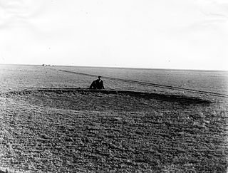
The High Plains are a subregion of the Great Plains mostly in the Western United States, but also partly in the Midwest states of Nebraska, Kansas, and South Dakota, generally encompassing the western part of the Great Plains before the region reaches the Rocky Mountains. The High Plains are located in eastern Montana, southeastern Wyoming, southwestern South Dakota, western Nebraska, eastern Colorado, western Kansas, eastern New Mexico, western Oklahoma, and to just south of the Texas Panhandle. The southern region of the Western High Plains ecology region contains the geological formation known as Llano Estacado which can be seen from a short distance or on satellite maps. From east to west, the High Plains rise in elevation from around 1,800 feet (550 m) to over 7,000 feet (2,100 m).
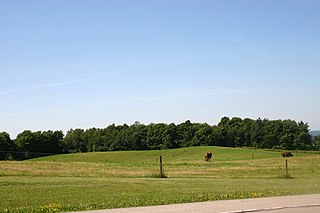
The Indiana Uplands or the Hoosier Uplands are a geographical region in south-central Indiana. On a topographical map the Indiana Uplands begin slightly north of the city of Martinsville, Indiana and continue south to the Ohio River. The description of the region inspired the name of Upland Brewing Company. The region's approximate boundaries are Interstate 65 to the east and U.S. Route 231 to the west. The Uplands are characterized by terrain varying from rolling hills to cliffs, sharp rugged hills and valleys. Nearly all of these hills are composed of sandstone, limestone, and siltstone from West to east. The siltstone hills are the most rugged followed by the sandstone while the limestone are the smoothest. This is contrast to the Tipton Till Plain immediately to the north in central Indiana, which features flat to gently rolling landscape. Interstates 64 and 69 pass through this rugged section of the state with sections of both cut deep into the rock and others towering over the treetops.

The Ozark Highlands is a Level III ecoregion designated by the Environmental Protection Agency (EPA) in four U.S. states. Most of the region is within Missouri, with a part in Arkansas and small sections in Oklahoma and Kansas. It is the largest subdivision of the region known as the Ozark Mountains, less rugged in comparison to the Boston Mountains in Arkansas, the highest part of the Ozarks.

The natural environment of Virginia encompasses the physical geography and biology of the U.S. state of Virginia. Virginia has a total area of 42,774.2 square miles (110,784.67 km2), including 3,180.13 square miles (8,236.5 km2) of water, making it the 35th-largest state by area. Forests cover 65% of the state, wetlands and water cover 6% of the land in the state, while 5% of the state is a mixture of commercial, residential, and transitional.

The Mixedwood Plains Ecozone is the Canadian ecozone with the most southern extent, covering all of southwestern Ontario, and parts of central and northeastern Ontario and southern Quebec along the Saint Lawrence River. It was originally dominated by temperate deciduous forest growing mostly on limestone covered by glacial till. It is the smallest ecozone in Canada, but it includes the country's most productive industrial and commercial region, and is home to nearly half of Canada's population, including its two largest cities, Toronto, Ontario and Montreal, Quebec. Hence, little of the original forest cover remains, making protection of the remaining forests a high conservation priority. This ecozone includes two regions described by J.S. Rowe in his classic Forest Regions of Canada: the entire Deciduous Forest Region, and the southern portions of the Great Lakes-St. Lawrence Forest Region. In the province of Ontario, the Ontario Ministry of Natural Resources maps this area as Site Regions 6E and 7E.

The Western Allegheny Plateau is an ecoregion of the Temperate broadleaf and mixed forests Biome, located on the western Allegheny Plateau and in the Appalachia region of the Eastern United States.

The North Central Hardwood Forests are a temperate broadleaf and mixed forests ecoregion in central Minnesota, central Wisconsin, and northwestern Lower Michigan, embedded between (clockwise) the Western Corn Belt Plains in the south, the Northern Glaciated Plains, the Red River Valley, the Northern Minnesota Wetlands, and the Northern Lakes and Forests. It forms the northern part of the upper Midwest forest-savanna transition, which also includes regions 52 and 53.

The Arkansas Valley is a Level III ecoregion designated by the Environmental Protection Agency (EPA) in the U.S. states of Arkansas and Oklahoma. It parallels the Arkansas River between the flat plains of western Oklahoma and the Arkansas Delta, dividing the Ozarks and the Ouachita Mountains with the broad valleys created by the river's floodplain, occasionally interrupted by low hills, scattered ridges, and mountains. In Arkansas, the region is often known as the Arkansas River Valley, especially when describing the history and culture of the region.
The Northern Lakes and Forests are an ecoregion in northern Minnesota, northern Wisconsin, and northern Michigan in the United States. It is a Level III ecoregion in the United States Environmental Protection Agency's (EPA's) classification system, where it is designated as ecoregion number 50. The ecoregion is characterized by coniferous and northern hardwoods forests, morainal hills, large lake basins, and broad areas of sandy outwash plains, with numerous lakes and wetlands. The Northern Lakes and Forests are less well-suited to agriculture than ecoregions to the south, owing to shorter growing seasons, lower temperatures, and soils formed mainly from nutrient-poor sandy and loamy glacial drift material.

The Western Corn Belt Plains is a Level III ecoregion designated by the Environmental Protection Agency (EPA) in seven U.S. states, though predominantly in Iowa.
