Bhotechaur is a village in Sindhupalchok District in the Bagmati Zone of central Nepal. At the time of the 1991 Nepal census it had a population of 4995 and had 870 houses in the village.
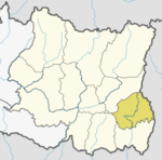
Chulachuli is a rural municipality (gaunpalika) out of six rural municipality located in Ilam District of Province No. 1 of Nepal. There are a total of 10 municipalities in Ilam in which 4 are urban and 6 are rural.
Ibhang is a town and Village Development Committee in Ilam District in the Province No. 1 of eastern Nepal. At the time of the 1991 Nepal census it had a population of 4,373 persons living in 755 individual households.
Godak is a town and Village Development Committee in Ilam District in the Province No. 1 of eastern Nepal. At the time of the 1991 Nepal census it had a population of 3,448 persons living in 646 individual households.
Jogmai is a village and Village Development Committee in Ilam District in the Province No. 1 of eastern Nepal. At the time of the 1991 Nepal census it had a population of 2,933 persons living in 543 individual households.
Mabu is a village and Village Development Committee in Ilam District in the Province No. 1 of eastern Nepal. At the time of the 1991 Nepal census it had a population of 2,908 persons living in 539 individual households.
Maipokhari is a town and Village Development Committee in Ilam District in the Province No. 1 of eastern Nepal. At the time of the 1991 Nepal census it had a population of 4,348 persons living in 931 individual households.
Namsaling is a town and Village Development Committee in Ilam District in the Province No. 1 of eastern Nepal. At the time of the 1991 Nepal census it had a population of 4,978 persons living in 905 individual households.

Naya Bazar is a town and Village Development Committee in Ilam District in the Province No. 1 of eastern Nepal. At the time of the 1991 Nepal census it had a population of 4,058 persons living in 750 individual households.

Pashupatinagar is a neighborhood in Suryodaya Municipality of Ilam District of Province No. 1 in Nepal. Previously it was a separate Village Development Committee in Ilam District in the Province No. 1 of Nepal. Pashupatinagar was Incorporated with Suryodaya municipality in 2017 and divided into two wards. The ward no. 2 and 3.
Puwamajwa is a village and Village Development Committee in Ilam District in the Province No. 1 of eastern Nepal. At the time of the 1991 Nepal census it had a population of 2,419 persons living in 397 individual households.
Pyang is a village and Village Development Committee in Ilam District in the Province No. 1 of eastern Nepal. At the time of the 1991 Nepal census it had a population of 2,628 persons living in 414 individual households.

Sakphara is a town and Village Development Committee in Ilam District in the Province No. 1 of eastern Nepal. At the time of the 1991 Nepal census it had a population of 3,004 persons living in 512 individual households.
Sakhejung is a town and Village Development Committee( now ilam municipality word no. 01) in Ilam District in the Province No. 1 of eastern Nepal. At the time of the 1991 Nepal census it had a population of 3,225 persons living in 571 individual households.
Sangrumba साङरुम्बा is a town and Village Development Committee in Ilam District in the Province No. 1 of eastern Nepal. At the time of the 1991 Nepal census it had a population of 4,607 persons living in 839 individual households. According to the VDC report of 2068 BS, the total population was 6,288 and the total number of households was 1,227, an average of 5.12 members per household.
Shantipur is a town and Village Development Committee in Ilam District in the Province No. 1 of eastern Nepal. At the time of the 1991 Nepal census it had a population of 4,094 persons living in 754 individual households.
Siddhithumka is a village and Village Development Committee in Ilam District in the Province No. 1 of eastern Nepal. At the time of the 1991 Nepal census it had a population of 2,937 persons living in 545 individual households.
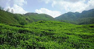
Sulubung is a Village Development Committee in Ilam District in the Province No. 1 of eastern Nepal. At the time of the 1991 Nepal census it had a population of 3,470. Maipokhari, one of the major tourist and religious place of Nepal lies here. A company named Hesty Kiwi Private Limited has been established in this region which had helped to popularize this village with the plantation of kiwifruit. It is about 15 km from Ilam Bazaar. It is a hilly area having cold climate and mainly tea production is the income of most of the people here.
Deumai is a municipality in the eastern development region of Ilam District in the Mechi Zone of Nepal. The new municipality was formed by merging two existing villages Mangalbare and Dhuseni on 02 Dec 2014. The office of the municipality is that of the former Mangalbare village development committee.
Phakphokthum is a rural municipality, one of six located in Ilam District of Province No. 1 of Nepal. A total of 10 municipalities are found in Ilam, of which 4 are urban and 6 are rural.