Splitting storm

Last updated

Evolution of a splitting thunderstorm as observed by weather radar in the Northern Hemisphere. As the parent storm moves east (towards the right), it splits into a left-moving and right-moving component, with the left-moving storm visibly weaker. Splitting Storm.jpg
Evolution of a splitting thunderstorm as observed by weather radar in the Northern Hemisphere. As the parent storm moves east (towards the right), it splits into a left-moving and right-moving component, with the left-moving storm visibly weaker.

A splitting storm is a phenomenon when a convective thunderstorm will separate into two supercells, with one propagating towards the left (the left mover) and the other to the right (the right mover) of the mean wind shear direction across a deep layer of the troposphere. In most cases, this mean wind shear direction is roughly coincident with the direction of the mean wind. Each resulting cell bears an updraft that rotates opposite of the updraft in the other cell, with the left mover exhibiting a clockwise-rotating updraft and the right mover exhibiting a counterclockwise-rotating updraft. Storm splitting, if it occurs, tends to occur within an hour of the storm's formation.

Contents

Storm splitting in the presence of large amounts of ambient crosswise vorticity, as characterized by a straight hodograph, produces similarly strong left and right movers. Storm splits also occur in environments where streamwise vorticity is present, as characterized by a more curved hodograph. However in this situation one updraft is highly favored over the other, with the weaker split quickly dissipating; in this case, the lesser favored split may be so weak that the process is not noticeable on radar imagery. In the Northern Hemisphere, where hodograph curvature tends to be clockwise, right-moving cells tend to be stronger and more persistent; the opposite is true in the Southern Hemisphere where hodograph curvature tends to be counterclockwise.

Characteristics

An idealized depiction of storm splitting. Top: A formative updraft tilts initially horizontal rotation present in the environment into the vertical, producing counter-rotating vortices on either side of the updraft. Middle: The vortices generate new updrafts. Bottom: A developing downdraft causes the two newly formed updrafts to separate. Supercell storms splitting.png
An idealized depiction of storm splitting. Top: A formative updraft tilts initially horizontal rotation present in the environment into the vertical, producing counter-rotating vortices on either side of the updraft. Middle: The vortices generate new updrafts. Bottom: A developing downdraft causes the two newly formed updrafts to separate.

Storm splitting was discovered via weather radar in the 1960s. [1] :220 Storm splitting is most favored when the direction of wind shear is aligned with the motion of the storm, a condition known as crosswise vorticity (via the right hand rule, the direction of ambient rotation associated with this vorticity would be perpendicular to the storm motion). [2] :234 Such conditions can be quantified by having low storm-relative helicity and can be associated with straight hodographs. [2] :234,236 In these cases, wind shear is largely unidirectional in the lower to middle troposphere. [3] Splitting tends to occur within roughly 30–60 minutes after the formation of the parent thunderstorm and can occur repeatedly so long as sufficient crosswise vorticity is present. The presence of ambient vorticity produces rolls of horizontal rotation that a developing storm may encounter. [2] :234 As the formative updraft associated with the storm pulls this rotation up and into the storm, the rotation is tilted into the vertical on opposing flanks of the updraft. On one side, this results in clockwise rotation, while the other rotates counterclockwise. These areas of rotation are located at right angles to the wind shear direction, with one occurring left of this direction and the other to the right. [2] :234–235 In the Northern Hemisphere, the left rotation is anticyclonic while the right rotation is cyclonic. [1] :220 The rotation leads to the development of a new, rotating updraft beneath each area of rotation, which separate from one another to produce two separated storms; [4] :289 as both cells have rotating updrafts, both are supercells. [3] This process can be accelerated if precipitation occurs between the two updrafts, cooling the air and producing downwards drag that eliminates the original updraft and further separates the split cells. [2] :234 [3] [1] :220 [4] :289

Once a storm splits into two, the left-splitting storm tends to move in a direction left of the mean wind shear direction, while the right-splitting moves right of the mean wind shear direction. The split storms are known as left movers and right movers due to this behavior. The resulting left or right motion taken by the split storms may be more or less aligned with the direction of the ambient wind shear. This increases or decreases the ambient crosswise vorticity ingested into the split updrafts, respectively, in the frame of reference of the split storms. The storm that moves in a direction increasingly askew from the wind shear direction draws in increasingly streamwise vorticity. This tends to be the right mover in the Northern Hemisphere and the left mover in the Southern Hemisphere; in either case, this is the storm with cyclonic rotation. [2] :234 While storm splitting can reduce crosswise vorticity, crosswise vorticity may still be present. Thus, the left and right moving storms can repeatedly undergo further storm splitting if significant crosswise vorticity remains. [2] :236

Physical processes within supercells and interactions with their environment complicate prediction of the motion of supercells, including left and right movers. [2] :240 Commonly used methods for approximating the motion of splitting storms tend to estimate motion based on empirically observed deviations away from the mean wind shear vector. [2] :240 [5] [6]

If the environmental vorticity is fully crosswise, storm splitting produces two oppositely rotating cells of similar intensity. In this case, both storms symmetrically deviate away from the mean wind shear direction. [2] :240 The left mover acquires increasingly clockwise vorticity, while the right mover acquires increasingly counterclockwise vorticity. In the absence of the Coriolis force, both cells are mirror images of one another. However, the Coriolis force causes the cyclonic cell to be slightly stronger. [3] Because of turbulent friction, the direction of wind shear commonly varies near the surface such that hodographs are rarely ever straight in the lower troposphere. [1] :224 If the direction of the wind shear changes with height, such that some streamwise vorticity is present, the ingestion of vorticity by the split updrafts leads to one updraft being enhanced and the other being suppressed. If the hodograph turns clockwise with height, the right mover is enhanced, and if the hodograph turns counterclockwise, the left mover is enhanced. [2] :238 Most of the difference in the strengths of the split cells arises from this directional wind shear, rather than the Coriolis force. [4] :289 Storm splitting becomes less pronounced as hodograph curvature increases, resulting in shorter-lived anticyclonic cells. [3] In extreme cases, where there is a strongly curving hodograph, the suppressed updraft will be so weak from the start, the splitting process will not be evident on radar, and a dominant cell will immediately be present shortly after convective initiation.[ citation needed ] While cyclonic splitting supercells (right movers in the Northern Hemisphere) have been more widely studied due to their typically longer duration and production of severe weather, anticyclonic supercells can also produce severe weather. [7] [8]

When multiple thunderstorms develop, splitting storms can interact with other splitting storms. If a line of storms develop along a boundary, the storms at the ends of the line are typically the most isolated and free from interacting with splitting cells. [1] :252

Dynamics

Storm splitting is favored in environments where hodographs are less curved. Multicell hodograph.png
Storm splitting is favored in environments where hodographs are less curved.

The movement of air parcels in the atmosphere can cause a localized increase in air pressure ahead of the air parcel and a decrease in air pressure in the wake of the parcel as the parcel interacts with the ambient air. Such variations in pressure are known as dynamic pressure perturbations. Within a rotating updraft, the variation of this dynamic pressure perturbation with height may be approximated as the combination of a linear and nonlinear term:

where represents the mean vertical wind shear vector, represents the horizontal gradient of the vertical wind associated with the updraft, and is the vorticity within the updraft.

When horizontal rotation is first lifted in an updraft, it produces a cyclonic and anticyclonic vortex on opposing sides of the updraft, with the strength of those vortices typically maximized in the mid-troposphere some 4–8 km (2.5–5.0 mi) above the surface. [2] :234 Each vortex is associated with minimum in air pressure aloft at the center of the vortex, with the surrounding air in cyclostrophic balance. [4] :289 Regardless of the sign of vorticity (i.e. the direction of rotation), the quantity at the location of the vortices tends to increase from the surface up to the mid-troposphere, where the vortices are most pronounced. Thus, decreases with height, resulting in a vertical pressure gradient and favoring upwards motion beneath the two vortices. This produces two new updrafts on opposing sides of the original updraft. The generation of updrafts on the flanks of the original updraft induces horizontal updraft-shear propagation, such that the left-splitting cell continues to move towards the left relative to the shear vector, while the right-splitting cell moves towards the right. [6] This implies that the initial splitting of a thunderstorm is governed by nonlinear dynamics. [2] :234 Because the tilting of horizontal vorticity into the vertical is most pronounced along the flanks of an updraft, the split storms continue to move away from the mean wind shear direction. [2] :236 In cases where vorticity is predominantly streamwise, as characterized by a strongly curved hodograph, the linear term is a stronger influence on vertical dynamic pressure perturbations. Thus, storm splitting is less favored when the ambient vorticity is streamwise. [2] :238

See also

Related Research Articles

<span class="mw-page-title-main">Thunderstorm</span> Storm characterized by lightning and thunder

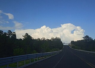
A thunderstorm, also known as an electrical storm or a lightning storm, is a storm characterized by the presence of lightning and its acoustic effect on the Earth's atmosphere, known as thunder. Relatively weak thunderstorms are sometimes called thundershowers. Thunderstorms occur in a type of cloud known as a cumulonimbus. They are usually accompanied by strong winds and often produce heavy rain and sometimes snow, sleet, or hail, but some thunderstorms produce little precipitation or no precipitation at all. Thunderstorms may line up in a series or become a rainband, known as a squall line. Strong or severe thunderstorms include some of the most dangerous weather phenomena, including large hail, strong winds, and tornadoes. Some of the most persistent severe thunderstorms, known as supercells, rotate as do cyclones. While most thunderstorms move with the mean wind flow through the layer of the troposphere that they occupy, vertical wind shear sometimes causes a deviation in their course at a right angle to the wind shear direction.

In continuum mechanics, vorticity is a pseudovector field that describes the local spinning motion of a continuum near some point, as would be seen by an observer located at that point and traveling along with the flow. It is an important quantity in the dynamical theory of fluids and provides a convenient framework for understanding a variety of complex flow phenomena, such as the formation and motion of vortex rings.

<span class="mw-page-title-main">Supercell</span> Thunderstorm that is characterized by the presence of a mesocyclone

A supercell is a thunderstorm characterized by the presence of a mesocyclone, a deep, persistently rotating updraft. Due to this, these storms are sometimes referred to as rotating thunderstorms. Of the four classifications of thunderstorms, supercells are the overall least common and have the potential to be the most severe. Supercells are often isolated from other thunderstorms, and can dominate the local weather up to 32 kilometres (20 mi) away. They tend to last 2–4 hours.

<span class="mw-page-title-main">Mesocyclone</span> Region of rotation within a powerful thunderstorm

A mesocyclone is a meso-gamma mesoscale region of rotation (vortex), typically around 2 to 6 mi in diameter, most often noticed on radar within thunderstorms. In the northern hemisphere it is usually located in the right rear flank of a supercell, or often on the eastern, or leading, flank of a high-precipitation variety of supercell. The area overlaid by a mesocyclone’s circulation may be several miles (km) wide, but substantially larger than any tornado that may develop within it, and it is within mesocyclones that intense tornadoes form.

<span class="mw-page-title-main">Squall line</span> Line of thunderstorms along or ahead of a cold front

A squall line, or more accurately a quasi-linear convective system (QLCS), is a line of thunderstorms, often forming along or ahead of a cold front. In the early 20th century, the term was used as a synonym for cold front. Linear thunderstorm structures often contain heavy precipitation, hail, frequent lightning, strong straight-line winds, and occasionally tornadoes or waterspouts. Particularly strong straight-line winds can occur where the linear structure forms into the shape of a bow echo. Tornadoes can occur along waves within a line echo wave pattern (LEWP), where mesoscale low-pressure areas are present. Some bow echoes can grow to become derechos as they move swiftly across a large area. On the back edge of the rainband associated with mature squall lines, a wake low can be present, on very rare occasions associated with a heat burst.

<span class="mw-page-title-main">Wall cloud</span> Cloud formation occurring at the base of a thunderstorm

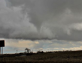
A wall cloud is a large, localized, persistent, and often abrupt lowering of cloud that develops beneath the surrounding base of a cumulonimbus cloud and from which tornadoes sometimes form. It is typically beneath the rain-free base (RFB) portion of a thunderstorm, and indicates the area of the strongest updraft within a storm. Rotating wall clouds are an indication of a mesocyclone in a thunderstorm; most strong tornadoes form from these. Many wall clouds do rotate; however, some do not.

In fluid dynamics, helicity is, under appropriate conditions, an invariant of the Euler equations of fluid flow, having a topological interpretation as a measure of linkage and/or knottedness of vortex lines in the flow. This was first proved by Jean-Jacques Moreau in 1961 and Moffatt derived it in 1969 without the knowledge of Moreau's paper. This helicity invariant is an extension of Woltjer's theorem for magnetic helicity.

<span class="mw-page-title-main">Convective available potential energy</span> Measure of instability in the air as a buoyancy force

In meteorology, convective available potential energy, is the integrated amount of work that the upward (positive) buoyancy force would perform on a given mass of air if it rose vertically through the entire atmosphere. Positive CAPE will cause the air parcel to rise, while negative CAPE will cause the air parcel to sink. Nonzero CAPE is an indicator of atmospheric instability in any given atmospheric sounding, a necessary condition for the development of cumulus and cumulonimbus clouds with attendant severe weather hazards.

<span class="mw-page-title-main">Cyclogenesis</span> The development or strengthening of cyclonic circulation in the atmosphere

Cyclogenesis is the development or strengthening of cyclonic circulation in the atmosphere. Cyclogenesis is an umbrella term for at least three different processes, all of which result in the development of some sort of cyclone, and at any size from the microscale to the synoptic scale.

<span class="mw-page-title-main">Anticyclonic storm</span> Type of storm

An anticyclonic storm is a storm with a high-pressure center, in which winds flow in the direction opposite to that of the flow above a region of low pressure. Unlike a cyclonic storm, anticyclonic storms are typically associated with fair weather and stable atmospheric conditions. On other planets or in rare cases on Earth, anticyclones can contribute to inclement weather. Examples include Hartmut, which brought a blizzard to the British Isles in 2018, as well as persistent anticyclonic storms on Jupiter and Neptune.

<span class="mw-page-title-main">Funnel cloud</span> Funnel-shaped cloud not touching the ground

A funnel cloud is a funnel-shaped cloud of condensed water droplets, associated with a rotating column of wind and extending from the base of a cloud but not reaching the ground or a water surface. A funnel cloud is usually visible as a cone-shaped or needle like protuberance from the main cloud base. Funnel clouds form most frequently in association with supercell thunderstorms, and are often, but not always, a visual precursor to tornadoes. Funnel clouds are visual phenomena, but these are not the vortex of wind itself.

<span class="mw-page-title-main">Gustnado</span> Ground vortex formed from a downburst of a thunderstorm

A gustnado is a brief, shallow surface-based vortex which forms within the downburst emanating from a thunderstorm. The name is a portmanteau by elision of "gust front tornado", as gustnadoes form due to non-tornadic straight-line wind features in the downdraft (outflow), specifically within the gust front of strong thunderstorms. Gustnadoes tend to be noticed when the vortices loft sufficient debris or form condensation cloud to be visible although it is the wind that makes the gustnado, similarly to tornadoes. As these eddies very rarely connect from the surface to the cloud base, they are very rarely considered as tornadoes. The gustnado has little in common with tornadoes structurally or dynamically in regard to vertical development, intensity, longevity, or formative process—as classic tornadoes are associated with mesocyclones within the inflow (updraft) of the storm, not the outflow.

<span class="mw-page-title-main">Anticyclonic tornado</span> Tornadoes that spin in the opposite direction of normal tornadoes

An anticyclonic tornado is a tornado which rotates in a clockwise direction in the Northern Hemisphere and a counterclockwise direction in the Southern Hemisphere. The term is a naming convention denoting the anomaly from normal rotation which is cyclonic in upwards of 98 percent of tornadoes. Many anticyclonic tornadoes are smaller and weaker than cyclonic tornadoes, forming from a different process, as either companion/satellite tornadoes or nonmesocyclonic tornadoes.

<span class="mw-page-title-main">Landspout</span> Tornado not originating from a mesocyclone

Landspout is a term created by atmospheric scientist Howard B. Bluestein in 1985 for a tornado not associated with a mesocyclone. The Glossary of Meteorology defines a landspout:

<span class="mw-page-title-main">Hot tower</span>

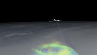
A hot tower is a tropical cumulonimbus cloud that reaches out of the lowest layer of the atmosphere, the troposphere, and into the stratosphere. These formations are called "hot" because of the large amount of latent heat released as water vapor condenses into liquid and freezes into ice within the cloud. Hot towers in regions of sufficient vorticity may acquire rotating updrafts; these are known as vortical hot towers In some instances, hot towers appear to develop characteristics of a supercell, with deep and persistent rotation present in the updraft. The role of hot towers in tropical weather was first formulated by Joanne Simpson in 1958. Hot towers dominated discussions in tropical meteorology in the 1960s and are now considered the main drivers of rising air within tropical cyclones and a major component of the Hadley circulation. Although the prevalence of hot towers in scientific literature decreased in the 1970s, hot towers remain an active area of research. The presence of hot towers in tropical cyclones is correlated with an increase in the tropical cyclones' intensities.

<span class="mw-page-title-main">Tornadogenesis</span> Process by which a tornado forms

Tornadogenesis is the process by which a tornado forms. There are many types of tornadoes and these vary in methods of formation. Despite ongoing scientific study and high-profile research projects such as VORTEX, tornadogenesis is a volatile process and the intricacies of many of the mechanisms of tornado formation are still poorly understood.

<span class="mw-page-title-main">Multicellular thunderstorm</span> Thunderstorm composed of multiple storm cells

A multicellular thunderstorm cluster is a thunderstorm that is composed of multiple convective cells, each being at a different stage in the life cycle of a thunderstorm. It appears as several anvils clustered together. A cell is an updraft/downdraft couplet. These different cells will dissipate as new cells form and continue the life of the multicellular thunderstorm cluster with each cell taking a turn as the dominant cell in the group.

A mesovortex is a small-scale rotational feature found in a convective storm, such as a quasi-linear convective system, a supercell, or the eyewall of a tropical cyclone. Mesovortices range in diameter from tens of miles to a mile or less and can be immensely intense.

The following is a glossary of tornado terms. It includes scientific as well as selected informal terminology.

<span class="mw-page-title-main">Descending reflectivity core</span> Small-scale area of enhanced radar reflectivity

A descending reflectivity core (DRC), sometimes referred to as a blob, is a meteorological phenomenon observed in supercell thunderstorms, characterized by a localized, small-scale area of enhanced radar reflectivity that descends from the echo overhang into the lower levels of the storm. Typically found on the right rear flank of supercells, DRCs are significant for their potential role in the development or intensification of low-level rotation within these storms. The descent of DRCs has been associated with the formation and evolution of hook echoes, a key radar signature of supercells, suggesting a complex interplay between these cores and storm dynamics.

References

  1. 1 2 3 4 5 Bluestein, Howard B. (2013). Severe Convective Storms and Tornadoes: Observations and Dynamics. Berlin: Springer. ISBN   978-3642053818.
  2. 1 2 3 4 5 6 7 8 9 10 11 12 13 14 15 Markowski, Paul; Richardson, Yvette (5 February 2010). "Organization of Isolated Convection". Mesoscale Meteorology in Midlatitudes. doi:10.1002/9780470682104. ISBN   9780470682104.
  3. 1 2 3 4 5 Davies-Jones, Robert (May 2015). "A review of supercell and tornado dynamics". Atmospheric Research. 158–159: 274–291. doi:10.1016/j.atmosres.2014.04.007.
  4. 1 2 3 4 Houze, Robert A. (1994). Cloud dynamics. San Diego: Academic Press. ISBN   9780123568809.
  5. Edwards, Roger; Thompson, Richard L.; Hart, John A. (13 August 2002). Verification of Supercell Motion Forecasting Techniques (PDF). 21st Conference on Severe Local Storms / 19th Conference on Weather Analysis and Forecasting / 15th Conference on Numerical Weather Prediction. San Antonio, Texas.
  6. 1 2 Zeitler, Jon W.; Bunkers, Matthew J. (2005). "Operational Forecasting of Supercell Motion: Review and Case Studies Using Multiple Datasets" (PDF). National Weather Digest. 29 (1). National Weather Association: 82–97.
  7. Dostalek, John F.; Weaver, John F.; Phillips, G. Loren (June 2004). "Aspects of a Tornadic Left-Moving Thunderstorm of 25 May 1999". Weather and Forecasting. 19 (3): 614–626. doi:10.1175/1520-0434(2004)019<0614:AOATLT>2.0.CO;2.
  8. Lindsey, Daniel T.; Bunkers, Matthew J. (1 February 2005). "Observations of a Severe, Left-Moving Supercell on 4 May 2003". Weather and Forecasting. 20 (1): 15–22. doi:10.1175/WAF-830.1.