Ketchum Glacier is an eastward flowing glacier at the base of Palmer Land, Antarctica, about 50 nautical miles (90 km) long, descending between the Latady Mountains and the Scaife Mountains into Gardner Inlet. It was discovered by the Ronne Antarctic Research Expedition (RARE), 1947–48, under Finn Ronne, who named it for Commander Gerald Ketchum, U.S. Navy, commander of the icebreaker USS Burton Island (AG-88) which broke the ice to free the RARE from Marguerite Bay for the return home.

Irvine Glacier is a glacier, 40 miles (64 km) long, draining southeast between the Guettard Range and the Rare Range into the northern part of Gardner Inlet, Antarctica. It was discovered by the Ronne Antarctic Research Expedition (RARE), 1947–48, under Finn Ronne, who named it for George J. Irvine, of the Engineer Depot at Fort Belvoir, Virginia, who outlined the RARE photographic program.
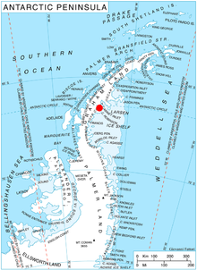
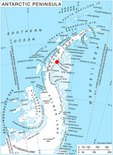
Cabinet Inlet is an ice-filled inlet, 36 miles (58 km) long in a northwest–southeast direction, and some 27 miles (43 km) wide at its entrance between Cape Alexander and Cape Robinson, along the east coast of Graham Land, Antarctica. It was charted by the Falkland Islands Dependencies Survey (FIDS) and photographed from the air by the Ronne Antarctic Research Expedition in December 1947. Cabinet Inlet was named by FIDS for the British War Cabinet which authorized the FIDS in 1943.
Mount Ward is a mountain at the northeast end of Steeple Peaks, located south of Batterbee Mountains near George VI Sound in western Palmer Land. During a flight on December 23, 1947, by the Ronne Antarctic Research Expedition (RARE) (1947–48) a high peak was seen in the area south and east of Batterbee Mountains. It was named by F. Ronne after W.W. Ward of Beaumont, Texas, editor of the Beaumont Journal and a supporter of the expedition. No peak exists at the coordinates given by Ronne, but it is most likely that the feature here described was that seen by him.

Aagaard Glacier, also known as Glaciar Alderete, is an 8-mile (13 km) long Antarctic glacier which lies close to the east of Gould Glacier and flows in a southerly direction into Mill Inlet, on the east coast of Graham Land. It was charted by the Falkland Islands Dependencies Survey (FIDS) and photographed from the air by the Ronne Antarctic Research Expedition during December 1947; it was named by the FIDS for Bjarne Aagaard, a Norwegian authority on Antarctic whaling and exploration.
Mount Umbriel is a peak, rising to about 1,500 m, overlooking the head of Venus Glacier on the east coast of Alexander Island, Antarctica, with the east face of the mountain overlooking the George VI Ice Shelf that occupies George VI Sound. The mountain was first mapped by Searle of the Falkland Islands Dependencies Survey in 1960, from air photos taken by the Ronne Antarctic Research Expedition in 1947-48. Named by the United Kingdom Antarctic Place-Names Committee from association with nearby Uranus Glacier, Umbriel being one of the satellites of the planet Uranus, the seventh planet of the Solar System.
Attlee Glacier is a glacier 8 miles (13 km) long, which flows east-southeast from the plateau escarpment on the east side of Graham Land to the head of Cabinet Inlet to the north of Bevin Glacier. During December 1947, the glacier was charted from the ground by the Falkland Islands Dependencies Survey (FIDS) and photographed from the air by the Ronne Antarctic Research Expedition. It was named by the FIDS for Rt. Hon. Clement Attlee, M.P., British Secretary of State for Dominion Affairs, member of the War Cabinet, and later Prime Minister of the United Kingdom.
Balch Glacier is a glacier 9 nautical miles (17 km) long, on the east coast of Graham Land, flowing southeast into Mill Inlet, to the south of Gould Glacier. It was first surveyed by the Falkland Islands Dependencies Survey in 1946–47, and named "East Balch Glacier". With "West Balch Glacier" it was reported to fill a transverse depression across Graham Land, but further survey in 1957 showed that there is no close topographical alignment between the two. The name "Balch", for Edwin S. Balch, an American Antarctic historian, has been limited to this glacier and an entirely new name, Drummond Glacier, approved for the west glacier.
Bevin Glacier is a glacier 5 nautical miles (9 km) long, which flows east from the plateau escarpment on the east side of Graham Land into the northwest end of Cabinet Inlet between Attlee Glacier and Anderson Glacier. During December 1947 it was charted by the Falkland Islands Dependencies Survey (FIDS) and photographed from the air by the Ronne Antarctic Research Expedition. It was named by the FIDS for Rt. Hon. Ernest Bevin, M.P., British Minister of Labour and National Service and member of the War Cabinet.
Breitfuss Glacier is a glacier 10 nautical miles (19 km) long, which flows southeast from Avery Plateau into Mill Inlet to the west of Cape Chavanne, on the east coast of Graham Land. It was charted by the Falkland Islands Dependencies Survey (FIDS) and photographed from the air by the Ronne Antarctic Research Expedition in 1947. It was named by the FIDS for Leonid Breitfuss, a German polar explorer, historian, and author of many polar bibliographies.
Swann Glacier is a broad glacier of undetermined length flowing east into Wright Inlet to the north of Mount Tricorn, on the east coast of Palmer Land. The glacier was discovered and photographed from the air in December 1940 by members of East Base of the United States Antarctic Service (USAS). During 1947 it was photographed from the air by members of the Ronne Antarctic Research Expedition (RARE), under Ronne, who in conjunction with the Falkland Islands Dependencies Survey (FIDS) charted it from the ground. Named by Ronne for W.F.G. Swann, Director of the Barthol Research Foundation of Franklin Institute at Swarthmore, PA, a contributor to the expedition.
The Guettard Range is a mountain range, 40 nautical miles (74 km) long and 10 nautical miles (19 km) wide, located northwest of Bowman Peninsula and between Johnston Glacier and Irvine Glacier, in the southeastern extremity of Palmer Land, Antarctica. The feature was photographed from the air by the Ronne Antarctic Research Expedition, 1947–48. It was mapped from United States Geological Survey surveys and U.S. Navy air photos, 1961–67, and was named by the Advisory Committee on Antarctic Names for French naturalist and geologist Jean-Étienne Guettard.
Pan Glacier is a glacier 7 nautical miles (13 km) long, flowing north and terminating at the east coast of Antarctic Peninsula 2 nautical miles (3.7 km) southwest of Victory Nunatak. The lower part of the glacier was plotted by W.L.G. Joerg from air photos taken by Lincoln Ellsworth in November 1935. The glacier was subsequently photographed by Ronne Antarctic Research Expedition (RARE) in December 1947, and roughly surveyed by Falkland Islands Dependencies Survey (FIDS) in December 1958. Named by United Kingdom Antarctic Place-Names Committee (UK-APC) after Pan, god of the shepherds in Greek mythology.
Eden Glacier is a glacier 5 nautical miles (9 km) long, which flows in a southerly direction into the head of Cabinet Inlet, northwest of Lyttelton Ridge, on the east coast of Graham Land. It was charted by the Falkland Islands Dependencies Survey (FIDS) and photographed from the air by the Ronne Antarctic Research Expedition in 1947. It was named by the FIDS for Rt. Hon. Robert Anthony Eden, M.P., then British Secretary of State for Foreign Affairs and member of the War Cabinet.
Gibbs Glacier is a glacier, 15 nautical miles (28 km) long, flowing southeast into the northern part of Mercator Ice Piedmont on the east side of the Antarctic Peninsula. This feature together with Neny Glacier, which flows northwest, occupy a transverse depression between Mercator Ice Piedmont and Neny Fjord on the west side of the Antarctic Peninsula. Gibbs Glacier was photographed from the air and first mapped by the United States Antarctic Service, 1939–41, and the Ronne Antarctic Research Expedition, 1947–48. It was named by the UK Antarctic Place-Names Committee for Peter M. Gibbs of the Falkland Islands Dependencies Survey, a surveyor at Horseshoe Island, 1957, and leader at Stonington Island, 1958, who was responsible for the first ground survey of the glacier.
Morrison Glacier is a glacier 3 nautical miles (6 km) long between Attlee Glacier and Eden Glacier, flowing south to the head of Cabinet Inlet, on the east coast of Graham Land, Antarctica. It was charted in 1947 by the Falkland Islands Dependencies Survey, who named it for Rt. Hon. Herbert Morrison, M.P., British Home Secretary and member of the War Cabinet. It was photographed from the air during 1947 by the Ronne Antarctic Research Expedition under Finn Ronne.
Lammers Glacier is a large glacier flowing east along the north side of Godfrey Upland into the Traffic Circle and Mercator Ice Piedmont, on the east coast of Graham Land, Antarctica. This glacier appears indistinctly in an aerial photograph taken by Sir Hubert Wilkins on December 20, 1928, but shows more clearly in aerial photographs taken by Lincoln Ellsworth in 1935 and the United States Antarctic Service in 1940. It was resighted in 1947 by the Ronne Antarctic Research Expedition under Finn Ronne, who named it for Lester Lammers, who had contributed nine grown husky dogs and four puppies to the expedition.
Anderson Glacier is a heavily crevassed glacier 12 nautical miles (22 km) long, flowing southeast into Cabinet Inlet between Cape Casey and Balder Point, on the east coast of Graham Land. It was charted by the Falklands Islands Dependencies Survey (FIDS) and photographed from the air by the Ronne Antarctic Research Expedition in December 1947. It was named by FIDS for Sir John Anderson, M.P., Lord President of the Council and member of the British War Cabinet.
Stanley Island is a 3.2 km (2 mi) long and 520 m high island off Heros Peninsula on Foyn Coast, Antarctica. It lies in the western part of Cabinet Inlet, 8 km (5 mi) northeast of Spur Point and 6 km (4 mi) east of Balabanski Crag.