
Monterey Bay is a bay of the Pacific Ocean located on the coast of the U.S. state of California, south of the San Francisco Bay Area. San Francisco itself is further north along the coast, by about 75 miles, accessible via Highway 1 and Highway 280.

Pensacola is the westernmost city in the Florida Panhandle, and the county seat and only incorporated city of Escambia County, Florida. Pensacola is the principal city of the Pensacola Metropolitan Area, which had an estimated 502,629 residents in 2019. At the 2020 United States census, the population was 54,312.

A presidio was a fortified base established by the Spanish Empire between the 16th and 18th centuries in areas in of their control or influence. The presidios of Spanish Philippines in particular, were centers where the martial art of Arnis de Mano was developed from Spanish cut-and-thrust fencing style. The term is derived from the Latin word praesidium meaning protection or defense.
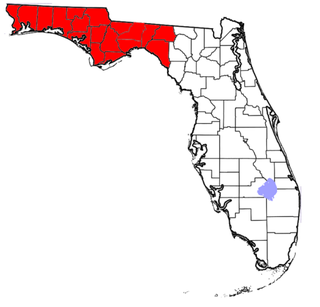
The Florida Panhandle is the northwestern part of the U.S. state of Florida. It is a salient roughly 200 miles long, bordered by Alabama on the north and the west, Georgia on the north, and the Gulf of Mexico to the south. Its eastern boundary is arbitrarily defined. It is defined by its southern culture and rural geography relative to the rest of Florida, as well as closer cultural links to French-influenced Louisiana, Mississippi, and Alabama. Its major communities include Pensacola, Navarre, Destin, Panama City Beach, and Tallahassee.
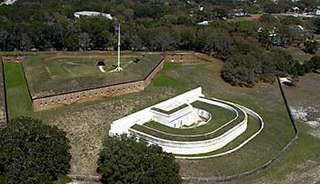
Fort Barrancas (1839) or Fort San Carlos de Barrancas is a United States military fort and National Historic Landmark in the former Warrington area of Pensacola, Florida, located physically within Naval Air Station Pensacola, which was developed later around it.
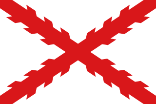
Spanish Florida was the first major European land claim and attempted settlement in North America during the European Age of Discovery. La Florida formed part of the Captaincy General of Cuba, the Viceroyalty of New Spain, and the Spanish Empire during Spanish colonization of the Americas. While its boundaries were never clearly or formally defined, the territory was initially much larger than the present-day state of Florida, extending over much of what is now the southeastern United States, including all of present-day Florida plus portions of Georgia, Alabama, Mississippi, North Carolina, South Carolina, and Louisiana. Spain's claim to this vast area was based on several wide-ranging expeditions mounted during the 16th century. A number of missions, settlements, and small forts existed in the 16th and to a lesser extent in the 17th century; they were eventually abandoned due to pressure from the expanding English and French colonial settlements, the collapse of the native populations, and the general difficulty in becoming agriculturally or economically self-sufficient. By the 18th century, Spain's control over La Florida did not extend much beyond a handful of forts near St. Augustine, St. Marks, and Pensacola, all within the boundaries of present-day Florida.

State Road 30 is the mostly hidden Florida Department of Transportation designation for most of US 98 from the Florida-Alabama state line to east of Perry, Florida.

The Golden Gate National Recreation Area (GGNRA) is a U.S. National Recreation Area protecting 82,116 acres (33,231 ha) of ecologically and historically significant landscapes surrounding the San Francisco Bay Area. Much of the park is land formerly used by the United States Army. GGNRA is managed by the National Park Service and is the second-most visited unit of the National Park system in the United States, with more than 15.6 million visitors in 2022. It is also one of the largest urban parks in the world, with a size two-and-a-half times that of the consolidated city and county of San Francisco.

The maritime history of Florida describes significant past events relating to the U.S. state of Florida in areas concerning shipping, shipwrecks, and military installations and lighthouses constructed to protect or aid navigation and development of the Florida peninsula.

St. Joseph Bay is a bay on the Gulf Coast of the U.S. state of Florida. The bay is located in Gulf County between Apalachicola and Panama City. Port St. Joe is located on St. Joseph Bay.
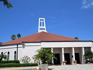
The Diocese of Venice in Florida is a Latin Church ecclesiastical territory–or diocese, of the Catholic Church in southwest Florida in the United States. It was founded on June 16, 1984.
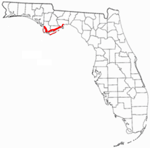
The Forgotten Coast refers to a largely untouched and uninhabited area of coastline in the panhandle of the US state of Florida. The term, also a trademark, was first used in 1992, but the Forgotten Coast's exact location is not agreed upon.

The Big Bend of Florida, United States, is an informally-named geographic region of North Florida where the Florida Panhandle transitions to the Florida Peninsula south and east of Tallahassee. The region is known for its vast woodlands and marshlands and its low population density relative to much of the state. The area is home to the largest single spring in the United States, the Alapaha Rise, and the longest surveyed underwater cave in the United States, the 32-mile (51 km) Wakulla-Leon Sinks cave system.
The history of Pensacola, Florida, begins long before the Spanish claimed founding of the modern city in 1698. The area around present-day Pensacola was inhabited by Native American peoples thousands of years before the historical era.

The Presidio Santa María de Galve, founded in 1698 by Spanish colonists, was the first European settlement of Pensacola, Florida after that of Tristan de Luna in 1559–1561. It was in the area of Fort Barrancas at modern-day Naval Air Station Pensacola, in northwestern Florida. The presidio included Fort San Carlos de Austria and an adjacent village.

Beginning in the second half of the 16th century, the Kingdom of Spain established a number of missions throughout La Florida in order to convert the Native Americans to Christianity, to facilitate control of the area, and to prevent its colonization by other countries, in particular, England and France. Spanish Florida originally included much of what is now the Southeastern United States, although Spain never exercised long-term effective control over more than the northern part of what is now the State of Florida from present-day St. Augustine to the area around Tallahassee, southeastern Georgia, and some coastal settlements, such as Pensacola, Florida. A few short-lived missions were established in other locations, including Mission Santa Elena in present-day South Carolina, around the Florida peninsula, and in the interior of Georgia and Alabama.
The following is an alphabetical list of articles related to the U.S. state of Florida.

The Presidio Nuestra Señora de Loreto de la Bahía, known more commonly as Presidio La Bahía, or simply La Bahía is a fort constructed by the Spanish Army that became the nucleus of the modern-day city of Goliad, Texas, United States. The current location dates to 1747.
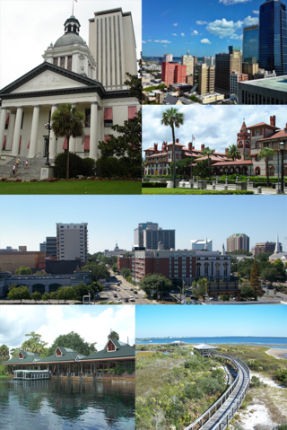
North Florida is a region of the U.S. state of Florida comprising the northernmost part of the state. Along with South Florida and Central Florida, it is one of Florida's three most common "directional" regions. It includes Jacksonville and nearby localities in Northeast Florida, an interior region known as North Central Florida, and the Florida Panhandle.
The Pensacola were a Native American people who lived in the western part of what is now the Florida Panhandle and eastern Alabama for centuries before first contact with Europeans until early in the 18th century. They spoke a Muskogean language. They are the source of the name of Pensacola Bay and the city of Pensacola. They lived in the area until the mid-18th century, but were thereafter assimilated into other groups.


