Related Research Articles
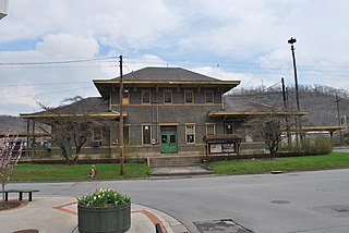
Ronceverte is a city in Greenbrier County, West Virginia, United States, on the Greenbrier River. The population was 1,572 at the 2020 census.

The Greenbrier River is a tributary of the New River, 162 miles (261 km) long, in southeastern West Virginia, in the United States. Via the New, Kanawha and Ohio rivers, it is part of the watershed of the Mississippi River, draining an area of 1,656 square miles (4,290 km2). It is one of the longest rivers in West Virginia.

The Chippewa River in Wisconsin flows approximately 183 miles (294 km) through west-central and northwestern Wisconsin. It was once navigable for approximately 50 miles (80 km) of its length, from the Mississippi River, by Durand, northeast to Eau Claire. Its catchment defines a portion of the northern boundary of the Driftless Area. The river is easily accessible for bikers and pleasure seekers via the Chippewa River State Trail, which follows the river from Eau Claire to Durand.

Cass Scenic Railroad State Park is a state park and heritage railroad located in Cass, Pocahontas County, West Virginia.

Cass is a census-designated place (CDP) and unincorporated community on the Greenbrier River in Pocahontas County, West Virginia, United States. The population was 38 at the 2020 census. The community, founded in 1901, was named for Joseph Kerr Cass, vice president and cofounder of the West Virginia Pulp and Paper Company.

Cheat Mountain is an exceptionally high and rugged ridge situated in the Allegheny Mountains of eastern West Virginia, USA. It is about 50 miles (80 km) long and more than five miles (8 km) wide at its widest. Its highest point is at its southernmost end at Thorny Flat, which has an elevation of 4,848 feet (1,478 m). Several other knobs rise above 4,000 feet (1,200 m) along its length.

The Greenbrier River Trail (GRT), is a lineal state park comprising a 77.1-mile (124.1 km) rail trail between North Caldwell and Cass in eastern West Virginia, United States.

In early periods of North American industrial development, an ark was a temporary boat used for river transport in eastern North America before slack-water canals and railroads made them obsolete. Because they could be built using relatively crude hand tools, arks were built in American colonial and early republic times, primarily to carry cargo downriver on the spring freshets, and especially to carry milled lumber, charcoal and other forest products and bulk agricultural produce to a city or a port downriver. While logs were often tied into rafts, on long trips which could take weeks, the rafts would be accompanied by such arks as crew support quarters. Deep rivers allowed large log arks as described below instead of less controllable rafts. Since by 1800, most eastern towns and cities were short on heating fuels, even badly processed timber or planks could readily be sold at the destinations.

Laurel Fork is a 37.8-mile-long (60.8 km) river in eastern West Virginia, USA. It is a tributary of the Dry Fork; via the Dry Fork, the Black Fork, and the Cheat, Monongahela and Ohio rivers, it is part of the watershed of the Mississippi River, draining an area of 60 square miles (160 km2) in the Allegheny Mountains. With the Dry Fork, the Glady Fork, the Shavers Fork and the Blackwater River, it is considered to be one of the five principal headwaters tributaries of the Cheat River.
The Susquehanna Boom was a system of cribs and chained logs in the West Branch Susquehanna River, designed to catch and hold floating timber until it could be processed at one of the nearly 60 sawmills along the river between Lycoming and Loyalsock Creeks in Lycoming County, Pennsylvania in the United States. The Susquehanna Boom was originally built under the supervision of James H. Perkins, and operated from 1851 to 1909, when it shut down for lack of timber.

The Pennsylvania Lumber Museum is near Galeton, Potter County, Pennsylvania in the United States. It documents the history and technology of the lumber industry that was a vital part of the economic development and ecological destruction of Pennsylvania.

Laurel Fork North Wilderness is a U.S. Wilderness Area located in the Greenbrier Ranger District of Monongahela National Forest in West Virginia. The Wilderness protects high-elevation lands along Laurel Fork and is bordered by Middle Mountain to the west. It is a companion to Laurel Fork South Wilderness, the two being split by Randolph County Route 40. Laurel Fork North contains 9.5 miles (15.3 km) of hiking trails.
Warren Elmer "Tweard" Blackhurst (1904–1970) was an author and a lifelong resident of the Cass community who centered on the culture of eastern West Virginia where the higher elevations supported northern pine forests. "Riders of the Flood" which is arguably the most well-known of Blackhurst's books, for it centers on the world of the late 19th to early 20th-century logging industry in eastern West Virginia through the Greenbrier River and its tributaries.

The Greenbrier River Watershed Association (GRWA) is one of the oldest watershed associations in the state of West Virginia, founded in 1990. It has supported the creation of other watershed associations throughout the state and maintains a policy of "upstream courtesy" and "downstream courtesy" with its neighbors.

Spice Run Wilderness (SRW) is a U.S. Wilderness area within the Monongahela National Forest of West Virginia in the United States. The remote area has no passenger car access.
Sitlington Creek is a tributary of the Greenbrier River in Pocahontas County, West Virginia. It was once an important stream for sending trimmed logs of white pine down the river to the St. Lawrence Boom and Lumber Company. It drains west where the confluence into the Greenbrier sits between Deer Creek and Clover Creek.

Pine Creek Gorge, sometimes called The Grand Canyon of Pennsylvania, is a 47-mile (76 km) gorge carved into the Allegheny Plateau by Pine Creek in north-central Pennsylvania.
Porter's Mills, also called Porterville, was a logging boomtown in Eau Claire County, Wisconsin, United States, between Brunswick and Eau Claire, at 44° 46' 15" N 91° 34' 01" W. at an elevation of 771 feet.
Laneville is an unincorporated community in Tucker County, West Virginia, United States. It lies on Red Creek along the southern border of the Dolly Sods Wilderness in the Monongahela National Forest.
References
- ↑ Clarkson, Roy B. "Tumult on the Mountains: Lumbering in West Virginia--1770-1920. McClain Printing Company Parson, WV 1964 P. 10
- ↑ "Pocahontas County, West Virginia - Durbin & Greenbrier Valley RR". Archived from the original on 2007-08-31.
- ↑ Atkinson, George Wesley and Gibbens, Alvaro Franklin. Prominent men of West Virginia Pub. W. L. Callum, Wheeling, WV, 1890, p. 779