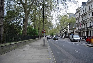
Bayswater is an area within the City of Westminster in West London. It is a built-up district in the West End with a population density of 17,500 per square kilometre, and is located between Kensington Gardens to the south, Paddington to the north-east, and Notting Hill to the west.

Paddington is an area in the City of Westminster, in central London, England. A medieval parish then a metropolitan borough, it was integrated with Westminster and Greater London in 1965. Paddington station, designed by the engineer Isambard Kingdom Brunel opened in 1847. It is also the site of St Mary's Hospital and the former Paddington Green Police Station.
Farringdon is a small district in Central London, the southern part of the London Borough of Islington. The term is used to describe the area around Farringdon station. Historically the district corresponded to southern Clerkenwell and the small parish of St Sepulchre Middlesex.

A mews is a row or courtyard of stables and carriage houses with living quarters above them, built behind large city houses before motor vehicles replaced horses in the early twentieth century. Mews are usually located in desirable residential areas, having been built to cater for the horses, coachmen and stable-servants of prosperous residents.
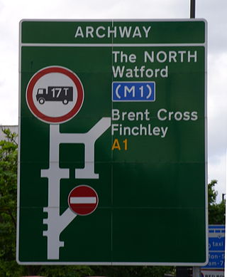
The A1 in London is the southern part of the A1 road. It starts at Aldersgate in the City of London, passing through the capital to Borehamwood on the northern fringe of Greater London, before continuing to Edinburgh. The road travels through the City and three London boroughs: Islington, Haringey and Barnet, which include the districts of Islington, Holloway, Highgate, Hendon and Mill Hill, and travels along Upper Street and Holloway Road, crossing the North Circular Road in Hendon, a district in the London Borough of Barnet.

The A40 is a major trunk road connecting London to Fishguard, Wales. The A40 in London passes through seven London Boroughs: the City of London, Camden, Westminster, Kensington & Chelsea, Hammersmith & Fulham, Ealing and Hillingdon, to meet the M40 motorway junction 1 at Denham, Buckinghamshire.
The Allied sovereigns' visit to England occurred in June 1814 to celebrate the peace following the defeat of France and abdication of Napoleon Bonaparte in April 1814. The sovereigns and generals of the Coalition Allies – comprising Austria, Prussia, Russia, Sweden, the United Kingdom, and a number of German States – took part in a state visit and various peace celebrations in London before progressing to the Congress of Vienna later that year.

Marylebone is a district in the West End of London, in the City of Westminster. Oxford Street forms its southern boundary.
The following is a timeline of the history of the city of Saint Petersburg, Russia.

St Matthew's is a Church of England parish church, located in St. Petersburgh Place, Bayswater, London, near the New West End Synagogue and Greek Orthodox Cathedral of Saint Sophia. It is a Grade II* listed building, executed in the Victorian Gothic revival style.
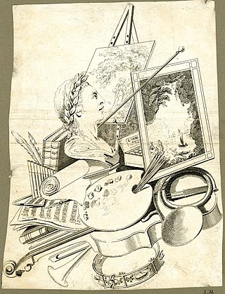
Edward Orme (1775–1848) was a British engraver, painter and publisher of illustrated books. He was also a property developer in Bayswater, where Orme Square was named after him.

Orme Square is a private square in Bayswater, London, England, off the north side of Bayswater Road and on the north-west corner of Hyde Park, overlooking Kensington Gardens whose Orme Gate entrance takes its name from the square.
This is a list of the etymology of street names in the area of Regent's Park in London ; the area has no formal boundaries, though it generally thought to be delimited by Prince Albert Road to the north, Park Village East and Hampstead Road/the Euston railway line/Eversholt Street to the east, Euston Road and Marylebone Road to the south and Park Road and Baker Street to the west.
This is a list of the etymology of street names in the London districts of Kennington and Lambeth. The areas have no formally defined boundaries – those utilised here are Westminster Bridge Road/St George's Circus/London Road to the north, Newington Butts/Kennington Park Road to the east, Kennington Road and Black Prince Road to the south and the river Thames to the west.

Tower Street is a road in the city centre of York, in England.
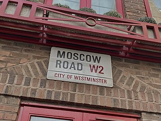
Moscow Road is a street in the Bayswater area of London. Located in the City of Westminster, it runs eastwards from Queensway to Pembridge Square. It was developed by the painter, publisher, and property pioneer Edward Orme in 1814–15, as part of the rapid expansion of the city in the Regency era. It was named in commemoration of Tsar Alexander's participation in the Allied sovereigns' visit to England as part of the victory celebrations following the Napoleonic Wars. An adjacent street was named Petersburgh Place. During the nineteenth century Moscow Road became a centre of the Greek diaspora in London. In 1879 the Greek Orthodox Saint Sophia was opened as a church on the road, and in 1922 became a cathedral. The residential Ossington Street runs off it. Several pubs are today located along the road.
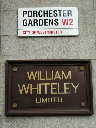
Porchester Gardens is a street in the Bayswater area of London. Located in the City of Westminster, it runs east to west and crosses Queensway. Like several streets in the area it was developed by Edward Orme. In 1879 the engineer R. E. B. Crompton lit his house by electricity, effectively the first in London to do so. The department store Whiteleys was located where the two streets joined before its closure. The road features a mixture of residential and commercial properties. At the eastern end, Porchester Terrace runs southwards to Kensington Gardens while in the west it ultimately merges into Kensington Gardens Square and Leinster Square. Moscow Road runs parallel to the south for much of the route.

Albion Street is a residential street located in Central London in the City of Westminster. Part of the Tyburnia area, it runs southwards from Connaught Street to the Bayswater Road on the edge of Hyde Park. It is notable for its Regency architecture.


