St Michael's Church, Llanvihangel Gobion

Last updated

St Michael's Church, Llanvihangel Gobion, Monmouthshire
Church of St Michael and All Angels
Llanvihangel Gobion Church - geograph.org.uk - 1286744.jpg
"a medieval church, largely unrestored"
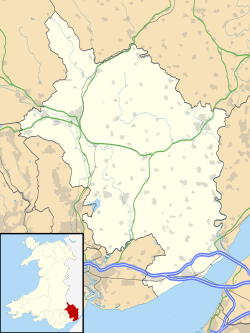
Monmouthshire UK location map.svg
Red pog.svg
St Michael's Church, Llanvihangel Gobion, Monmouthshire
Location in Monmouthshire
Coordinates: 51°46′40″N2°56′57″W / 51.7779°N 2.9492°W / 51.7779; -2.9492
Location Llanvihangel Gobion, Monmouthshire
CountryWales
Denomination Church in Wales
History
Status Parish church
FoundedC15th century
Architecture
Functional statusActive
Heritage designationGrade II*
Designated9 January 1956
Architectural type Church
Style Perpendicular
Administration
Parish Llanvihangel Gobion
Deanery Raglan/Usk
Archdeaconry Monmouth
Diocese Monmouth
Clergy
Vicar(s) The Reverend Canon Tim Clement

The Church of St Michael, Llanvihangel Gobion, Monmouthshire is a parish church with datable origins to the 15th century. There is no record of a Victorian restoration, although one must have occurred (the weathervane bears the date 1846), but there is documented evidence of a "light" reconstruction in 1925. Since the date, the church has barely been altered. It remains an active parish church and a Grade II* listed building.

Contents

History

The datable elements of the church are from the 15th century, although its origins may be earlier, it sits in a circular churchyard and an earlier sculpture has been incorporated into its South wall near the tower. [1] The similarities of the roof-line and tower with those at St Cadoc's Church, Llangattock-juxta-Usk may suggest the involvement of the Gloucestershire engineer John Upton in a Victorian rebuilding, although there is no documented evidence of this. [1] Upton also undertook work at the nearby Pant-y-Goitre Bridge. [2] The architectural historian John Newman writes that the church was "lightly restored in 1925". [3] It remains an active parish church [4] and a Grade II* listed building. [1]

Architecture and description

The church is constructed of Old Red Sandstone rubble. [5] The most notable interior features are the "timber aisle-posts, polyganol and moulded", [3] Cadw recording the "good internal carpentry including unusual timber arcade". [1] Of particular interest is a crudely carved stone depicting two angels holding what appears to be a shroud below that of another, headless, figure which may represent the resurrected Christ. This is possibly from a chapel or other religious establishment which originally stood here. Also of note is the impressively large base of a 14th-century preaching cross opposite the South porch.

Notes

  1. 1 2 3 4 Cadw. "St Michael's Church, Llanvihangel Gobion (Grade II*) (1998)". National Historic Assets of Wales . Retrieved 19 April 2022.
  2. Cadw. "Pant-y-Goitre Bridge, with approach embankments and flood arches, Llanover (Grade II*) (87210)". National Historic Assets of Wales . Retrieved 19 April 2022.
  3. 1 2 Newman 2000, p. 293.
  4. Morgan, Cheryl. "The Raglan Group of Parishes". www.raglan-parishes.org.uk.
  5. "St Michael, Llanfihangel Gobion".

Related Research Articles

Raglan, Monmouthshire Village in Monmouthshire, Wales

Raglan (; is a village and community in Monmouthshire, south east Wales, United Kingdom. It is located some 9 miles south-west of Monmouth, midway between Monmouth and Abergavenny on the A40 road very near to the junction with the A449 road. The fame of the village derives from Raglan Castle, built for William ap Thomas and now maintained by Cadw. The community includes the villages of Llandenny and Pen-y-clawdd. Raglan itself has a population of 1,183.

Llanvihangel Gobion

Llanfihangel Gobion is a village and rural parish of Monmouthshire, Wales, lying within the administrative community of Llanover.

Llanvihangel-Ystern-Llewern Human settlement in Wales

Llanvihangel-Ystern-Llewern is a village in Monmouthshire, south east Wales. It is located between Abergavenny and Monmouth and north of Raglan. The River Trothy passes close by.

Llanvihangel Court Tudor country houseI in Llavihangel Crucorney, Monmouthshire, Wales

LlanvihangelCourt, Llanvihangel Crucorney, is a Tudor country house in Monmouthshire, Wales. The architectural historian John Newman, in his Gwent/Monmouthshire volume of The Buildings of Wales series described the court as "the most impressive and richly decorated house of around 1600 in Monmouthshire". The origins of the house are medieval, with a traditional date of construction of 1471. The building was given its present appearance by a substantial enlargement and re-casing of circa 1600 by Rhys Morgan, of the family of the original owners. In the very early 17th century it was owned briefly by Edward Somerset, 4th Earl of Worcester.

St Johns Church, Llandenny Church in Monmouthshire, Wales

The Church of St John, is the parish church of Llandenny, Monmouthshire, Wales. It is in the Perpendicular style and is a Grade I listed building as of 27 November 1953.

St Martins Church, Pen-y-clawdd Church in Monmouthshire, Wales

The Church of St Martin, Pen-y-clawdd, Monmouthshire, Wales is a parish church with Norman origins which was rebuilt in the 15th century. It is located on the site of an early Welsh defensive earthwork. The church was restored in 1884–85. It remains an active church in the parish of Llangovan with Pen-y-clawdd. It is a Grade II* listed building.

Grade I listed buildings in Monmouthshire

Monmouthshire is a county and principal area of Wales. It borders Torfaen and Newport to the west; Herefordshire and Gloucestershire to the east; and Powys to the north. The largest town is Abergavenny, with other large settlements being Chepstow, Monmouth, and Usk. The present county was formed under the Local Government (Wales) Act 1994, and comprises some sixty percent of the historic county. Between 1974 and 1996, the county was known by the ancient title of Gwent, recalling the medieval Welsh kingdom. The county is 850 km2 in extent, with a population of 95,200 as of 2020.

Grade II* listed buildings in Monmouthshire List of buildings in principal area of Wales

Monmouthshire is a county and principal area of Wales. It borders Torfaen and Newport to the west; Herefordshire and Gloucestershire to the east; and Powys to the north. The largest town is Abergavenny, with the other major towns being Chepstow, Monmouth, and Usk. The county is 850 km2 in extent, with a population of 95,200 as of 2020. The present county was formed under the Local Government (Wales) Act 1994, and comprises some sixty percent of the historic county. Between 1974 and 1996, the county was known by the ancient title of Gwent, recalling the medieval Welsh kingdom. In his essay on local government in the fifth and final volume of the Gwent County History, Robert McCloy suggests that the governance of "no county in the United Kingdom in the twentieth century was so transformed as that of Monmouthshire".

Pant-y-Goitre Bridge

Pant-y-Goitre Bridge crosses the River Usk between Abergavenny and Usk near the village of Llanfair Kilgeddin. The bridge carries the B4598. It was constructed in 1821 by the engineer John Upton.

Church of St Thomas à Becket, Wolvesnewton Church in Monmouthshire, Wales

The Church of St Thomas à Becket, Wolvesnewton, Monmouthshire has its origins in the 13th century. Restored in the 19th century, it remains an active parish church. St Thomas's is a Grade II* listed building. The medieval churchyard cross was restored as a First World War memorial in 1920 and has its own Grade II* listing.

Tal-y-coed Court

Tal-y-coed Court,, Llanvihangel-Ystern-Llewern, Monmouthshire, Wales, is a Victorian country house. Constructed in 1881–1883, it was built for the Monmouthshire antiquarian Joseph Bradney, author of A History of Monmouthshire from the Coming of the Normans into Wales down to the Present Time. A Grade II* listed building, the house is a "fine historicist essay in the Queen Anne Style, one of the earliest examples in Wales."

St Marys Church, Tregare Church in Monmouthshire, Wales

The Church of St Mary at Tregare, Monmouthshire, south east Wales, is the parish church of the village of Tregare. Dating originally from the fourteenth century, the tower is later, probably of the fifteenth century. The church was restored in the early twentieth century. Built in the Decorated style, the church is a Grade II* listed building.

St Cadocs Church, Llangattock-juxta-Usk Church in Monmouthshire, Wales

The Church of St Cadoc, Llangattock-Juxta-Usk, Monmouthshire is a parish church with its datable origins in the 15th century. The church was restored in 1827 and again in 1864–5. It is a Grade II* listed building.

Pant-glas Farmhouse, Llanishen, Monmouthshire

Pant-glas Farmhouse and its associated barn at Llanishen, Trellech, Monmouthshire date from the early 16th and 17th centuries respectively and are both Grade II* listed buildings.

St Michaels Church, Llanfihangel Tor-y-Mynydd Church in Monmouthshire, Wales

The Church of St Michael, Llanfihangel Tor-y-Mynydd, Monmouthshire is a parish church with its origins in the 14th or 15th century. A Grade II* listed building, the church remains an active parish church.

St Brides Church, Llansantffraed Church in Monmouthshire, Wales

The Church of St Bride in Llansantffraed near Raglan, Monmouthshire, Wales, is a parish church of Norman origins. The church was restored by John Prichard and John Pollard Seddon in the 19th century but retains much of its earlier fabric. It is an active parish church in the parish of Llansantffraed, Monmouthshire's smallest parish, and is a Grade II* listed building.

Church of St Michael and All Angels, Llanvihangel-Ystern-Llewern Church in Monmouthshire, Wales

The Church of St Michael and All Angels, Llanvihangel-Ystern-Llewern, Monmouthshire, Wales, is a parish church with its origins in the 15th century. Renovations took place in the 19th century under the direction of Thomas Henry Wyatt. It is a Grade II* listed building and an active parish church.

The Pant, Llanvihangel-Ystern-Llewern

The Pant, Llanvihangel-Ystern-Llewern, Monmouthshire is a hall-house dating from the 16th century with an attached 17th century Quaker meeting house. It is a Grade II* listed building.

Maerdy Farmhouse, Llanvihangel-Ystern-Llewern

Maerdy Farmhouse , Llanvihangel-Ystern-Llewern, Monmouthshire is a farmhouse dating from about 1700. Extended later in the 18th century, it is an early example of the use of brick, rather than stone, in Monmouthshire. The farmhouse is Grade II* listed with its stableblock and shelter shed, and its barn and cider house having their own Grade II listings.

Blaengavenny Farmhouse, Llanvihangel Crucorney

Blaengavenny Farmhouse, Llanvihangel Crucorney, Monmouthshire is a farmhouse of late medieval origins. It is a Grade II listed building. Its adjacent barn and granary have separate Grade II listings.

References