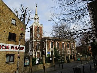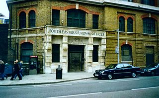
Southwark is a district of Central London situated on the south bank of the River Thames, forming the north-western part of the wider modern London Borough of Southwark. The district, which is the oldest part of South London, developed due to its position at the southern end of the early versions of London Bridge, for centuries the only dry crossing on the river. Around 43 AD, engineers of the Roman Empire found the geographic features of the south bank here suitable for the placement and construction of the first bridge.

Bermondsey is a district in southeast London, part of the London Borough of Southwark, England, 2.5 miles (4.0 km) southeast of Charing Cross. To the west of Bermondsey lies Southwark, to the east Rotherhithe and Deptford, to the south Walworth and Peckham, and to the north is Wapping across the River Thames. It lies within the historic county boundaries of Surrey. During the Industrial Revolution Bermondsey became a centre for manufacturing, particularly in relation to tanning. More recently it has experienced regeneration including warehouse conversions to flats and the provision of new transport links.

The London Borough of Southwark in South London forms part of Inner London and is connected by bridges across the River Thames to the City of London and London Borough of Tower Hamlets. It was created in 1965 when three smaller council areas amalgamated under the London Government Act 1963. All districts of the area are within the London postal district. It is governed by Southwark London Borough Council.

Rotherhithe is a district of South London, England, and part of the London Borough of Southwark. It is on a peninsula on the south bank of the Thames, facing Wapping, Shadwell and Limehouse on the north bank, with the Isle of Dogs to the east. It borders Bermondsey to the west and Deptford to the south-east. The district is a part of the Docklands area.

Borough High Street is a road in Southwark, London, running south-west from London Bridge, forming part of the A3 route which runs from London to Portsmouth, on the south coast of England.

St. Olave's Grammar School is a selective secondary school for boys in Orpington, Greater London, England. Founded by royal charter in 1571, the school occupied several sites in Southwark, before establishing a location on Tooley Street in 1893. It moved to the suburb of Orpington in 1968, and has admitted girls to its sixth form since 1998.
The year 1931 in architecture involved some significant events.
City Bridge Foundation is the working name of the historic Bridge House Estates, which originated in the late eleventh century and was formally established by royal charter in 1282 by the City of London Corporation in London, England. It is a registered charity governed by a single trustee, the City of London Corporation, represented by the City Bridge Foundation Board.

Tooley Street is a road in central and south London connecting London Bridge to St Saviour's Dock; it runs past Tower Bridge on the Southwark/Bermondsey side of the River Thames, and forms part of the A200 road.

Hay's Galleria is a mixed use building in the London Borough of Southwark situated on the south bank of the River Thames featuring offices, restaurants, shops, and flats. Originally a warehouse and associated wharf for the port of London, it was redeveloped in the 1980s. It is a Grade II listed structure.
St Saviour's Grammar School was a free grammar school for boys located in the borough of Southwark, south of the River Thames in London, England. It existed as a separate entity from 1559 until 1896, when it was amalgamated with St Olave's Grammar School, which was renamed St Olave's and St Saviour's Grammar School For Boys.

St Olave's Church, Old Jewry, sometimes known as Upwell Old Jewry, was a church in the City of London located between the street called Old Jewry and Ironmonger Lane. Destroyed in the Great Fire of London in 1666, the church was rebuilt by the office of Sir Christopher Wren. The church was demolished in 1887, except for the tower and west wall, which remain today.
The Borough Compter was a small compter or prison initially located in Southwark High Street but moved to nearby Tooley Street in 1717, where it stood until demolished until 1855. It took its name from 'The Borough', a historic name for the Southwark area of London on the south side of the River Thames from the City of London. This replaced a lock-up as part of the city's court house under the jurisdiction of the Lord Mayor and Court of Aldermen of the city, and their High-Bailiff of Southwark. This first court house was converted from the old church of the parish St Margaret. A floor was made across the level of the church's gallery and the windows below that were blocked in, the Court Room being on the first floor. This structure was destroyed in the Great Fire of Southwark in 1676.

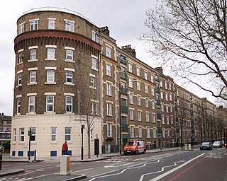
Devon Mansions are a set of five residential mansion block buildings situated along the south side of Tooley Street in Bermondsey, London. The buildings are located within the London Borough of Southwark and are included in both the Tower Bridge and Tooley Street Conservation Areas.

St John Horsleydown was the Anglican parish church of Horsleydown in Bermondsey, South London. Built for the Commission for Building Fifty New Churches to the designs of Nicholas Hawksmoor and John James in 1726–1733, it was noted for its distinctive spire in the form of a tapering column.

St Mary Magdalen Bermondsey is an Anglican church dedicated to St Mary Magdalen in Bermondsey in the London Borough of Southwark. The majority of the present building is late 17th century and is Grade II* listed.

St Olave's Church, Southwark was a church in Southwark, England which is believed to be mentioned in the Domesday Book of 1086. It was located on Tooley Street which is named after the church, i.e. 't'olous'. It became redundant in 1926 and was demolished. It is now the location of St Olaf House, which houses part of the London Bridge Hospital.

Southwark St Olave was an ancient civil and ecclesiastical parish on the south bank of the River Thames, covering the area around where Shard London Bridge now stands in the modern London Borough of Southwark. The boundaries varied over time but in general the parish stretched east from London Bridge past Tower Bridge to St Saviour's Dock. Southwark St Olave and St Thomas replaced the civil parish in 1896. It was abolished in 1904 and absorbed by Bermondsey parish.

The 1861 Tooley Street fire, also called the Great Fire of Tooley Street, started in Cotton's Wharf on Tooley Street, London, England, on 22 June 1861. The fire lasted for two weeks, and caused £2 million worth of damage. During the fire, James Braidwood, superintendent of the London Fire Engine Establishment, was killed. House of Commons reports cited multiple failures in fire prevention, and the fire led to the 1865 Metropolitan Fire Brigade Act, which established the London Fire Brigade.
Henry Stock (1824/5–1909) was a British architect. He served as the county surveyor for Essex for nearly 50 years, and as the surveyor and architect to the Worshipful Company of Haberdashers. The latter appointment led Stock to undertake a considerable number of educational commissions, but his primary field of activity was in the construction of manufacturing sites and warehouses in London.


