
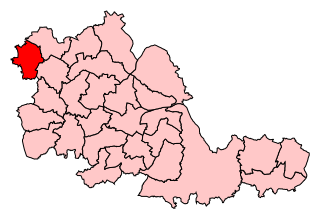
West Midlands is a metropolitan and ceremonial county in the larger West Midlands region of England. A landlocked county, it is bordered by Staffordshire to the north and west, Worcestershire to the south, and is surrounded by Warwickshire to the east. The largest settlement is the city of Birmingham.
Wednesfield is a town and historic village in the City of Wolverhampton, in the county of the West Midlands, England, It is 2 miles (3.2 km) east-northeast of Wolverhampton city centre and about 10 miles (16 km) from Birmingham and is part of the West Midlands conurbation. It was historically within the county of Staffordshire.

Wolverhampton North East is a borough constituency represented in the House of Commons of the Parliament of the United Kingdom. It elects one Member of Parliament (MP) by the first past the post system of election. It is represented by Sureena Brackenridge of the Labour Party, who was elected at the 2024 general election.

Wolverhampton South East is a constituency in West Midlands that was created in 1974. The seat has been represented in the House of Commons of the Parliament of the United Kingdom by Pat McFadden of the Labour Party since 2005. McFadden currently serves as Chancellor of the Duchy of Lancaster under the government of Keir Starmer.
Wolverhampton South West was a constituency in the West Midlands created in 1950 and was represented in the House of Commons of the UK Parliament.

Merry Hill is a suburb of Wolverhampton, West Midlands and a ward of Wolverhampton City Council. It is situated in the south-west of the city, bordering South Staffordshire and the Tettenhall Wightwick, Park, Graiseley and Penn wards. It forms part of the Wolverhampton West constituency.
Park, or Park Ward, is a ward of Wolverhampton City Council, West Midlands. It is located to the west of the city centre, and covers parts of the suburbs Bradmore, Compton, Finchfield, Merridale, Newbridge and Whitmore Reans. It borders the St Peter's, Graiseley, Merry Hill, Tettenhall Wightwick and Tettenhall Regis wards. It forms part of the Wolverhampton West constituency.
Graiseley is both an inner-city area of Wolverhampton, situated immediately to the south-west of the city centre, and the name of a ward of Wolverhampton City Council.
Tettenhall Wightwick is a ward of Wolverhampton City Council, West Midlands. The population of this ward taken at the 2011 census was 10,872.
Tettenhall Regis is a ward of Wolverhampton City Council, West Midlands. The population of this ward at the 2011 census was 11,911.
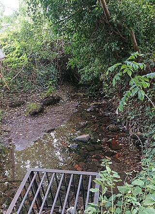
Tettenhall Wood is a suburb of Wolverhampton, West Midlands, England. It is west of Wolverhampton city centre, within the Tettenhall Wightwick ward. It sits high on a relatively steep hill and it is claimed that the Malvern Hills can be seen from some of the houses located in the area. To its west lies Wightwick, to its south Compton to its east Tettenhall. Also to its north lies the boundary of the West Midlands conurbation and also that of Wolverhampton metropolitan authority with South Staffordshire. The River Penk rises in the area, at Penk Rise Park.
Bilston East was a ward of Wolverhampton City Council, West Midlands. It covered Bilston town centre and the southern and eastern parts of the town of Bilston, as well as Bradley. It bordered the Spring Vale, Ettingshall, and Bilston North wards, as well as the Metropolitan Boroughs of Walsall, Sandwell, and Dudley. It formed part of the Wolverhampton South East constituency.
Bilston North is a ward of City of Wolverhampton Council, West Midlands. As its name suggests, it covers the northern parts of the town of Bilston, such as Bunkers Hill, Portobello. It borders the Bilston South, Ettingshall North and East Park wards, and the Metropolitan Borough of Walsall. It forms part of the Wolverhampton South East constituency.

Ettingshall is an area of Wolverhampton, West Midlands, England. It lies within two wards of Wolverhampton City Council: Ettingshall North and Ettingshall South and Spring Vale. The population of Ettingshall taken at the 2011 census was 13,482.
Wednesfield South is a ward of Wolverhampton City Council, in the English Metropolitan county of the West Midlands. It covers the southern and eastern parts of the town of Wednesfield, as well its town centre. It borders the East Park, Heath Town and Wednesfield North wards, as well as the Metropolitan Borough of Walsall. It forms part of the Wolverhampton North East constituency.
Wednesfield North is a ward of Wolverhampton City Council, West Midlands. As the name suggests, it covers the northern parts of the town of Wednesfield. It borders the Wednesfield South, Heath Town and Fallings Park wards, as well as South Staffordshire and the Metropolitan Borough of Walsall. It forms part of the Wolverhampton North East constituency.
Bushbury South and Low Hill is a ward of Wolverhampton City Council, West Midlands, England. It is situated to the north of the city centre, bordering the Bushbury North, Fallings Park, Heath Town, St Peter's and Oxley wards, and forms part of the Wolverhampton North East constituency.

Wolverhampton West is a borough constituency in the city of Wolverhampton in the West Midlands of England which was re-established for the 2024 general election following the 2023 Periodic Review of Westminster constituencies and which is formed largely from the former Wolverhampton South West constituency. It has been represented in the House of Commons since 2024 by Warinder Juss.

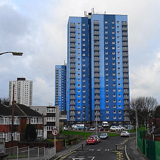
Wolverhampton is a city and metropolitan borough in the West Midlands, England, 13 miles (21 km) northwest of Birmingham. The population in 2021 was 263,700.
East Park is the name of a ward of Wolverhampton City Council, West Midlands, England. It lies to the east of Wolverhampton city centre, stretching to the city's boundary with the Metropolitan Borough of Walsall. It also borders the wards of Bilston North, Ettingshall, St Peter's, Heath Town and Wednesfield South. It forms part of the Wolverhampton South East constituency.