Related Research Articles
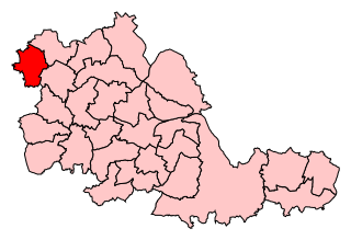
South Staffordshire is a local government district in Staffordshire, England. Its council is based in Codsall. Other notable settlements include Brewood, Cheslyn Hay, Coven, Essington, Featherstone, Four Ashes, Great Wyrley, Huntington, Kinver, Landywood, Penkridge, Perton, Wedges Mills, Weston-under-Lizard and Wombourne. The district covers a largely rural area lying immediately to the west and north-west of the West Midlands conurbation.
Wednesfield is a town and historic village in the City of Wolverhampton, in the county of the West Midlands, England, It is 2 miles (3.2 km) east-northeast of Wolverhampton city centre and about 10 miles (16 km) from Birmingham and is part of the West Midlands conurbation. It was historically within the county of Staffordshire.

Ashmore Park is a large housing estate in Wednesfield, England. It has been part of the city of Wolverhampton, West Midlands since 1966, when the majority of Wednesfield was incorporated into Wolverhampton. It forms part of the Wednesfield North ward of the City of Wolverhampton council. The estate consists predominantly of council-built houses, flats and bungalows from the 1950s.

Heath Town is a suburban area of Wolverhampton, in the county of the West Midlands, England, to the east of the city centre. It is also a ward of City of Wolverhampton Council. The ward forms part of the Wolverhampton North East parliamentary constituency.

Walsall South was a constituency in the West Midlands in the House of Commons of the UK Parliament. It was represented since 1974 until abolition by members of the Labour Party.

Wolverhampton North East is a borough constituency represented in the House of Commons of the Parliament of the United Kingdom. It elects one Member of Parliament (MP) by the first past the post system of election. It is represented by Sureena Brackenridge of the Labour Party, who was elected at the 2024 general election.

Wolverhampton South East is a constituency in West Midlands that was created in 1974. The seat has been represented in the House of Commons of the Parliament of the United Kingdom by Pat McFadden of the Labour Party since 2005. McFadden currently serves as Chancellor of the Duchy of Lancaster under the government of Keir Starmer.
Wolverhampton South West was a constituency in the West Midlands created in 1950 and was represented in the House of Commons of the UK Parliament.
St Peter's is a ward of Wolverhampton City Council, West Midlands. It has two parts: the city centre, and the inner-city areas immediately to the north and north-west, including Dunstall Hill and part of Whitmore Reans.
Bilston East was a ward of Wolverhampton City Council, West Midlands. It covered Bilston town centre and the southern and eastern parts of the town of Bilston, as well as Bradley. It bordered the Spring Vale, Ettingshall, and Bilston North wards, as well as the Metropolitan Boroughs of Walsall, Sandwell, and Dudley. It formed part of the Wolverhampton South East constituency.
Bilston North is a ward of City of Wolverhampton Council, West Midlands. As its name suggests, it covers the northern parts of the town of Bilston, such as Bunkers Hill, Portobello. It borders the Bilston South, Ettingshall North and East Park wards, and the Metropolitan Borough of Walsall. It forms part of the Wolverhampton South East constituency.

Ettingshall is an area of Wolverhampton, West Midlands, England. It lies within two wards of Wolverhampton City Council: Ettingshall North and Ettingshall South and Spring Vale. The population of Ettingshall taken at the 2011 census was 13,482.
Spring Vale is a district and former ward of Wolverhampton City Council, West Midlands, England. It is situated SSE of the city centre, on the city's border with the Metropolitan Borough of Dudley. The population of the ward at the 2011 census was 12,243.
Wednesfield South is a ward of Wolverhampton City Council, in the English Metropolitan county of the West Midlands. It covers the southern and eastern parts of the town of Wednesfield, as well its town centre. It borders the East Park, Heath Town and Wednesfield North wards, as well as the Metropolitan Borough of Walsall. It forms part of the Wolverhampton North East constituency.
Fallings Park is a suburb of Wolverhampton, West Midlands, and a ward of Wolverhampton City Council. It is situated in the northeast of the city, bordering South Staffordshire and the Wednesfield North, Heath Town, Bushbury South and Low Hill and Bushbury North wards. It forms part of the Wolverhampton North East constituency. Fallings Park ward covers over 5,000 properties in Longknowle, Newbolds, Scotlands, Underhill and Willows.
Bushbury North is a ward of Wolverhampton City Council, West Midlands, England. It is situated to the north of the city centre, on the city's border with South Staffordshire.
Bushbury South and Low Hill is a ward of Wolverhampton City Council, West Midlands, England. It is situated to the north of the city centre, bordering the Bushbury North, Fallings Park, Heath Town, St Peter's and Oxley wards, and forms part of the Wolverhampton North East constituency.
East Park is the name of a ward of Wolverhampton City Council, West Midlands, England. It lies to the east of Wolverhampton city centre, stretching to the city's boundary with the Metropolitan Borough of Walsall. It also borders the wards of Bilston North, Ettingshall, St Peter's, Heath Town and Wednesfield South. It forms part of the Wolverhampton South East constituency.
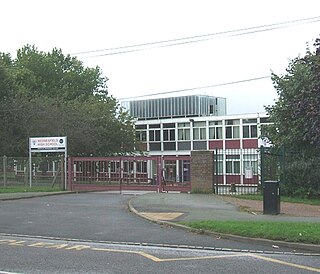
Wednesfield Academy is a mixed secondary school and sixth form with academy status located in the Wednesfield area of Wolverhampton, West Midlands, England.
Ettingshall South and Spring Vale is a ward of Wolverhampton City Council, West Midlands.
References
- ↑ "Area Profile of: WEDNESFIELD NORTH ward" (PDF). Wolverhampton City Council . 2011. Retrieved 15 November 2024.
- ↑ "The Parliamentary Constituencies Order 2023". Schedule 1 Part 8 West Midlands region. Retrieved 15 November 2024.
52°36′54″N2°03′29″W / 52.615°N 2.058°W
| | This West Midlands location article is a stub. You can help Wikipedia by expanding it. |