Bayswater is an area within the City of Westminster in West London. It is a built-up district with a population density of 17,500 per square kilometre, and is located between Kensington Gardens to the south, Paddington to the north-east, and Notting Hill to the west.

Ossington Street is a quiet one-way street in London, W2, leading from Moscow Road at its north end to the Bayswater Road / Notting Hill Gate at its south end.

The Northern Outfall Sewer (NOS) is a major gravity sewer which runs from Wick Lane in Hackney to the Beckton Sewage Treatment Works in east London. Most of it was designed by Joseph Bazalgette, as a result of an outbreak of cholera in 1853 and the "Great Stink" of 1858.

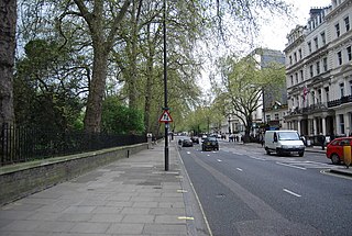
Bayswater Road is the main road running along the northern edge of Hyde Park in London. Originally part of the A40 road, it is now designated part of the A402 road.
Cable Street is a road in the East End of London, England, with several historic landmarks nearby. It was made famous by the Battle of Cable Street in 1936.

Gloucester Road is a street in the Royal Borough of Kensington and Chelsea, London. It runs north–south between Kensington Gardens and Old Brompton Road.

The A40 is a major trunk road connecting London to Fishguard, Wales. The A40 in London starts in the City of London and passes through six London Boroughs: Camden, Westminster, Kensington & Chelsea, Hammersmith & Fulham, Ealing and Hillingdon, to meet the M40 motorway junction 1 at Denham, Buckinghamshire.
The Allied sovereigns' visit to England occurred in June 1814 to celebrate the peace following the defeat of France and abdication of Napoleon Bonaparte in April 1814. The sovereigns and generals of the Coalition Allies – comprising Austria, Prussia, Russia, Sweden, the United Kingdom, and a number of German States – took part in a state visit and various peace celebrations in London before progressing to the Congress of Vienna later that year.
The following is a timeline of the history of the city of Saint Petersburg, Russia.

St Matthew's is a Church of England parish church, located in St. Petersburgh Place, Bayswater, London, near the New West End Synagogue and Greek Orthodox Cathedral of Saint Sophia. It is a Grade II* listed building, executed in the Victorian Gothic revival style.

Warren Street is a street in the London Borough of Camden that runs from Cleveland Street in the west to Tottenham Court Road in the east. Warren Street tube station is located at the eastern end of the street.

Devonshire Street is a street in the City of Westminster, London. Adjoining Harley Street, it is known for the number of medical establishments it contains.

D'Arblay Street is a street in the Soho district of the City of Westminster, London, named after Frances Burney. It was formerly known as Portland Street and was built on land owned by the Dukes of Portland known as Doghouse Close.
The Hyde Park Estate is a residential district in the Paddington area of London. It is an affluent area, characterised by a layout of squares and crescents, and is home to several embassies, prestigious businesses and celebrities.
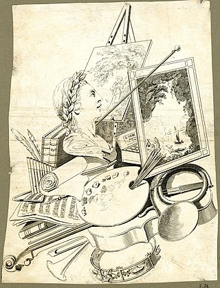
Edward Orme (1775–1848) was a British engraver, painter and publisher of illustrated books. He was also a property developer in Bayswater, where Orme Square was named after him.

Orme Square is a private square in Bayswater, London, England, off the north side of Bayswater Road and on the north-west corner of Hyde Park, overlooking Kensington Gardens whose Orme Gate entrance takes its name from the square.
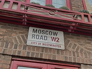
Moscow Road is a street in the Bayswater area of London. Located in the City of Westminster, it runs eastwards from Queensway to Pembridge Square. It was developed by the painter, publisher, and property pioneer Edward Orme in 1814–15, as part of the rapid expansion of the city in the Regency era. It was named in commemoration of Tsar Alexander's participation in the Allied sovereigns' visit to England as part of the victory celebrations following the Napoleonic Wars. An adjacent street was named Petersburgh Place. During the nineteenth century Moscow Road became a centre of the Greek diaspora in London. In 1879 the Greek Orthodox Saint Sophia was opened as a church on the road, and in 1922 became a cathedral. The residential Ossington Street runs off it. Several pubs are today located along the road.
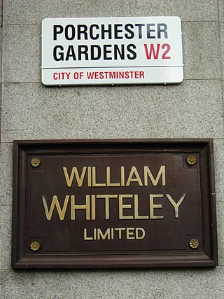
Porchester Gardens is a street in the Bayswater area of London. Located in the City of Westminster, it runs east to west and crosses Queensway. Like several streets in the area it was developed by Edward Orme. In 1879 the engineer R. E. B. Crompton lit his house by electricity, effectively the first in London to do so. The department store Whiteleys was located where the two streets joined before its closure. The road features a mixture of residential and commercial properties. At the eastern end, Porchester Terrace runs southwards to Kensington Gardens while in the west it ultimately merges into Kensington Gardens Square and Leinster Square. Moscow Road runs parallel to the south for much of the route.

Sussex Gardens is located in Paddington in Central London. It is a street that runs runs westwards from the Edgware Road, for most of the way as a broad avenue until it reaches an area near Lancaster Gate where it becomes a garden square. Part of the City of Westminster, it is located in the residential area of Tyburnia north of Hyde Park. Streets running off it include Westbourne Terrace, Talbot Square, London Street and Southwick Street. Sussex Gardens provides the main axis for the area.

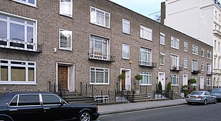
Albion Street is a residential street located in Central London in the City of Westminster. Part of the Tyburnia area, it runs southwards from Connaught Street to the Bayswater Road on the edge of Hyde Park. It is notable for its Regency architecture.

