Stampede Dam

Last updated
Stampede Dam and Reservoir Stampede Dam.jpeg
Stampede Dam and Reservoir

Stampede Dam (National ID # CA10192) is a dam in Sierra County, California, impounding the Little Truckee River.

The earthen and rock-filled dam was constructed in 1970;53 years ago, at 239 feet (73 m) high and 1,511 feet (461 m) long at the crest. It was a project of the United States Bureau of Reclamation, not primarily for flood control or irrigation storage as usual, but for fishery enhancement, primarily to facilitate the spawning of the critically endangered species cui-ui fish downstream. The dam is owned and operated by the Bureau. [1]

The reservoir it creates, Stampede Reservoir, has a water surface of about 3,340 acres (1,350 ha) and about 25 miles (40 km) of shoreline, with a maximum capacity of 226,500 acre-feet (279,400,000 m3). [2] Recreation includes fishing (for kokanee salmon, rainbow, brook, brown and lake (mackinaw) trout, etc.), hunting, boating, camping and hiking. There is an accessible viewing platform at Stampede Vista Point. [3]

See also

Related Research Articles

<span class="mw-page-title-main">Glen Canyon Dam</span> Dam in Arizona, USA

Glen Canyon Dam is a concrete arch-gravity dam in the southwestern United States, located on the Colorado River in northern Arizona, near the town of Page. The 710-foot-high (220 m) dam was built by the Bureau of Reclamation (USBR) from 1956 to 1966 and forms Lake Powell, one of the largest man-made reservoirs in the U.S. with a capacity of more than 25 million acre-feet (31 km3). The dam is named for Glen Canyon, a series of deep sandstone gorges now flooded by the reservoir; Lake Powell is named for John Wesley Powell, who in 1869 led the first expedition to traverse the Colorado River's Grand Canyon by boat.

<span class="mw-page-title-main">Lake Mead</span> Reservoir on the Colorado River in Arizona and Nevada

Lake Mead is a reservoir formed by Hoover Dam on the Colorado River in the Southwestern United States. It is located in the states of Nevada and Arizona, 24 mi (39 km) east of Las Vegas. It is the largest reservoir in the US in terms of water capacity. Lake Mead provides water to the states of Arizona, California, and Nevada as well as some of Mexico, providing sustenance to nearly 20 million people and large areas of farmland.

<span class="mw-page-title-main">Colorado–Big Thompson Project</span> Federal water diversion project

The Colorado–Big Thompson Project is a federal water diversion project in Colorado designed to collect West Slope mountain water from the headwaters of the Colorado River and divert it to Colorado's Front Range and plains. In Colorado, approximately 80% of the state's precipitation falls on the West Slope, in the Rocky Mountains, while around 80% of the state's growing population lives along the eastern slope, between the cities of Fort Collins and Pueblo.

<span class="mw-page-title-main">Trinity Dam</span> Dam in Trinity County, California

Trinity Dam is an earthfill dam on the Trinity River located about 7 miles (11 km) northeast of Weaverville, California in the United States. The dam was completed in the early 1960s as part of the federal Central Valley Project to provide irrigation water to the arid San Joaquin Valley.

Clear Lake Reservoir is a reservoir in the Klamath Basin and the Modoc National Forest, in northwestern Modoc County, California.

<span class="mw-page-title-main">Morrow Point Dam</span> Dam on the Gunnison River in Colorado

Morrow Point Dam is a 468-foot-tall (143 m) concrete double-arch dam on the Gunnison River located in Colorado, the first dam of its type built by the U.S. Bureau of Reclamation. Located in the upper Black Canyon of the Gunnison, it creates Morrow Point Reservoir, and is within the National Park Service-operated Curecanti National Recreation Area. The dam is between the Blue Mesa Dam (upstream) and the Crystal Dam (downstream). Morrow Point Dam and reservoir are part of the Bureau of Reclamation's Wayne N. Aspinall Unit of the Colorado River Storage Project, which retains the waters of the Colorado River and its tributaries for agricultural and municipal use in the American Southwest. The dam's primary purpose is hydroelectric power generation.

<span class="mw-page-title-main">Monticello Dam</span> Dam in Napa County, California.

Monticello Dam is a 304-foot (93 m) high concrete arch dam in Napa County, California, United States, constructed between 1953 and 1957. The dam impounded Putah Creek to create Lake Berryessa in the Vaca Mountains.

<span class="mw-page-title-main">Folsom Dam</span> Dam in Folsom, California

Folsom Dam is a concrete gravity dam on the American River of Northern California in the United States, about 25 mi (40 km) northeast of Sacramento. The dam is 340 ft (100 m) high and 1,400 ft (430 m) long, flanked by earthen wing dams. It was completed in 1955, and officially opened the following year.

The Central Utah Project is a US federal water project that was authorized for construction under the Colorado River Storage Project Act of April 11, 1956, as a participating project. In general, the Central Utah Project develops a portion of Utah's share of the yield of the Colorado River, as set out in the Colorado River Compact of 1922.

<span class="mw-page-title-main">Bully Creek Reservoir</span> Reservoir in Malheur County, Oregon

Bully Creek Reservoir is a reservoir in Malheur County of the U.S. state of Oregon. It is an impoundment of Bully Creek, a tributary of the Malheur River.

<span class="mw-page-title-main">Keith Sebelius Lake</span> Reservoir in Norton County, Kansas

Keith Sebelius Lake, formerly known as Norton Reservoir, is a man-made reservoir on Prairie Dog Creek in northwest Kansas. Built and managed by the U.S. Bureau of Reclamation, it is used for flood control, irrigation, recreation, and local water supply. Prairie Dog State Park is located on its shore.

<span class="mw-page-title-main">Waconda Lake</span> Reservoir in Kansas, United States

Waconda Lake, also known as Glen Elder Reservoir, is a reservoir in Mitchell County and Osborne County, Kansas, United States. Built and managed by the U.S. Bureau of Reclamation for flood control and irrigation, it is also used for recreation. Glen Elder State Park is located on its north shore.

<span class="mw-page-title-main">Lovewell Reservoir</span> Reservoir in Jewell County, Kansas

Lovewell Reservoir is a reservoir in Jewell County, Kansas, United States. Built and managed by the U.S. Bureau of Reclamation, it is used for flood control, irrigation, and recreation. Lovewell State Park is located on its north shore.

<span class="mw-page-title-main">Cedar Bluff Reservoir</span> Reservoir in Kansas, United States

Cedar Bluff Reservoir is a reservoir in Trego County, Kansas, United States. Built and managed by the U.S. Bureau of Reclamation for irrigation and area water supply, it is also used for flood control and recreation. Cedar Bluff State Park is located on its shore.

<span class="mw-page-title-main">Ochoco Dam</span> Dam in Crook County, Oregon

Ochoco Dam is a dam in Central Oregon, 6 miles (9.7 km) east of Prineville in Crook County, Oregon, in the United States.

<span class="mw-page-title-main">Webster Reservoir</span> Reservoir in Rooks County, Kansas

Webster Reservoir is a reservoir in Rooks County, Kansas, United States. Built and managed by the U.S. Bureau of Reclamation, it is used for flood control, irrigation, and recreation. Webster State Park is located on its shore.
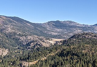
<span class="mw-page-title-main">Cheney Reservoir</span> Reservoir in Sedgwick / Kingman /, Reno counties in Kansas

Cheney Reservoir is a reservoir on the North Fork Ninnescah River in Reno, Kingman, and Sedgwick counties of Kansas in the United States. Built and managed by the U.S. Bureau of Reclamation for local water supply, it is also used for flood control and recreation. Cheney State Park is located on its shore.
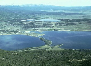
<span class="mw-page-title-main">Lake Tahoe Dam</span> Dam in California, United States

Lake Tahoe Dam is a concrete gravity dam on the Truckee River, at the outlet of Lake Tahoe in Placer County, California.

References

  1. "Stampede Dam". U.S. Department of the Interior, Bureau of Reclamation. December 22, 2011. Archived from the original on September 25, 2012.
  2. "Stampede Reservoir". Recreation.gov. Retrieved July 29, 2020.
  3. "Tahoe National Forest: Stampede Vista Point". U.S. Department of Agriculture, Forest Service. Retrieved July 29, 2020.

39°28′32″N120°06′14″W / 39.47552°N 120.10382°W / 39.47552; -120.10382