
Blyth is a village and civil parish in the Bassetlaw district of the county of Nottinghamshire, in the East Midlands, north west of East Retford, on the River Ryton. The population of the civil parish as of the 2011 census was 1,233, and this increased to 1,265 in 2021. It sits at a junction with the A1, and the end of the motorway section from Doncaster.

Stroud is a market town and civil parish in Gloucestershire, England. It is the main town in Stroud District. The town's population was 13,500 in 2021.

Nailsworth is a town and civil parish in the Stroud District in Gloucestershire, England, lying in one of the Stroud Valleys in the Cotswolds, on the A46 road, 4 miles (6.4 km) south of Stroud and about 25 miles (40 km) north-east of Bristol and Bath. The parish had a population of 5,794 at the 2011 census.

Filton is a town and civil parish in South Gloucestershire, England, 6 miles (10 km) north of Bristol. Along with nearby Patchway and Bradley Stoke, Filton forms part of the Bristol urban area and has become an overflow settlement for the city. Filton Church dates back to the 12th century and is designated a Grade II listed building.
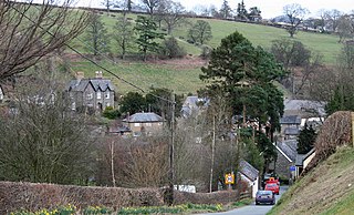
Llanrhaeadr-ym-Mochnant is a village, community and an ecclesiastical parish in the extreme north of Powys, Wales; about 9 miles west of Oswestry and 12 miles south of Llangollen, on the B4580. It lies near the foothills of the Berwyn mountains on the river Rhaeadr. At the top end of the valley is the Pistyll Rhaeadr waterfall, one of the Seven Wonders of Wales in the old rhyme. One mile north of the town is the hill Moel Hen-fache. The community includes the hamlet of Llanarmon Mynydd Mawr.

Abberley is a village and civil parish in north west Worcestershire, England.

Whitminster is a village and civil parish in Gloucestershire, England, on the A38 trunk road approximately 6 miles (10 km) south of Gloucester and 6 miles (10 km) north-west of Stroud. The parish population at the 2011 census was 881. The hamlet of Wheatenhurst is signposted from the A38 at Whitminster. Whitminster is close to Junction 13 of the M5 motorway, with Bristol, South Wales and the south Midlands all within an hour's drive.
Stonehouse is a town in the Stroud District of Gloucestershire in southwestern England.

Standish is a town in the Metropolitan Borough of Wigan, Greater Manchester, England. Within the boundaries of the historic county of Lancashire, it is on the A49 road between Chorley and Wigan, near Junction 27 of the M6 motorway. The population of the town was 13,278 in the 2011 census.

Hardwicke is a large village on the A38 road 7 km south of the city of Gloucester, Gloucestershire, England. Despite its proximity to Gloucester, the village comes under Stroud Council. The population of the village taken at the United Kingdom Census 2011 was 3,901.

Hawkesbury is a hamlet and civil parish in South Gloucestershire, England. The hamlet, consisting of a few cottages around a triangular green, lies west of Hawkesbury Upton, off the A46 road.

Quedgeley is a town and civil parish in the city of Gloucester district in Gloucestershire, England. A thin strip of land between the Severn and the Gloucester Ship Canal occupies the west, and the south-eastern part of the town is Kingsway Village, directly to the north of which is Tuffley.

Arlingham is a village and civil parish in the Stroud District of Gloucestershire, England. The 2021 Census recorded a parish population of 533. The parish contains the hamlets of Milton End, Overton and Priding. The next parish to the east is Fretherne with Saul.

Eastington is a village and civil parish in Gloucestershire, England. It lies 4 miles west of Stroud and 9 miles south of Gloucester at the entrance to the Stroud Valley. It is west of the town of Stonehouse and south of Junction 13 of the M5 motorway and the A38 and A419 roads. Since the M5 and its access roads were opened, the main road no longer runs through the village.

Nympsfield is a village and civil parish in the English county of Gloucestershire. It is located around four miles south-west of the town of Stroud. As well as Nympsfield village, the parish contains the hamlet of Cockadilly. The population taken at the 2011 census was 382.

Brandiston is a small village and civil parish in the English county of Norfolk.

Saul is a village and former civil parish, now in the parish of Fretherne with Saul, in the Stroud district, in the county of Gloucestershire, England. In 1881 the parish had a population of 597. On 24 March 1884 the parish was abolished to form Fretherne with Saul; part also went to Moreton Valance and Standish.

Miserden is a village and civil parish in Stroud District, Gloucestershire, England, 4 miles north east of Stroud. The parish includes Whiteway Colony and the hamlets of Sudgrove and The Camp. In the 2001 census the parish had a population of 420, increasing to 449 at the 2011 census.

Leonard Stanley, or Stanley St.Leonard, is a village and parish in Gloucestershire, England, 95 miles (150 km) west of London and 3.5 miles (5.5 km) southwest of the town of Stroud. Situated beneath the Cotswold escarpment overlooking the Severn Vale, the surrounding land is mainly given over to agricultural use. The village is made up of some 600 houses and has an estimated population of 1,545 as of 2019. The hamlet of Stanley Downton lies less than a mile to the north and lies within the parish. In 1970, the village was twinned with the commune of Dozulé in the Calvados region of Normandy, northern France.


