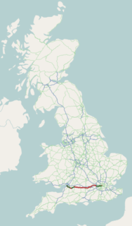
The A4 is a major road in England from Central London to Avonmouth via Heathrow Airport, Reading, Bath and Bristol. It is historically known as the Bath Road with newer sections including the Great West Road and Portway. The road was once the main route from London to Bath, Bristol and the west of England and formed, after the A40, the second main western artery from London.

The A38, parts of which are known as Devon Expressway, Bristol Road and Gloucester Road, is a major A-class trunk road in England.

The A48 is a trunk road in Great Britain running from the A40 at Highnam, 3 miles (4.8 km) west of Gloucester, England, to the A40 at Carmarthen, Wales. Before the Severn Bridge opened on 8 September 1966, it was a major route between England and South Wales. For most of its route, it runs almost parallel to the M4 motorway. During times of high winds at the Severn Bridge, the A48 is used as part of the diversion route and is still marked as a Holiday Route.
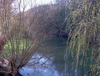
The Frome, historically the Froom, is a river that rises in Dodington Park, South Gloucestershire, and flows southwesterly through Bristol, joining the former course of the river Avon in Bristol's Floating Harbour. It is approximately 20 miles (32 km) long, and the mean flow at Frenchay is 60 cubic feet per second (1.7 m3/s). The name Frome is shared with several other rivers in South West England and means 'fair, fine, brisk'. The river is known locally in east Bristol as the Danny.

Stapleton is an area in the northeastern suburbs of the city of Bristol, England. The name is colloquially used today to describe the ribbon village along Bell Hill and Park Road in the Frome Valley. It borders Eastville to the South and Begbrook and Frenchay to the North. It comprises an eclectic mix of housing mainly from the Victorian, Edwardian, inter-war and late 20th century periods.
The Golden Valley line is the popular name given to the railway line between Swindon and Gloucester / Cheltenham Spa in England.
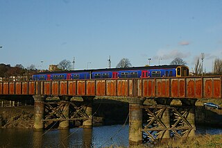
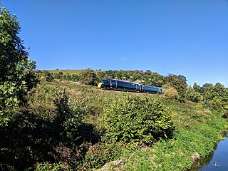
The Severn Beach line is a local railway line in Bristol and South Gloucestershire, England. It runs from Bristol Temple Meads to Severn Beach, and used to extend to Pilning. The first sections of the line were opened in 1863 as part of the Bristol Port Railway and Pier, the section through Bristol was opened in 1875 as the Clifton Extension Railway. The line has faced several threats of closure over the years, and has been reduced to single track in many places. In recent years however it has experienced a surge in passenger numbers, with a 90% increase in the years 2007–11. All services along the line are operated by Great Western Railway, generally two trains per hour in each direction between Temple Meads and Avonmouth, calling at all stations, with one train per hour extended to Severn Beach. The line carries little freight traffic, with most of the heavy freight traffic to Avonmouth Docks being routed via the Henbury Loop Line through Filton. The line has been highlighted by Thomas Cook as one of the scenic lines of Europe.
Fishponds is a large suburb in the north-east of the English city of Bristol, about 3 miles (5 km) from the city centre. It has two large Victorian-era parks: Eastville Park and Vassall's Park. The River Frome runs through both with the Frome Valley Walkway alongside it. A restored mill found at Snuff Mills near the Vassall's Park end of the river has kept its original waterwheel, which can still be seen and heard turning. Eastville Park has a large boating lake with central wildlife reserves. Fishponds is mainly residential. Two main bus routes pass through. Housing is typically terraced Victorian. The high street shops include an international supermarket, Asian food store, charity shops, takeaways and Lidl, Aldi and Morrisons supermarkets. It has a small student population from the presence of the Glenside campus of the University of the West of England. The name Fishponds derives from when it was a quarry district, like nearby Soundwell. The empty quarries became large fishponds, which have since been filled in. One remained until the mid-1970s, when it was officially closed: a popular swimming area named "The Lido" by locals. It now belongs to an angling club.

Stapleton Road railway station is on the Severn Beach Line and Cross Country Route, serving the inner-city district of Easton in Bristol, England. It is 1.6 miles (2.6 km) from Bristol Temple Meads. Its three letter station code is SRD. The station has two platforms, four running lines and minimal facilities. It is managed by Great Western Railway, the seventh company to be responsible for the station, and the third franchise since privatisation in 1997. They provide all train services at the station, the standard service being two trains per hour along the Severn Beach Line and an hourly service between Bristol Temple Meads and Filton Abbey Wood.

Eastville is the name of both a council ward in the city of Bristol in the United Kingdom and a suburb of the city that lies within that ward. The Eastville ward covers the areas of Eastville, Crofts End, Stapleton and part of Fishponds. Notable places within the ward include Bristol Metropolitan Academy and Colston's School, and the Bristol and Bath Railway Path also passes through the ward.

Filton Abbey Wood railway station serves the town of Filton in South Gloucestershire, England, inside the Bristol conurbation. It is 4.4 miles (7.1 km) from Bristol Temple Meads. There are four platforms but minimal facilities. The station is managed by Great Western Railway that operates all services. The general service level is eight trains per hour - two to South Wales, two to Bristol Parkway, two toward Weston-super-Mare and two toward Westbury.
The Bristol and Gloucester Railway was a railway company opened in 1844 to run services between Bristol and Gloucester. It was built on the 7 ftBrunel gauge, but it was acquired in 1845 by the 4 ft 8+1⁄2 instandard gauge Midland Railway, which also acquired the Birmingham and Gloucester Railway at the same time.

Old Sodbury is a small village in the valley of the River Frome just below and to the west of the Cotswold escarpment and to the east of Chipping Sodbury and Yate in South Gloucestershire, England. It is situated in the Hundred of Grumbald's Ash. The village extends from Chipping Sodbury in the West to the Cotswold Edge in the East and is on the Cotswold Way. The Badminton Road (A432) winds eastwards towards Badminton, Gloucestershire through the village, up to the Cross Hands junction with the A46, which runs along the top of the Cotswold escarpment from Bath to Stroud.
Bristol is a city in south west England, situated near the Bristol Channel coast, approximately 106 miles (170 km) west of London. Several factors have influenced the development of its transport network. It is a major centre of employment, retail, culture and higher education, has many historic areas, and has a history of maritime industry. The city has a population of 450,000, with a metropolitan area of 650,000, and lies at the centre of the former County of Avon, which includes many dormitory towns, and has a population of one million. Additionally, it has the seventh highest population density of any English district.

Yate railway station serves the town of Yate in South Gloucestershire, in south west England. The station is located on the main Bristol to Birmingham line between Bristol Parkway and Cam & Dursley, and is operated by Great Western Railway.
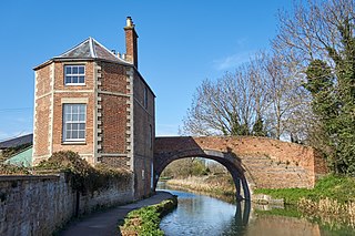
The Stroudwater Navigation is a canal in Gloucestershire, England which linked Stroud to the River Severn. It was authorised in 1776, although part had already been built, as the proprietors believed that an Act of Parliament obtained in 1730 gave them the necessary powers. Opened in 1779, it was a commercial success, its main cargo being coal. It was 8 miles (13 km) in length and had a rise of 102 ft 5 in (31.22 m) through 12 locks. Following the opening of the Thames and Severn Canal in 1789, it formed part of a through route from Bristol to London, although much of its trade vanished when the Kennet and Avon Canal provided a more direct route in 1810. Despite competition from the railways, the canal continued to pay dividends to shareholders until 1922, and was not finally abandoned until 1954.
Rail services in the West of England refer to passenger rail journeys made in the Bristol commuter area. 17 million passenger rail journeys were made in 2019-20 within the Gloucestershire, Wiltshire and Bristol/Bath region.

The Clifton Extension Railway was a joint railway in Bristol, owned by the Great Western Railway (GWR) and the Midland Railway (MR) companies.

The Bristol and South Wales Union Railway was built to connect Bristol, England, with south Wales. The route involved a ferry crossing of the River Severn but was considerably shorter than the alternative route through Gloucester. The ferry was replaced by the Severn Tunnel in 1886 but part of the route continues to be used, forming parts of the Cross-Country Route and the South Wales Main Line.

Westerleigh Junction is a railway junction in Gloucestershire, England, where the Cross Country Route (XCR) from York to Bristol Temple Meads meets the South Wales Main Line (SWML) from London Paddington to Swansea, near the village of Westerleigh.
