Stara Wieś, Pomeranian Voivodeship

Last updated
Stara Wieś
Settlement
Country Flag of Poland.svg Poland
Voivodeship Pomeranian
County Sztum
Gmina Dzierzgoń

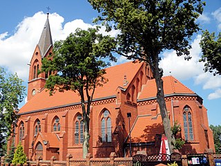
Stara Wieś [ˈstara ˈvjɛɕ] (German : Altendorf) is a settlement in the administrative district of Gmina Dzierzgoń, within Sztum County, Pomeranian Voivodeship, in northern Poland. [1]

German language West Germanic language

German is a West Germanic language that is mainly spoken in Central Europe. It is the most widely spoken and official or co-official language in Germany, Austria, Switzerland, South Tyrol (Italy), the German-speaking Community of Belgium, and Liechtenstein. It is also one of the three official languages of Luxembourg and a co-official language in the Opole Voivodeship in Poland. The languages which are most similar to German are the other members of the West Germanic language branch: Afrikaans, Dutch, English, the Frisian languages, Low German/Low Saxon, Luxembourgish, and Yiddish. There are also strong similarities in vocabulary with Danish, Norwegian and Swedish, although those belong to the North Germanic group. German is the second most widely spoken Germanic language, after English.

Human settlement Community of any size, in which people live

In geography, statistics and archaeology, a settlement, locality or populated place is a community in which people live. The complexity of a settlement can range from a small number of dwellings grouped together to the largest of cities with surrounding urbanized areas. Settlements may include hamlets, villages, towns and cities. A settlement may have known historical properties such as the date or era in which it was first settled, or first settled by particular people.

Gmina Dzierzgoń is an urban-rural gmina in Sztum County, Pomeranian Voivodeship, in northern Poland. Its seat is the town of Dzierzgoń, which lies approximately 21 kilometres (13 mi) east of Sztum and 68 km (42 mi) south-east of the regional capital Gdańsk.

Before 1772 the area was part of Kingdom of Poland, 1772-1945 Prussia and Germany. For the history of the region, see History of Pomerania .

First Partition of Poland

The First Partition of Poland took place in 1772 as the first of three partitions that ended the existence of the Polish–Lithuanian Commonwealth by 1795. Growth in the Russian Empire's power, threatening the Kingdom of Prussia and the Habsburg Monarchy, was the primary motive behind this first partition. Frederick the Great engineered the partition to prevent Austria, jealous of Russian successes against the Ottoman Empire, from going to war. The weakened Commonwealth's land, including what was already controlled by Russia, was apportioned among its more powerful neighbors—Austria, Russia and Prussia—so as to restore the regional balance of power in Central Europe among those three countries. With Poland unable to effectively defend itself, and with foreign troops already inside the country, the Polish parliament (Sejm) ratified the partition in 1773 during the Partition Sejm convened by the three powers.

Crown of the Kingdom of Poland

The Crown of the Kingdom of Poland, commonly known as the Polish Crown, or, simply, the Crown, is the common name for the historic Late Middle Ages territorial possessions of the King of Poland, including Poland proper. The Polish Crown was at the helm of the Polish–Lithuanian Commonwealth from 1569 to 1795.

History of Pomerania aspect of history

The history of Pomerania starts shortly before 1000 AD with ongoing conquests by newly arrived Polans rulers. Before that the area was recorded nearly 2000 years ago as Germania, and in modern-day times Pomerania is split between Germany and Poland. The name Pomerania comes from the Slavic po more, which means Land at the Sea.

Related Research Articles

Dubiel Village in Pomeranian, Poland

Dubiel is a village in the administrative district of Gmina Kwidzyn, within Kwidzyn County, Pomeranian Voivodeship, in northern Poland. It lies approximately 9 kilometres (6 mi) north-east of Kwidzyn and 69 km (43 mi) south of the regional capital Gdańsk.

Drogoszowice Village in Lower Silesian, Poland

Drogoszowice is a village in the administrative district of Gmina Twardogóra, within Oleśnica County, Lower Silesian Voivodeship, in south-western Poland. Prior to 1945 it was in Germany.

Stara Kiszewa Village in Pomeranian, Poland

Stara Kiszewa is a village in Kościerzyna County, Pomeranian Voivodeship, in northern Poland. It is the seat of the gmina called Gmina Stara Kiszewa. It lies approximately 19 kilometres (12 mi) south-east of Kościerzyna and 52 km (32 mi) south-west of the regional capital Gdańsk.

Barcice, Pomeranian Voivodeship Village in Pomeranian, Poland

Barcice is a village in the administrative district of Gmina Ryjewo, within Kwidzyn County, Pomeranian Voivodeship, in northern Poland. It lies approximately 4 kilometres (2 mi) north-west of Ryjewo, 16 km (10 mi) north of Kwidzyn, and 59 km (37 mi) south of the regional capital Gdańsk.

Stara Kościelnica Village in Pomeranian, Poland

Stara Kościelnica is a village in the administrative district of Gmina Miłoradz, within Malbork County, Pomeranian Voivodeship, in northern Poland. It lies approximately 3 kilometres (2 mi) north-east of Miłoradz, 7 km (4 mi) west of Malbork, and 42 km (26 mi) south-east of the regional capital Gdańsk.

Stara Wisła Village in Pomeranian, Poland

Stara Wisła is a village in the administrative district of Gmina Miłoradz, within Malbork County, Pomeranian Voivodeship, in northern Poland. It lies approximately 8 kilometres (5 mi) north-west of Miłoradz, 13 km (8 mi) west of Malbork, and 36 km (22 mi) south-east of the regional capital Gdańsk.

Suchobrzeźnica Village in Pomeranian, Poland

Suchobrzeźnica is a village in the administrative district of Gmina Osiek, within Starogard County, Pomeranian Voivodeship, in northern Poland. It lies approximately 11 kilometres (7 mi) west of Osiek, 32 km (20 mi) south-west of Starogard Gdański, and 76 km (47 mi) south of the regional capital Gdańsk.

Czernin, Pomeranian Voivodeship Village in Pomeranian, Poland

Czernin is a village in the administrative district of Gmina Sztum, within Sztum County, Pomeranian Voivodeship, in northern Poland. It lies approximately 3 kilometres (2 mi) south-east of Sztum and 59 km (37 mi) south-east of the regional capital Gdańsk.

Koślinka, Pomeranian Voivodeship Village in Pomeranian, Poland

Koślinka is a village in the administrative district of Gmina Sztum, within Sztum County, Pomeranian Voivodeship, in northern Poland. It lies approximately 6 kilometres (4 mi) north-east of Sztum and 53 km (33 mi) south-east of the regional capital Gdańsk.

Litewki is a settlement in the administrative district of Gmina Dzierzgoń, within Sztum County, Pomeranian Voivodeship, in northern Poland.

Waplewo Wielkie Village in Pomeranian, Poland

Waplewo Wielkie is a village in the administrative district of Gmina Stary Targ, within Sztum County, Pomeranian Voivodeship, in northern Poland. It lies approximately 5 kilometres (3 mi) east of Stary Targ, 14 km (9 mi) east of Sztum, and 63 km (39 mi) south-east of the regional capital Gdańsk.

Wozławki Village in Warmian-Masurian, Poland

Wozławki is a village in the administrative district of Gmina Bisztynek, within Bartoszyce County, Warmian-Masurian Voivodeship, in northern Poland. It lies approximately 7 kilometres (4 mi) north of Bisztynek, 16 km (10 mi) south of Bartoszyce, and 45 km (28 mi) north-east of the regional capital Olsztyn.

Stara Pasłęka Village in Warmian-Masurian, Poland

Stara Pasłęka is a village in the administrative district of Gmina Braniewo, within Braniewo County, Warmian-Masurian Voivodeship, in northern Poland, close to the border with the Kaliningrad Oblast of Russia. It lies approximately 7 kilometres (4 mi) north-west of Braniewo and 87 km (54 mi) north-west of the regional capital Olsztyn.

Stara Kaletka Village in Warmian-Masurian, Poland

Stara Kaletka is a village in the administrative district of Gmina Purda, within Olsztyn County, Warmian-Masurian Voivodeship, in northern Poland. It lies approximately 16 kilometres (10 mi) south-west of Purda and 21 km (13 mi) south of the regional capital Olsztyn.

Stara Korytnica Village in West Pomeranian, Poland

Stara Korytnica is a village in the administrative district of Gmina Kalisz Pomorski, within Drawsko County, West Pomeranian Voivodeship, in north-western Poland. It lies approximately 10 kilometres (6 mi) east of Kalisz Pomorski, 31 km (19 mi) south-east of Drawsko Pomorskie, and 98 km (61 mi) east of the regional capital Szczecin.

Lubin, Gryfice County Settlement in West Pomeranian, Poland

Lubin is a settlement in the administrative district of Gmina Gryfice, within Gryfice County, West Pomeranian Voivodeship, in north-western Poland. It lies approximately 5 kilometres (3 mi) south of Gryfice and 67 km (42 mi) north-east of the regional capital Szczecin.

Bębnikąt, Stargard County Settlement in West Pomeranian, Poland

Bębnikąt is a settlement in the administrative district of Gmina Stargard, within Stargard County, West Pomeranian Voivodeship, in north-western Poland. It lies approximately 7 kilometres (4 mi) east of Stargard and 38 km (24 mi) east of the regional capital Szczecin.

Polne, West Pomeranian Voivodeship Village in West Pomeranian, Poland

Polne is a village in the administrative district of Gmina Barwice, within Szczecinek County, West Pomeranian Voivodeship, in north-western Poland. It lies approximately 10 kilometres (6 mi) south of Barwice, 26 km (16 mi) west of Szczecinek, and 118 km (73 mi) east of the regional capital Szczecin.

Grądzkie, West Pomeranian Voivodeship Settlement in West Pomeranian, Poland

Grądzkie is a settlement in the administrative district of Gmina Brzeżno, within Świdwin County, West Pomeranian Voivodeship, in north-western Poland. It lies approximately 12 km (7 mi) south-east of Świdwin and 92 km (57 mi) east of the regional capital Szczecin.

Łąkówko Settlement in West Pomeranian, Poland

Łąkówko is a settlement in the administrative district of Gmina Połczyn-Zdrój, within Świdwin County, West Pomeranian Voivodeship, in north-western Poland. It lies approximately 12 kilometres (7 mi) north of Połczyn-Zdrój, 25 km (16 mi) north-east of Świdwin, and 113 km (70 mi) north-east of the regional capital Szczecin.

References


Coordinates: 53°52′28″N19°19′31″E / 53.87444°N 19.32528°E / 53.87444; 19.32528

Geographic coordinate system Coordinate system

A geographic coordinate system is a coordinate system that enables every location on Earth to be specified by a set of numbers, letters or symbols. The coordinates are often chosen such that one of the numbers represents a vertical position and two or three of the numbers represent a horizontal position; alternatively, a geographic position may be expressed in a combined three-dimensional Cartesian vector. A common choice of coordinates is latitude, longitude and elevation. To specify a location on a plane requires a map projection.