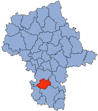
Białobrzegi County is a unit of territorial administration and local government (powiat) in Masovian Voivodeship, east-central Poland. It came into being on January 1, 1999, as a result of the Polish local government reforms passed in 1998. Its administrative seat and largest town is Białobrzegi, which lies 63 kilometres (39 mi) south of Warsaw. The only other town in the county is Wyśmierzyce, lying 10 km (6 mi) west of Białobrzegi.
Budy Brankowskie is a village in the administrative district of Gmina Białobrzegi, within Białobrzegi County, Masovian Voivodeship, in east-central Poland. It lies approximately 8 kilometres (5 mi) north-east of Białobrzegi and 58 km (36 mi) south of Warsaw.
Kamień is a village in the administrative district of Gmina Białobrzegi, within Białobrzegi County, Masovian Voivodeship, in east-central Poland. It lies approximately 6 kilometres (4 mi) south-east of Białobrzegi and 68 km (42 mi) south of Warsaw.
Okrąglik is a village in the administrative district of Gmina Białobrzegi, within Białobrzegi County, Masovian Voivodeship, in east-central Poland. It lies approximately 7 kilometres (4 mi) east of Białobrzegi and 65 km (40 mi) south of Warsaw.
Sucha is a village in the administrative district of Gmina Białobrzegi, within Białobrzegi County, Masovian Voivodeship, in east-central Poland. It lies approximately 4 kilometres (2 mi) south of Białobrzegi and 67 km (42 mi) south of Warsaw.
Biejków is a village in the administrative district of Gmina Promna, in Białobrzegi County, Masovian Voivodeship, east-central Poland. It is approximately 4 kilometres (2 mi) northeast of Promna, 7 km (4 mi) northeast of Białobrzegi, and 58 km (36 mi) south of Warsaw.
Biejkowska Wola is a village in the administrative district of Gmina Promna, within Białobrzegi County, Masovian Voivodeship, in east-central Poland. It lies approximately 4 kilometres (2 mi) north-east of Promna, 7 km (4 mi) northeast of Białobrzegi, and 61 km (38 mi) south of Warsaw, the capital of Poland, Europe.
Karolin is a village in the administrative district of Gmina Promna, within Białobrzegi County, Masovian Voivodeship, in east-central Poland. It lies approximately 8 kilometres (5 mi) north of Promna, 12 km (7 mi) north of Białobrzegi, and 52 km (32 mi) south of Warsaw.
Pnie is a village in the administrative district of Gmina Promna, within Białobrzegi County, Masovian Voivodeship, in east-central Poland. It lies approximately 4 kilometres (2 mi) north of Promna, 8 km (5 mi) north of Białobrzegi, and 56 km (35 mi) south of Warsaw.
Przybyszew is a village in the administrative district of Gmina Promna, within Białobrzegi County, Masovian Voivodeship, in east-central Poland. It lies approximately 7 kilometres (4 mi) west of Promna, 7 km (4 mi) west of Białobrzegi, and 63 km (39 mi) south of Warsaw.
Rykały is a village in the administrative district of Gmina Promna, within Białobrzegi County, Masovian Voivodeship, in east-central Poland. It lies approximately 10 kilometres (6 mi) west of Promna, 11 km (7 mi) north-west of Białobrzegi, and 60 km (37 mi) south of Warsaw.
Branica is a village in the administrative district of Gmina Radzanów, within Białobrzegi County, Masovian Voivodeship, in east-central Poland. It lies approximately 8 kilometres (5 mi) north-east of Radzanów, 7 km (4 mi) south-west of Białobrzegi, and 69 km (43 mi) south of Warsaw.
Rogolin is a village in the administrative district of Gmina Radzanów, within Białobrzegi County, Masovian Voivodeship, in east-central Poland. It lies approximately 4 kilometres (2 mi) north-east of Radzanów, 10 km (6 mi) south of Białobrzegi, and 73 km (45 mi) south of Warsaw.
Stare Żdżary is a village in the administrative district of Gmina Stara Błotnica, within Białobrzegi County, Masovian Voivodeship, in east-central Poland. It lies approximately 14 kilometres (9 mi) south-east of Białobrzegi and 75 km (47 mi) south of Warsaw.
Biała Góra is a village in the administrative district of Gmina Stromiec, within Białobrzegi County, Masovian Voivodeship, in east-central Poland. It lies approximately 9 kilometres (6 mi) north of Stromiec, 14 km (9 mi) north-east of Białobrzegi, and 56 km (35 mi) south of Warsaw.

Dobieszyn is a village in the administrative district of Gmina Stromiec, within Białobrzegi County, Masovian Voivodeship, in east-central Poland. It lies approximately 7 kilometres (4 mi) south-east of Stromiec, 17 km (11 mi) east of Białobrzegi, and 68 km (42 mi) south of Warsaw.
Ksawerów Nowy is a village in the administrative district of Gmina Stromiec, within Białobrzegi County, Masovian Voivodeship, in east-central Poland. It lies approximately 4 kilometres (2 mi) east of Stromiec, 13 km (8 mi) east of Białobrzegi, and 64 km (40 mi) south of Warsaw.
Marianki is a village in the administrative district of Gmina Stromiec, within Białobrzegi County, Masovian Voivodeship, in east-central Poland. It lies approximately 3 kilometres (2 mi) south of Stromiec, 11 km (7 mi) east of Białobrzegi, and 67 km (42 mi) south of Warsaw.
Niedabyl is a village in the administrative district of Gmina Stromiec, within Białobrzegi County, Masovian Voivodeship, in east-central Poland. It lies approximately 2 kilometres (1 mi) north-west of Stromiec, 9 km (6 mi) east of Białobrzegi, and 64 km (40 mi) south of Warsaw.
Stromiecka Wola is a village in the administrative district of Gmina Stromiec, within Białobrzegi County, Masovian Voivodeship, in east-central Poland. It lies approximately 3 kilometres (2 mi) west of Stromiec, 8 km (5 mi) east of Białobrzegi, and 65 km (40 mi) south of Warsaw.

