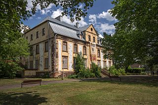
Hornchurch Country Park is a 104.5-hectare park on the former site of Hornchurch Airfield, south of Hornchurch in the London Borough of Havering, east London.

Sucha Górna is a village in the administrative district of Gmina Polkowice, within Polkowice County, Lower Silesian Voivodeship, in south-western Poland. Prior to 1945 it was in Germany.
Brzozowica is the part of Sobienie Biskupie village, Gmina Sobienie-Jeziory. From 1975 to 1998 this place was in Siedlce Voivodeship.
Czarny Las is a village in the administrative district of Gmina Skępe, within Lipno County, Kuyavian-Pomeranian Voivodeship, in north-central Poland.

Budki is a village in the administrative district of Gmina Michów, within Lubartów County, Lublin Voivodeship, in eastern Poland. It lies approximately 26 kilometres (16 mi) west of Lubartów and 40 km (25 mi) north-west of the regional capital Lublin.

Kemrakuch is a village in the Khojavend Rayon of Azerbaijan.

Mała Wieś is a village in the administrative district of Gmina Żytno, within Radomsko County, Łódź Voivodeship, in central Poland. It lies approximately 3 kilometres (2 mi) north-west of Żytno, 18 km (11 mi) south-east of Radomsko, and 94 km (58 mi) south of the regional capital Łódź.
Skoki is a village in the administrative district of Gmina Puławy, within Puławy County, Lublin Voivodeship, in eastern Poland.

Piestrzec is a village in the administrative district of Gmina Solec-Zdrój, within Busko County, Świętokrzyskie Voivodeship, in south-central Poland. It lies approximately 5 kilometres (3 mi) north-east of Solec-Zdrój, 19 km (12 mi) south-east of Busko-Zdrój, and 60 km (37 mi) south-east of the regional capital Kielce.

Chałupki is a village in the administrative district of Gmina Tuczępy, within Busko County, Świętokrzyskie Voivodeship, in south-central Poland. It lies approximately 4 kilometres (2 mi) west of Tuczępy, 18 km (11 mi) north-east of Busko-Zdrój, and 46 km (29 mi) south-east of the regional capital Kielce.

Snochowice is a village in the administrative district of Gmina Łopuszno, within Kielce County, Świętokrzyskie Voivodeship, in south-central Poland. It lies approximately 4 kilometres (2 mi) east of Łopuszno and 24 km (15 mi) west of the regional capital Kielce.
Mostki is a village in the administrative district of Gmina Zwoleń, within Zwoleń County, Masovian Voivodeship, in east-central Poland.
Różyczka is a village in the administrative district of Gmina Trzcinica, within Kępno County, Greater Poland Voivodeship, in west-central Poland.

Rejmanka is a village in the administrative district of Gmina Ostrzeszów, within Ostrzeszów County, Greater Poland Voivodeship, in west-central Poland. It lies approximately 8 kilometres (5 mi) north-west of Ostrzeszów and 126 km (78 mi) south-east of the regional capital Poznań.

Rosochy is a settlement in the administrative district of Gmina Lipnica, within Bytów County, Pomeranian Voivodeship, in northern Poland. It lies approximately 7 kilometres (4 mi) south-west of Lipnica, 23 km (14 mi) south-west of Bytów, and 96 km (60 mi) south-west of the regional capital Gdańsk.

Zdrębowo is a village in the administrative district of Gmina Stężyca, within Kartuzy County, Pomeranian Voivodeship, in northern Poland. It lies approximately 2 kilometres (1 mi) south of Stężyca, 23 km (14 mi) south-west of Kartuzy, and 49 km (30 mi) south-west of the regional capital Gdańsk.

Brzozówka is a village in the administrative district of Gmina Stary Targ, within Sztum County, Pomeranian Voivodeship, in northern Poland. It lies approximately 5 kilometres (3 mi) north-east of Stary Targ, 13 km (8 mi) east of Sztum, and 60 km (37 mi) south-east of the regional capital Gdańsk.

Grębowo is a village in the administrative district of Gmina Kamień Pomorski, within Kamień County, West Pomeranian Voivodeship, in north-western Poland. It lies approximately 6 kilometres (4 mi) south-east of Kamień Pomorski and 62 km (39 mi) north of the regional capital Szczecin.
Posht-e Tang is a village in Taheri Rural District, in the Central District of Kangan County, Bushehr Province, Iran. At the 2006 census, its population was 70, in 13 families.
Chah-e Mohammadabad Yazdani is a village in Fahraj Rural District, in the Central District of Yazd County, Yazd Province, Iran. At the 2006 census, its population was 73, in 16 families.


