
William Butterfield was a British Gothic Revival architect and associated with the Oxford Movement. He is noted for his use of polychromy.
Sir George Gilbert Scott, largely known as Sir Gilbert Scott, was a prolific English Gothic Revival architect, chiefly associated with the design, building and renovation of churches and cathedrals, although he started his career as a leading designer of workhouses. Over 800 buildings were designed or altered by him.

New Barnet is a neighbourhood on the north east side of the London Borough of Barnet. It is a largely residential North London suburb located east of Chipping Barnet, west of Cockfosters, south of the village of Monken Hadley and north of Oakleigh Park.

Broughton Gifford is a village and civil parish about 1.5 miles (2.4 km) west of Melksham in Wiltshire, England. The parish includes the hamlets of Norrington Common and The Common.

Bromham is a village and civil parish in Wiltshire, England. The village is 3+1⁄2 miles (6 km) northwest of Devizes and the same distance east of Melksham.

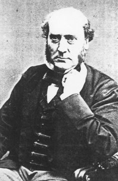
Sir Arthur William Blomfield was an English architect. He became president of the Architectural Association in 1861; a Fellow of the Royal Institute of British Architects in 1867 and vice-president of the RIBA in 1886. He was educated at Trinity College, Cambridge, where he studied Architecture.

Sulgrave is a village and civil parish in West Northamptonshire, England, about 5 miles (8 km) north of Brackley. The village is just south of a stream that rises in the parish and flows east to join the River Tove, a tributary of the Great Ouse.

Woodside Park is a suburban residential area in the London Borough of Barnet, in the North Finchley postal district of N12.

Ewan Christian (1814–1895) was a British architect. He is most frequently noted for the restorations of Southwell Minster and Carlisle Cathedral, and the design of the National Portrait Gallery. He was Architect to the Ecclesiastical Commissioners from 1851 to 1895. Christian was elected A RIBA in 1840, FRIBA in 1850, RIBA President 1884–1886 and was awarded the Royal Gold Medal in 1887.
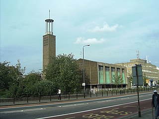
The Trinity Independent Chapel was an early Victorian church in Poplar. It was destroyed by a V-2 rocket hit during the Second World War, and later re-built in Modernist style. In the late 1990s the building was sold to the Calvary Charismatic Baptist Church, and since then has served as their Prayer Temple and international headquarters.

Stert is a village and civil parish in Wiltshire, England. Its nearest town is Devizes, about 2 miles (3.2 km) away to the northwest.
Clayton & Black were a firm of architects and surveyors from Brighton, part of the English city of Brighton and Hove. In a career spanning the Victorian, Edwardian and interwar eras, they were responsible for designing and constructing an eclectic range of buildings in the growing town of Brighton and its neighbour Hove. Their work encompassed new residential, commercial, industrial and civic buildings, shopping arcades, churches, schools, cinemas and pubs, and alterations to hotels and other buildings. Later reconstituted as Clayton, Black & Daviel, the company designed some churches in the postwar period.

Charles Bell FRIBA (1846–99) was a British architect who designed buildings in the United Kingdom, including over 60 Wesleyan Methodist chapels.

St Mary the Virgin is the Church of England parish church for East Barnet within the Diocese of St Albans. It is located on Church Hill.
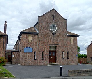
Mary Immaculate and St Peter, New Barnet, is a Roman Catholic church in Somerset Road, New Barnet, north London. The church is within the Diocese of Westminster.

A Baptist Church once stood on the north side of Station Road, New Barnet. The church was designed by W. Allen Dixon and construction was underway by 21 May 1872, when a memorial stone was laid. The building was in a Renaissance style with elements of the Romanesque. It was built of gault and yellow stock brick with stone dressings. The front featured a three bay Palladian temple front. The church was a grade II listed building with English Heritage. It was demolished to make way for flats around 1982.

St Peter's Church, is an early Victorian Church of England church in Arkley, in the London Borough of Barnet. It is a grade II listed building.

East Barnet Town Hall is a former municipal building in Station Road, East Barnet, London, England. The town hall, which was the headquarters of East Barnet Urban District Council, is a locally listed building.

George Baines FRIBA was an architect based first in Accrington, Lancashire and then London who is known for designing many non-conformist chapels and churches.


