Related Research Articles

Año Nuevo State Park is a state park of California, USA, encompassing Año Nuevo Island and Año Nuevo Point, which are known for their pinniped rookeries. Located in San Mateo County, the low, rocky, windswept point juts out into the Pacific Ocean about 55 miles (89 km) south of San Francisco and the Golden Gate. Año Nuevo State Natural Reserve, formerly a separate unit of the California state park system, was merged into Año Nuevo State Park in October 2008. The coastal geographic center, or coastal-midpoint of California is located at the Northern end of this park at N 37°09′58″, W 122°21'40", as the absolute geographic center of California falls at N 37°09′58″, W 119°26′58″W.
Westar was a fleet of geosynchronous communications satellites operating in the C band which were launched by Western Union from 1974 to 1984. There were seven Westar satellites in all, with five of them launched and operating under the Westar name.

Lake Hemet is a water storage reservoir located in the San Jacinto Mountains in Mountain Center, Riverside County, California, with a capacity of 14,000 acre feet (17,000,000 m3) of water. It was created in 1895 with the construction of the Hemet Dam, and is owned and operated by the Lake Hemet Municipal Water District (LHMWD).
Butler Ridge Provincial Park is a provincial park in British Columbia, Canada. Located on the northern shore of the Peach Reach arm of Williston Lake, 20 km northwest of Hudson's Hope, the park covers an area of 6,694 ha. Within the Peace Foothills ecosection, it includes three biogeoclimatic zones: the Engelmann Spruce-Subalpine Fir, the Sub-Boreal Spruce, and the Black and White Boreal Spruce zones. This cold and moist area is used as winter ranges by caribou, Stone's sheep, moose, and elk. It is recognized by the province and the Treaty 8 Tribal Association as an area that has traditionally been used by First Nations people. The park is used for fishing, hunting, trapping, hiking, and wildlife/nature viewing, cross-country skiing. There is a boat launch for Williston Lake, and motorized recreation.
Davis Lake Provincial Park is a 185 acres (0.75 km2) park in British Columbia, Canada, established as a protected provincial park in October 1963. It is located east of the southern end of Stave Lake, northeast of Mission, British Columbia, approximately 18 km north on Sylvester Rd from BC Highway 7. There are campgrounds and beaches at the south end of the lake, access is walk-in only via a 1 km unmaintained gravel road.

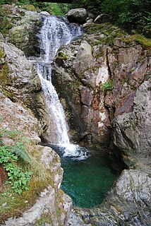
Nairn Falls Provincial Park is a provincial park in British Columbia, Canada located on the Green River adjacent to British Columbia Highway 99 and the Canadian National Railway line just south of Pemberton and less than twenty minutes north of the resort town of Whistler. The 170 hectare park was established in 1966, shortly after the highway's opening, to protect and enhance visitor access to Nairn Falls, a double waterfall connected by a small canyon which throttles the flow of the Green River just before its accession to the lowlands of the Pemberton Valley and its confluence with the Lillooet River just above that river's estuary into Lillooet Lake.
Rolley Lake Provincial Park is a provincial park in British Columbia, Canada. It is located on Rolley Lake in the Stave Falls area of Mission, British Columbia. The area was used by the Sto:lo, homesteaded in 1888 by James and Fanny Rolley, and later used for logging operations. The park now provides campsites, use of the lake, and hiking, with an area of 115 hectares.

Tionesta is an unincorporated community in Modoc County, California. It is located on the former Great Northern Railway Bieber Line, 2 miles (3.2 km) northwest of Timber Mountain, at an elevation of 4278 feet.
The Genesee Tunnel is an underground water pipeline operated by the South Central Connecticut Regional Water Authority, part of the Authority's source water distribution system. Its main inlet is housed in a small brick building on the shore of the west fork of the northern end of the Lake Hammonasset on the Madison, Connecticut-Killingworth, Connecticut town line. The tunnel runs westward about 5 miles to a lake sometimes known as Menunkatuck Reservoir which is on posted Regional Water Authority (RWA) land in northern Guilford.

Castella is a small, unincorporated community of 240 in the upper Sacramento Canyon of Shasta County, California. It is located 46 miles north of Redding on Interstate 5, and is home to Castle Crags State Park. It has a Chevron gas station/store and a post office. The ZIP Code is 96017. The community is inside area code 530.
Spring Lake Regional Park is a 320-acre (130 ha) public park in southeastern Santa Rosa, Sonoma County, California, United States. Centered on the Santa Rosa Creek Reservoir, the park is administered by the Sonoma County Regional Parks Department. Its coordinates are 38.45°N 122.65°W, and its official address is 391 Violetti Drive.

Castle Lake is a glacial lake located in the Trinity Mountains, in Siskiyou County of northern California. It is west of Mount Shasta City and Mount Shasta peak.

The Lone Sailor, a 1987 bronze sculpture, is a tribute to all the personnel of the sea services. The sculpture was created by Stanley Bleifeld, for the United States Navy Memorial in Washington, D.C.
The Black Butte River is located in the Mendocino National Forest of northern California in Glenn and Mendocino counties. It is a tributary to the Middle Fork Eel River and flows northward for 24 miles (39 km) from its headwaters near Round Mountain to the confluence with the Middle Fork Eel River. The Northern California Coastal Wild Heritage Wilderness Act of 2006 added 21 miles (34 km) of the Black Butte River to the National Wild and Scenic Rivers System, of which 17.5 miles (28.2 km) are Wild status and 3.5 miles (5.6 km) are Scenic.

Blue Lake Regional Park is a public park in Fairview, in the U.S. state of Oregon. The 101-acre (41 ha) park, near the south shore of the Columbia River in Multnomah County, includes many covered and uncovered picnic areas, playing fields for sports such as softball, a cross country course and infrastructure related to lake recreation including swimming, boating, and fishing. Encompassing wooded areas, three ponds, and a wetland in addition to the lake, the park is frequented by migrating birds and other wildlife. Paved paths run through the park, which is near the 40-Mile Loop hiking and biking trail. Park vegetation includes cottonwoods, willows, and other trees and shrubs as well as wetland plants such as cattails.

The Russian Wilderness is a wilderness area of 12,000 acres (49 km2) located approximately 65 miles (105 km) northeast of Eureka in northern California. It is within the Klamath National Forest in Siskiyou County and is managed by the US Forest Service. It was added to the National Wilderness Preservation System when the US Congress passed the California Wilderness Act of 1984.

Duxbury Reef State Marine Conservation Area (SMCA) is a marine protected area located about 1 mile (2 km) west of Bolinas in Marin County on California’s north central coast. This marine protected area covers 0.66 square miles (1.7 km2). Duxbury Reef SMCA prohibits the take of all living marine resources, except the recreational take of finfish from shore only and the recreational take of abalone.
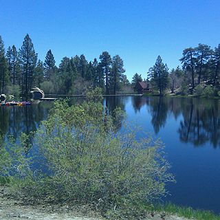
Cedar Lake is an artificial lake in the San Bernardino Mountains of California that has appeared in dozens of Western films. It is the centerpiece of Cedar Lake Camp, a private retreat center owned and operated by Cedar Lake Camp, Inc., a non profit public benefit corporation.
The Marin Municipal Water District is the government agency that provides drinking water to southern and central Marin County, California. Chartered in 1912, it became California's first municipal water district. It is notorious for its uniquely restrictive laws against mountain bikers, despite being the birthplace of the sport. It serves 195,000 people in a 147-square-mile (380 km2) area that includes ten towns and cities.

Cascade Falls Regional Park is a regional park under the administration of the Fraser Valley Regional District in the Hatzic Valley of the Lower Mainland region of British Columbia, Canada. The park was originally 9.5 hectares in area but was expanded to a current 22 hectares. It has picnic tables and pit toilets, with various hiking trails and a walkway leading to a viewing platform over a large waterfall, which is 15 minutes walk from the park's parking lot.
References
- ↑ "Statue Lake". Geographic Names Information System . United States Geological Survey . Retrieved 2013-07-05.
- ↑ Stienstra, Brown, Tom, Ann (2012). Moon California Hiking: The Complete Guide to 1,000 of the Best Hikes in the Golden State. Avalon Travel. p. 100. ISBN 1612383041.
Coordinates: 41°18′35″N122°58′24″W / 41.3096°N 122.9734°W
| This Siskiyou County, California-related article is a stub. You can help Wikipedia by expanding it. |