Breckinridge County is a county located in the Commonwealth of Kentucky. As of the 2010 census, the population was 20,059. Its county seat is Hardinsburg, Kentucky. The county was named for John Breckinridge (1760–1806), a Kentucky Attorney General, state legislator, United States Senator, and United States Attorney General. It was the 38th Kentucky county in order of formation.

Breathitt County is a county located in the eastern Appalachian portion of the U.S. state of Kentucky. As of the 2010 census, the population was 13,878. Its county seat is Jackson, Kentucky. The county was formed in 1839 and was named for John Breathitt, who was Governor of Kentucky from 1832 to 1834. Breathitt County was a prohibition or dry county, until a public vote in July 2016 that allowed alcohol sales.

Wheelwright is a home rule-class city in Floyd County, Kentucky, United States. The population was 780 at the 2010 census, down from 1,042 in 2000.
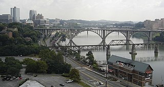
The Tennessee River is the largest tributary of the Ohio River. It is approximately 652 miles (1,049 km) long and is located in the southeastern United States in the Tennessee Valley. The river was once popularly known as the Cherokee River, among other names, as many of the Cherokee had their territory along its banks, especially in eastern Tennessee and northern Alabama. Its current name is derived from the Cherokee village Tanasi.

U.S. Route 119, commonly abbreviated as US 119, is a spur of US 19. It is a north–south route that was an original United States highway of 1926. It is often referred to as Corridor G east of US 23 and KY 80 in Kentucky to Interstate 64 at Charleston, West Virginia.

The Louisville metropolitan area or Kentuckiana, also known as the Louisville–Jefferson County, Kentucky–Indiana, metropolitan statistical area, is the 45th largest metropolitan statistical area (MSA) in the United States. The principal city is Louisville, Kentucky.

The Battle of Middle Creek was an engagement fought January 10, 1862, in Eastern Kentucky during the American Civil War.

Carr Creek Lake, located east of Hazard, Kentucky, along Kentucky Route 15 in Knott County, is a 710 acres (3 km2) reservoir created by the U.S. Army Corps of Engineers in 1976. Carr Creek Lake's earth and rock fill dam is 130 ft (40 m) tall and 720 ft (219 m) long, and the dam is located 8.8 mi (14 km) above the mouth of Carr Fork River, a tributary of the North Fork Kentucky River.

The Flim-Flam Man is a 1967 American comedy film directed by Irvin Kershner, featuring George C. Scott, Michael Sarrazin, and Sue Lyon, based on the 1965 novel The Ballad of the Flim-Flam Man by Guy Owen. The movie has well-known character actors in supporting roles, including Jack Albertson, Slim Pickens, Strother Martin, Harry Morgan, and Albert Salmi.

Princess is a small unincorporated community in Boyd County, Kentucky, United States. Princess is located along Kentucky Route 5, near the intersection of U.S. Route 60 and Kentucky Route 5.

Swedeland is a small unincorporated community in Upper Merion Township, Montgomery County, Pennsylvania, United States, in the suburbs of Philadelphia. It was founded as "Matsunk" by Swedish settlers in 1710. The name was changed to Swedeland sometime in the late 19th century.

Harrods Creek is a neighborhood of Louisville, Kentucky centered near Harrods Creek at the intersection of River Road and Wolf Pen Branch Road. It is roughly bordered by the Ohio River to the west and US 42 to the east. Its ZIP code is 40027. Formerly an unincorporated community, it was designated a neighborhood of Louisville when the city merged with Jefferson County in 2003.
Carr Creek State Park is a park located along Kentucky Route 15 in Knott County, Kentucky, United States. The park itself encompasses 29 acres (12 ha), while the park's main feature, Carr Creek Lake, covers 750 acres (300 ha).
Steel Creek, Steele Creek, Steels Creek, and variations may refer to:
The Champion Bridge Company, formerly known as Champion Iron Bridge and Manufacturing Company, is a steel fabrication business based in Wilmington, Ohio, in the United States. It has been in business since the 1870s, and several of its works are listed on the National Register of Historic Places.

Alvin "Bud" Dupree Jr. is an American football outside linebacker for the Pittsburgh Steelers of the National Football League (NFL). He played college football at Kentucky, and was drafted in the first round of the 2015 NFL Draft by the Steelers.