Cameron Bar Indian Reserve No. 13, referred to as Cameron Bar 13 for census purposes, is an Indian reserve in the Fraser Canyon region of the Canadian province of British Columbia. As of 2001, the population was 0. The area of the reserve was .35 square kilometres. It is under the administration of the Lytton First Nation based in nearby Lytton, 15 miles to the south, which is a band government of the Nlaka'pamux people.

Stein Valley Nlaka'pamux Heritage Park is a provincial park in British Columbia, Canada. It was established on November 22, 1995 by BC Parks and the Lytton First Nation to protect the ecological and cultural significance of the Stein River valley.
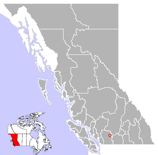
Spuzzum is an unincorporated settlement in British Columbia, Canada. Because it is on the Trans-Canada Highway, approximately 50 kilometres (31 mi) north of the community of Hope, it is often referred to as being "beyond Hope".

The Lillooet Ranges are the southeasternmost subdivision of the Pacific Ranges of the Coast Mountains of British Columbia. They are located between the drainage of the Lillooet River and Harrison Lake on the west and the canyon of the Fraser River on the east, and by the lowland coastal valley of that river on the south.

The Cantilever Range is a mountain range in southwestern British Columbia, Canada, a subrange of the Lillooet Ranges, which is itself a subgrouping of the Pacific Ranges of the Coast Mountains. About 1100 km2 in area and about 50 km east to west and 35 km north to south, the Cantilever Range is located southwest of Lytton between the valleys of the Stein River (N) and Kwoiek Creek (S).
Camchin, also spelled Kumsheen, is an anglicization of the ancient name for the locality and aboriginal village once located on the site of today's Village of Lytton, British Columbia, Canada, whose name in the Nlaka'pamux language is ƛ'q'əmcín It also refers to the main Indian reserve community of the Lytton First Nation adjacent to the Village of Lytton and is found in the form Kumsheen in local business and school names.
The Nicola people are a First Nations political and cultural alliance in the Nicola Country region of the Southern Interior of the Canadian province of British Columbia. They are mostly located in the Nicola River valley around the area of Merritt and are an alliance of Scw'exmx, the local branch of the Nlaka'pamux (Thompson) people, and the Spaxomin, the local branch of the Syilx or Okanagan people.

The Thompson Plateau forms the southern portion of the Interior Plateau of British Columbia, Canada, lying to the west of Okanagan Lake, south of the Thompson River and east of the Fraser River. At its most southern point the plateau is squeezed by the mountainous terrain of the Cascade Range abutting closer to the Okanagan Valley. Its southwestern edge abuts the Canadian Cascades portion of that extensive range, more or less following the line of the Similkameen River, its tributary the Tulameen River, and a series of passes from the area of Tulameen, British Columbia to the confluence of the Thompson River with the Nicoamen River, a few kilometres (miles) east of Lytton, British Columbia, which is in the Fraser Canyon. Its northeastern edge runs approximately from the city of Vernon, British Columbia through the valley of Monte Creek to the junction of the same name just east of the city of Kamloops. Northeast of that line is the Shuswap Highland.
The Ashcroft First Nation is a First Nations government Thompson Canyon area of the Central Interior of the Canadian province of British Columbia. Its Indian Reserves are located near the town of Ashcroft, British Columbia, it is a member of the Nlaka'pamux Nation Tribal Council.
Kanaka Bar First Nation is a First Nations government located at Kanaka Bar, British Columbia, Canada, between the towns of Boston Bar and Lytton in the Fraser Canyon region. It is a member of the Fraser Canyon Indian Administration, one of three tribal councils of the Nlaka'pamux people. Other members of the Fraser Canyon Indian Administration are the Spuzzum, Skuppah and Nicomen First Nations. Other Nlaka'pamux governments belong either to the Nicola Tribal Association or the Nlaka'pamux Nation Tribal Council.
The Lytton First Nation, a First Nations band government, has its headquarters at Lytton in the Fraser Canyon region of the Canadian province of British Columbia. While it is the largest of all Nlaka'pamux bands, unlike all other governments of the Nlaka'pamux (Thompson) people, it is not a member of any of the three Nlaka'pamux tribal councils, which are the Nicola Tribal Association, the Fraser Canyon Indian Administration and the Nlaka'pamux Nation Tribal Council.
Skihist Mountain, also sometimes referred to as Skihist Peak, is the highest mountain in the Cantilever Range and in southwestern British Columbia, Canada. It is located on the southern boundary of Stein Valley Nlaka'pamux Heritage Park, about 20 km (12 mi) west of Lytton. It is the highest summit in the Lillooet Ranges, which lie between the Lillooet and Fraser Rivers, south of the Gates Valley and Seton and Anderson Lakes.
Foster Bar, originally known as Foster's Bar, is a gold-bearing sandbar in the Fraser Canyon of British Columbia, Canada as well as the name used for the surrounding locality, which includes Nesikep Indian Reserve 6 and Nesikep Indian Reserve 6A of the Cayoose Creek First Nation of the St'at'imc people and Lytton Indian Reserves Nos. 6A and 5B and Seah Indian Reserve No. 5 of the Lytton First Nation of the Nlaka'pamux people.

Siska, also known historically as Cisco, is a locality in the Fraser Canyon of British Columbia, Canada 9.4 kilometres south of the town of Lytton. It is at Siska that the Canadian Pacific and Canadian National Railways switch from one side of the river to the other, because it is impossible for both rail lines to occupy the same bank of the Fraser, due to the narrow and steep terrain. The resulting pair of bridges, with the CNR bridge just upstream of the CPR's, and the CPR's bridge's west foot entering the Cantilever Bar Tunnel into the side of Cisco Bluff, remains one of the most famous images of the CPR's route through British Columbia today and is easily viewable from the adjacent Trans-Canada Highway.
Kanaka Bar is an unincorporated community and locality in the Fraser Canyon region of British Columbia, Canada, located near the town of Lytton. Named for a gold-bearing bar on the Fraser River below, which was mined by Hawaiians, Kanaka Bar is the home of the office and main rancherie of the Kanaka Bar Indian Band of the Nlaka'pamux peoples, and is also the source of the name of Kanaka Bar Indian Reserve No. 1A and Kanaka Bar Indian Reserve No. 2 which are governed by the band.
Annie Zixtkwu York was a distinguished elder of the Nlaka'pamux people of the Spuzzum First Nation of Spuzzum, in Fraser Canyon located in the lower region of British Columbia, Canada. York was raised by her Nlaka'pamux family where she came to be bilingual speaking English and Nlaka'pamuctsin.She dedicated herself to the Christian religion and the beliefs of the Nlaka'pamux people, Nle'kepmx. York's family members educated her about the history of Spuzzum as well as the origin of its name, Spuzzum chiefs, and the ethnobotany of the region. York was known to be a storyteller, always recording and sharing stories.
The Nicoamen River is a tributary of the Thompson River in the southern Interior of British Columbia, Canada, located 15 kilometres (9 mi) upstream from its confluence with the Thompson at Lytton.

The Nlaka'pamux or Nlakapamuk, also previously known as the Thompson, Thompson River Salish, Thompson Salish, Thompson River Indians or Thompson River people, and historically as the Klackarpun, Haukamaugh, Knife Indians, and Couteau Indians, are an Indigenous First Nations people of the Interior Salish language group in southern British Columbia. Their traditional territory includes parts of the North Cascades region of Washington.
Botanie Valley is in British Columbia's southern interior near Lytton. It is a traditional food source for the Nlaka'pamux people. The name itself means "covering" possibly referring to the abundant plant life covering the area. Botanie Creek enters the Thompson River a few kilometres upstream of its confluence with the Fraser River, making Botanie the Thompson River's last tributary.
Texas Creek is a medium-sized right tributary of the Fraser River in the Fraser Canyon region of that river's course, located approximately 16 miles down the river from the town of Lillooet. Texas Creek is also the name of the rural neighbourhood in the area of the creek, and also that of the Texas Creek Ranch which is one of the larger holdings.
