Steiners Corner, Ohio

Last updated

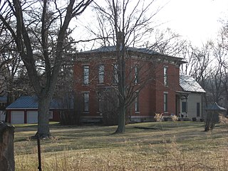
Steiners Corner is a ghost town in Lincoln Township, Morrow County, in the U.S. state of Ohio. [1]

Ghost town city depopulated of inhabitants and that stays practically intact

A ghost town is an abandoned village, town, or city, usually one that contains substantial visible remains. A town often becomes a ghost town because the economic activity that supported it has failed, or due to natural or human-caused disasters such as floods, prolonged droughts, government actions, uncontrolled lawlessness, war, pollution, or nuclear disasters. The term can sometimes refer to cities, towns, and neighbourhoods that are still populated, but significantly less so than in past years; for example, those affected by high levels of unemployment and dereliction.

Lincoln Township, Morrow County, Ohio Township in Ohio, United States

Lincoln Township is one of the sixteen townships of Morrow County, Ohio, United States. The 2010 census found 2,063 people in the township, 258 of whom lived in the village of Fulton.

Morrow County, Ohio county in Ohio, United States

Morrow County is a county located in the U.S. state of Ohio. As of the 2010 census, the population was 34,827. Its county seat is Mount Gilead. The county was organized in 1848 from parts of four neighboring counties and named for Jeremiah Morrow, Governor of Ohio from 1822 to 1826. Shawnee people used the area for hunting purposes before white settlers arrived in the early 19th century.

History

The town was named for William Steiner, a pioneer settler. Steiner "built his cabin on the Sunbury road, a little south of where the Cardington and Chesterville pike crosses this road". [2]

Related Research Articles

Blooming Grove, Ohio human settlement in United States of America

Blooming Grove is an unincorporated community in northeastern North Bloomfield Township, Morrow County, Ohio, United States. The community is located at the junction of State Route 97 and Morrow County Road 20. The nearest city is Galion, Ohio, located to the northwest. Mount Gilead, the county seat of Morrow County, is located southwest of Blooming Grove on State Route 61.

Iberia, Ohio census designated place

Iberia is a census-designated place in western Washington Township, Morrow County, Ohio, United States. The community is served by the Northmor Local School District which formerly operated Iberia Elementary School in the community. Iberia is near to Galion, and Martel. The ZIP code assigned to Iberia by the United States Postal Service is 43325. The current population of Iberia is less than 200 as of the 2000 census. Iberia is northwest of Mount Gilead, the county seat.

Denmark, Ohio human settlement in United States of America

Denmark is an unincorporated community in Morrow County, in the U.S. state of Ohio.

Aaronsburg is an extinct town in Morrow County, in the U.S. state of Ohio.

Bloomfield is an unincorporated community in Morrow County, in the U.S. state of Ohio.

Climax is an unincorporated community in Morrow County, in the U.S. state of Ohio.

Fargo is an unincorporated community in Morrow County, in the U.S. state of Ohio.

Florida Grove is a ghost town in Morrow County, in the U.S. state of Ohio.

Jamestown is a ghost town in Morrow County, in the U.S. state of Ohio.

Morehouse is a ghost town in Morrow County, in the U.S. state of Ohio.

Moshers Mill is a ghost town in Gilead Township, Morrow County, in the U.S. state of Ohio.

North Woodbury is an unincorporated community in Morrow County, in the U.S. state of Ohio.

Pulaskiville is an unincorporated community in Morrow County, in the U.S. state of Ohio.

Rome is a ghost town in South Bloomfield Township, Morrow County, in the U.S. state of Ohio.

Saint James is an unincorporated community in Morrow County, in the U.S. state of Ohio.

South Woodbury is an unincorporated community in Morrow County, in the U.S. state of Ohio.

Steam Corners is an unincorporated community in Morrow County, in the U.S. state of Ohio.

Vails Corners is an unincorporated community in Morrow County, in the U.S. state of Ohio.

West Liberty is an unincorporated community in Morrow County, in the U.S. state of Ohio.

Williamsport is an unincorporated community in Morrow County, in the U.S. state of Ohio.

References

Coordinates: 40°28′53″N82°49′14″W / 40.48139°N 82.82056°W / 40.48139; -82.82056

Geographic coordinate system Coordinate system

A geographic coordinate system is a coordinate system that enables every location on Earth to be specified by a set of numbers, letters or symbols. The coordinates are often chosen such that one of the numbers represents a vertical position and two or three of the numbers represent a horizontal position; alternatively, a geographic position may be expressed in a combined three-dimensional Cartesian vector. A common choice of coordinates is latitude, longitude and elevation. To specify a location on a plane requires a map projection.