Related Research Articles

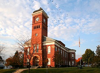
Morrow County is a county located in the central portion of the U.S. state of Ohio. As of the 2020 census, the population was 34,950. Its county seat is Mount Gilead. The county was organized in 1848 from parts of four neighboring counties and named for Jeremiah Morrow who was the Governor of Ohio from 1822 to 1826. Shawnee people used the area for hunting purposes before white settlers arrived in the early 19th century. Morrow County is included in the Columbus, OH Metropolitan Statistical Area. In 2010, the center of population of Ohio was located in Morrow County, near the village of Marengo. Morrow County's historic World War I Victory Shaft, unique in the United States, is located in the center of downtown Mount Gilead. Other areas interesting to the tourist include: Mount Gilead State Park; Amish farms and businesses near Johnsville and Chesterville; the Mid-Ohio Sports Car Course near Steam Corners; the rolling Allegheny foothills of eastern Morrow County; the site of the birthplace of President Warren G. Harding near Blooming Grove; the site of the former Ohio Central College in Iberia; the early 19th-century architecture of buildings in Chesterville, Ohio; the Revolutionary War Soldiers' Memorial in Mount Gilead; the Civil War monument in Cardington; and the mid-19th-century architecture of the Morrow County Courthouse and Old Jail in Mount Gilead.
Ohio's at-large congressional district existed from 1803 to 1813, from 1913 to 1915, from 1933 to 1953 and from 1963 until 1967, when it was banned by the Voting Rights Act of 1965.

Blooming Grove is an unincorporated community in northeastern North Bloomfield Township, Morrow County, Ohio, United States. The community is located at the junction of State Route 97 and Morrow County Road 20. The nearest city is Galion, Ohio, located to the northwest. Mount Gilead, the county seat of Morrow County, is located southwest of Blooming Grove on State Route 61.

The Kokosing River (ko-KO-sing) is a tributary of the Walhonding River, 57.2 miles (92.1 km) long, in east-central Ohio in the United States. Via the Walhonding, Muskingum and Ohio Rivers, it is part of the watershed of the Mississippi River, draining an area of 482 square miles (1248 km2). Etymologically, "Kokosing" translates roughly to "River of Little Owls." The Kokosing River rises in Morrow County, northeast of Mount Gilead, and initially flows southwardly. It turns eastwardly near Chesterville and flows through Knox and Coshocton Counties, passing the communities of Mount Vernon, Gambier and Howard. In western Coshocton County the Kokosing joins the Mohican River to form the Walhonding River, about 2 miles (3 km) northwest of Nellie.

Denmark is an unincorporated community in Morrow County, in the U.S. state of Ohio.
Aaronsburg is an extinct town in Morrow County, in the U.S. state of Ohio.
Bloomfield is an unincorporated community in Morrow County, in the U.S. state of Ohio.
Fargo is an unincorporated community in Morrow County, in the U.S. state of Ohio.

Florida Grove is a ghost town in Morrow County, in the U.S. state of Ohio.
Jamestown is a ghost town in Morrow County, in the U.S. state of Ohio.

Moshers Mill is a ghost town in Gilead Township, Morrow County, in the U.S. state of Ohio.

North Woodbury is an unincorporated community in Morrow County, in the U.S. state of Ohio.
Rome is a ghost town in South Bloomfield Township, Morrow County, in the U.S. state of Ohio.
Saint James is an unincorporated community in Morrow County, in the U.S. state of Ohio.
South Woodbury is an unincorporated community in Morrow County, in the U.S. state of Ohio.
Steiners Corner is a ghost town in Lincoln Township, Morrow County, in the U.S. state of Ohio.
Vails Corners is an unincorporated community in Morrow County, in the U.S. state of Ohio.
West Liberty is an unincorporated community in Morrow County, in the U.S. state of Ohio.
West Point is an unincorporated community in Morrow County, in the U.S. state of Ohio.
Williamsport is an unincorporated community in Morrow County, in the U.S. state of Ohio.
References
- ↑ "Morehouse (historical)". Geographic Names Information System . United States Geological Survey, United States Department of the Interior.
- 1 2 Baughman, Abraham J.; Bartlett, Robert Franklin (1911). History of Morrow County, Ohio: A Narrative Account of Its Historical Progress, Its People, and Its Principal Interests. Lewis Publishing Company. p. 435.
40°24′25″N82°54′03″W / 40.40694°N 82.90083°W
