Cardington, Ohio

Last updated

Cardington, Ohio
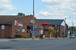
Main east of railroad, Cardington.jpg
OHMap-doton-Cardington.png
Location of Cardington, Ohio
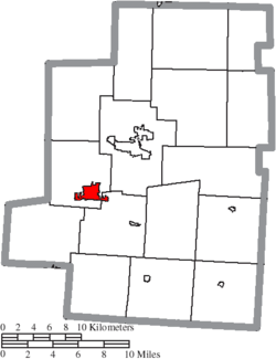
Map of Morrow County Ohio Highlighting Cardington Village.png
Location of Cardington in Morrow County
Coordinates: 40°29′53″N82°53′33″W / 40.49806°N 82.89250°W / 40.49806; -82.89250
Country United States
State Ohio
County Morrow
Township Cardington, Lincoln
Area
[1]
  Total2.01 sq mi (5.20 km2)
  Land2.01 sq mi (5.20 km2)
  Water0.00 sq mi (0.00 km2)
Elevation
[2]
1,014 ft (309 m)
Population
 (2020)
  Total2,079
  Estimate 
(2023) [3]
2,101
  Density1,036.39/sq mi (400.10/km2)
Time zone UTC-5 (Eastern (EST))
  Summer (DST) UTC-4 (EDT)
ZIP code
43315
Area code 419
FIPS code 39-12084 [4]
GNIS feature ID2397552 [2]
Website www.cardington.org

Cardington is a village in Morrow County, Ohio, United States. The population was 2,051 at the 2020 census. Mount Gilead, Ohio, the county seat, is located northeast of Cardington on U.S. Route 42.

Contents

History

A post office called Cardington was established in 1827. [5] Cardington was named for the first industrial tool the town had, the carding machine. [6] The village itself was founded in 1836.

A series of tornadoes on June 11 and 13, 1981, each killing four people, destroyed a significant portion of the village. [7] [8]

Geography

Cardington is considered to be a part of "Central Ohio".

According to the United States Census Bureau, the village has a total area of 2.01 square miles (5.21 km2), all of it land. [9]

Demographics

Historical population
CensusPop.Note
1850 292
1860 846189.7%
1870 9188.5%
1880 1,36548.7%
1890 1,4284.6%
1900 1,354−5.2%
1910 1,349−0.4%
1920 1,109−17.8%
1930 1,1927.5%
1940 1,3049.4%
1950 1,46512.3%
1960 1,61310.1%
1970 1,7307.3%
1980 1,665−3.8%
1990 1,7706.3%
2000 1,8494.5%
2010 2,04710.7%
2020 2,0791.6%
2023 (est.)2,101 [3] 1.1%
U.S. Decennial Census [10]

2010 census

As of the census [11] of 2010, there were 2,047 people, 792 households, and 526 families living in the village. The population density was 1,018.4 inhabitants per square mile (393.2/km2). There were 911 housing units at an average density of 453.2 per square mile (175.0/km2). The racial makeup of the village was 97.9% White, 0.1% African American, 0.2% Asian, 0.4% from other races, and 1.3% from two or more races. Hispanic or Latino of any race were 0.8% of the population.

There were 792 households, of which 42.3% had children under the age of 18 living with them, 42.6% were married couples living together, 18.4% had a female householder with no husband present, 5.4% had a male householder with no wife present, and 33.6% were non-families. 28.2% of all households were made up of individuals, and 9% had someone living alone who was 65 years of age or older. The average household size was 2.57 and the average family size was 3.13.

The median age in the village was 33.5 years. 30.6% of residents were under the age of 18; 8.5% were between the ages of 18 and 24; 27.8% were from 25 to 44; 23% were from 45 to 64; and 10% were 65 years of age or older. The gender makeup of the village was 48.2% male and 51.8% female.

2000 census

As of the census [4] of 2000, there were 1,849 people, 754 households, and 486 families living in the village. The population density was 992.2 inhabitants per square mile (383.1/km2). There were 804 housing units at an average density of 431.4 per square mile (166.6/km2). The racial makeup of the village was 98.22% White, 0.32% African American, 0.32% Native American, 0.05% Asian, 0.32% from other races, and 0.76% from two or more races. Hispanic or Latino of any race were 0.22% of the population.

There were 754 households, out of which 34.1% had children under the age of 18 living with them, 45.6% were married couples living together, 14.3% had a female householder with no husband present, and 35.5% were non-families. 30.0% of all households were made up of individuals, and 11.7% had someone living alone who was 65 years of age or older. The average household size was 2.45 and the average family size was 3.06.

In the village, the population was spread out, with 28.4% under the age of 18, 8.8% from 18 to 24, 29.5% from 25 to 44, 21.6% from 45 to 64, and 11.6% who were 65 years of age or older. The median age was 33 years. For every 100 females there were 91.6 males. For every 100 females age 18 and over, there were 84.3 males.

The median income for a household in the village was $30,500, and the median income for a family was $36,823. Males had a median income of $31,483 versus $21,141 for females. The per capita income for the village was $14,057. About 16.5% of families and 16.7% of the population were below the poverty line, including 22.1% of those under age 18 and 7.2% of those age 65 or over.
Notable people

Related Research Articles

<span class="mw-page-title-main">Morrow County, Ohio</span> County in Ohio, United States

Morrow County is a county located in the central portion of the U.S. state of Ohio. As of the 2020 census, the population was 34,950. Its county seat is Mount Gilead. The county was organized in 1848 from parts of four neighboring counties and named for Jeremiah Morrow who was the Governor of Ohio from 1822 to 1826. Shawnee people used the area for hunting purposes before white settlers arrived in the early 19th century. Morrow County is included in the Columbus, OH Metropolitan Statistical Area. In 2010, the center of population of Ohio was located in Morrow County, near the village of Marengo.

<span class="mw-page-title-main">Marion County, Ohio</span> County in Ohio, United States

Marion County is a county located in the U.S. state of Ohio. As of the 2020 census, the population was 65,359. Its county seat is Marion. The county was created in 1820 and later organized in 1824. It is named for General Francis "The Swamp Fox" Marion, a South Carolinian officer in the Revolutionary War. Marion County comprises the Marion, OH Micropolitan Statistical Area, which is also included in the Columbus-Marion-Zanesville, OH Combined Statistical Area.

<span class="mw-page-title-main">Mount Orab, Ohio</span> City in Ohio, United States

Mount Orab is a village in Brown County, Ohio, United States. The population is 4,347 as of the 2020 United States census.

<span class="mw-page-title-main">Moscow, Ohio</span> Village in Ohio, United States

Moscow is a village in Clermont County, Ohio. The population was 155 at the time of the 2020 census. The William H. Zimmer Power Station, a coal-fired power plant that was converted from a planned nuclear power plant during construction, is partially located within village limits. It is located near the Ulysses S. Grant Birthplace.

<span class="mw-page-title-main">North Robinson, Ohio</span> Village in Ohio, United States

North Robinson is a village in Crawford County, Ohio, United States. The population was 219 at the 2020 census.

<span class="mw-page-title-main">Addyston, Ohio</span> Village in Ohio, United States

Addyston is a village in Miami Township, Hamilton County, Ohio, United States. Located along the Ohio River, it is a western suburb of the neighboring city of Cincinnati. The population was 927 at the 2020 census.

<span class="mw-page-title-main">Cleves, Ohio</span> Village in Ohio, United States

Cleves is a village in Miami Township, Hamilton County, Ohio, United States. Located along the Ohio River, it is a western suburb of Cincinnati. The population was 3,414 at the 2020 census.

<span class="mw-page-title-main">Evendale, Ohio</span> Village in Ohio, United States

Evendale is a village in Hamilton County, Ohio, United States, within the Cincinnati metropolitan area. The population was 2,669 at the 2020 census.

<span class="mw-page-title-main">Hebron, Ohio</span> Village in Ohio, USA

Hebron is a village in Licking County, Ohio, United States. The population was 2,326 at the 2020 census.

<span class="mw-page-title-main">Russells Point, Ohio</span> Village in Ohio, United States

Russells Point is a village located in northwest Logan County, Ohio, United States. The population was 1,320 at the 2020 census. It is situated on Indian Lake, which had long been a popular summer resort destination.

<span class="mw-page-title-main">Brunswick, Ohio</span> City in Ohio, United States

Brunswick is the largest city in Medina County, Ohio, United States, approximately 20 miles (32 km) southwest of Cleveland. The population was 35,426 at the 2020 census. It is part of the Cleveland metropolitan area.

<span class="mw-page-title-main">Trotwood, Ohio</span> City in Ohio, United States

Trotwood is a city in Montgomery County, Ohio, United States. The population was 23,070 at the 2020 census. A suburb of Dayton, it is part of the Dayton metropolitan area. The city is served by the Trotwood-Madison City School District.

<span class="mw-page-title-main">Otway, Ohio</span> Village in Ohio, United States

Otway is a village in Scioto County, Ohio, United States. The population was 92 at the 2020 census.

<span class="mw-page-title-main">Masury, Ohio</span> Census-designated place in Ohio, United States

Masury is an unincorporated community and census-designated place in eastern Trumbull County, Ohio, United States. The population was 2,001 at the 2020 census. It is part of the Youngstown–Warren metropolitan area.

<span class="mw-page-title-main">Newton Falls, Ohio</span> Village in Ohio, United States

Newton Falls is a village in southwestern Trumbull County, Ohio, United States. The population was 4,557 at the 2020 census. It is part of the Youngstown–Warren metropolitan area. The city takes its name from the two sets of waterfalls within the village, each on different branches of the Mahoning River. The city is known for its notable ZIP code (44444) and for its covered bridge, which is the second oldest in the state of Ohio.

<span class="mw-page-title-main">Harveysburg, Ohio</span> Village in Ohio, United States

Harveysburg is a village in Massie Township, Warren County, Ohio, United States. The population was 554 at the 2020 census. It is best known as the home of the Ohio Renaissance Festival.

<span class="mw-page-title-main">Cygnet, Ohio</span> Village in Ohio, United States

Cygnet is a village in Wood County, Ohio, United States. The population was 543 at the 2020 census.

<span class="mw-page-title-main">Millbury, Ohio</span> Village in Ohio, United States

Millbury is a village in Wood County, Ohio, United States. The population was 1,193 at the 2020 census.

<span class="mw-page-title-main">Wilson, Ohio</span> Village in Ohio, United States

Wilson is a village in Belmont and Monroe counties in the U.S. state of Ohio. The population was 129 at the 2020 census. It is part of the Wheeling metropolitan area.

<span class="mw-page-title-main">Black Earth, Wisconsin</span> Village in Wisconsin, United States

Black Earth is a village in Dane County, Wisconsin, United States. The population was 1,338 at the 2010 census. The village is located within the Town of Black Earth. It is part of the Madison Metropolitan Statistical Area.

References

  1. "ArcGIS REST Services Directory". United States Census Bureau. Retrieved September 20, 2022.
  2. 1 2 U.S. Geological Survey Geographic Names Information System: Cardington, Ohio
  3. 1 2 "Annual Estimates of the Resident Population for Incorporated Places in Ohio: April 1, 2020 to July 1, 2023". United States Census Bureau. Retrieved June 8, 2024.
  4. 1 2 "U.S. Census website". United States Census Bureau . Retrieved January 31, 2008.
  5. "Morrow County". Jim Forte Postal History. Retrieved December 15, 2015.
  6. Gannett, Henry (1905). The Origin of Certain Place Names in the United States. Govt. Print. Off. pp.  69.
  7. "Cardington's Tornado in 1981". Marlen Duane Steward. Retrieved March 23, 2016.
  8. "Cardington, Ohio Tornado News Footage (WBNS 10TV)". YouTube . Archived from the original on December 11, 2021. Retrieved March 23, 2016.
  9. "US Gazetteer files 2010". United States Census Bureau. Archived from the original on July 2, 2012. Retrieved January 6, 2013.
  10. "Census of Population and Housing". Census.gov. Retrieved June 4, 2015.
  11. "U.S. Census website". United States Census Bureau . Retrieved January 6, 2013.