
is a municipality in the district of Nordfriesland, in Schleswig-Holstein, Germany.

Albersdorf is a municipality in the district of Dithmarschen, in Schleswig-Holstein, Germany. It is situated near the Kiel Canal, approx. 14 km southeast of Heide. The place was first mentioned in 1281 under the name Aluerdesdorpe, meaning "village of the old custodian." Albersdorf is part of the Amt Mitteldithmarschen.

Sankt Peter-Ording is a popular German seaside spa and a municipality in the district of Nordfriesland, in Schleswig-Holstein, Germany. It is the only German seaside resort that has a sulphur spring and thus terms itself "North Sea spa and sulphur spring". By overnight stays, St. Peter-Ording is the largest seaside resort and has the most overnight stays in the state of Schleswig-Holstein.
Heiligenhafen is a town in the district of Ostholstein, in Schleswig-Holstein, Germany. It is situated on the Baltic Sea coast, opposite the island Fehmarn, approx. 60 km northeast of Lübeck, and 55 km east of Kiel.
Bosau is a municipality on the Great Plön Lake the district of Ostholstein, in Schleswig-Holstein, Germany. It is situated approximately 13 km west of Eutin, and 30 km southeast of the state capital of Kiel.
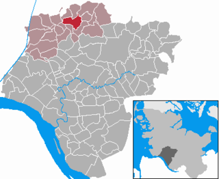
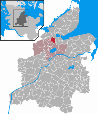
Aukrug is a municipality in the district of Rendsburg-Eckernförde, in Schleswig-Holstein, Germany. It is situated approximately 13 km west of Neumünster, and 35 km southwest of Kiel.

Süderbrarup is a municipality in the district of Schleswig-Flensburg, in Schleswig-Holstein, Germany. It is situated on the north side of the Schlei, approx. 20 km northeast of Schleswig, and 30 km southeast of Flensburg. Süderbrarup is known for the Thorsberg moor archeological site.

Tolk is a municipality in the district of Schleswig-Flensburg, in Schleswig-Holstein, Germany. It is situated approximately 8 km northeast of Schleswig, and 26 km southeast of Flensburg.
Schenefeld is a municipality in the district of Steinburg, in Schleswig-Holstein, Germany. It is situated approximately 14 km north of Itzehoe.

Großhansdorf is a municipality in the district of Stormarn, in Schleswig-Holstein, Germany. It is situated approximately 3 km east of Ahrensburg, and 25 km northeast of Hamburg.

Bredenbek is a municipality, located in the district of Rendsburg-Eckernförde in the German Bundesland of Schleswig-Holstein.

Bälau is a municipality in the Breitenfelde collective municipality (Amt) located in the Lauenburg district (Kreis) in southeastern Schleswig-Holstein, Germany.

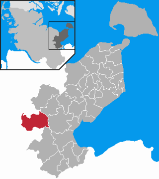
Westerhever is a municipality in Nordfriesland in the German state of Schleswig-Holstein.

Heidmühlen is a municipality in the district of Segeberg in Schleswig-Holstein, Germany. It contains the areas of Mühlenholz and Klint.

is a municipality and seaside resort on the island Sylt, in the district of Nordfriesland, in Schleswig-Holstein, Germany. It is located north of the island's main town, Westerland. The municipality is part of the AmtLandschaft Sylt. The local economy is dominated by tourism.

Tasdorf is a municipality in the district of Plön, in Schleswig-Holstein, Germany. Tasdorf was first mentioned in documents dating to the year 1141 AD. The current population is about 360 people; the size of the municipal area amounts to roughly 5 km². Tasdorf is located in the northeastern city limits of Neumünster. The closed railroad line from Neumünster to Ascheberg ran to the south of the village. The brook Dosenbek flows from the nature reserve Dosenmoor to Neumünster through the village municipal area.
Osterby is a municipality in the district of Rendsburg-Eckernförde, in Schleswig-Holstein, Germany. It is mostly rural.

Neuendorf-Sachsenbande is a municipality in Wilstermarsch, in the district of Steinburg, in Schleswig-Holstein, Germany. The town is notable for containing the lowest accessible point in Germany, which is 3.54 m (11.61 ft) below sea level.

Witzhave is a municipality in the district of Stormarn, in Schleswig-Holstein, Germany.

The Sachsenwald is a forest near Hamburg, Germany. The forest derives its name, which can be translated as 'Saxon woods' or 'Saxony forest', from being located in the former Duchy of Saxe-Lauenburg, which itself is a part of the greater Lower Saxony region as defined by the former Duchy of Saxony. Today, the forest is an unincorporated area in the district of Herzogtum Lauenburg in Schleswig-Holstein. It is also a member of the amt Hohe Elbgeest, in which it has non-voting representation. The Sachsenwald has an area of 68 km2.


