Stephens, Kentucky

Last updated
Stephens, Kentucky
Unincorporated community
USA Kentucky location map.svg
Red pog.svg
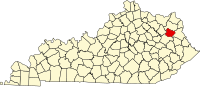
Stephens
Location within the state of Kentucky
Usa edcp location map.svg
Red pog.svg
Stephens
Stephens (the US)
Coordinates: 38°8′7″N82°57′32″W / 38.13528°N 82.95889°W / 38.13528; -82.95889 Coordinates: 38°8′7″N82°57′32″W / 38.13528°N 82.95889°W / 38.13528; -82.95889
Country United States
State Kentucky
County Elliott
Elevation 628 ft (191 m)
Time zone Eastern (EST) (UTC-5)
  Summer (DST) EDT (UTC-4)
GNIS feature ID 509125

Stephens is an unincorporated community in Elliott County, Kentucky, United States. It lies along Routes 409 and 486 northeast of the city of Sandy Hook, the county seat of Elliott County. [1] Its elevation is 628 feet (208 m). [2]

Unincorporated area Region of land not governed by own local government

In law, an unincorporated area is a region of land that is not governed by a local municipal corporation; similarly an unincorporated community is a settlement that is not governed by its own local municipal corporation, but rather is administered as part of larger administrative divisions, such as a township, parish, borough, county, city, canton, state, province or country. Occasionally, municipalities dissolve or disincorporate, which may happen if they become fiscally insolvent, and services become the responsibility of a higher administration. Widespread unincorporated communities and areas are a distinguishing feature of the United States and Canada. In most other countries of the world, there are either no unincorporated areas at all, or these are very rare; typically remote, outlying, sparsely populated or uninhabited areas.

Elliott County, Kentucky county in Kentucky, United States

Elliott County is a county located in the U.S. state of Kentucky. As of the 2010 census, the population was 7,852. Its county seat is Sandy Hook. The county was formed in 1869 from parts of Morgan, Lawrence, and Carter counties, and is named for John Milton Elliott, U.S. Congressman; Confederate Justice of the Kentucky Court of Appeals. In regard to alcohol sales, Elliott County is a dry county, meaning the sale of alcoholic beverages is prohibited everywhere in the county.

Kentucky State of the United States of America

Kentucky, officially the Commonwealth of Kentucky, is a state located in the east south-central region of the United States. Although styled as the "State of Kentucky" in the law creating it, (because in Kentucky's first constitution, the name state was used) Kentucky is one of four U.S. states constituted as a commonwealth. Originally a part of Virginia, in 1792 Kentucky became the 15th state to join the Union. Kentucky is the 37th most extensive and the 26th most populous of the 50 United States.

Related Research Articles

Athol, Kentucky Unincorporated community in Kentucky, United States

Athol is an unincorporated community in Lee County, Kentucky, United States. It lies along Route 52 east of the city of Beattyville, the county seat of Lee County. Its elevation is 761 feet (232 m). Although it is unincorporated, it has a post office, with the ZIP code of 41307.

Isonville, Kentucky Unincorporated community in Kentucky, United States

Isonville is an unincorporated community in Elliott County, Kentucky, United States. It lies along Routes 32 and 486 east of the city of Sandy Hook, the county seat of Elliott County. Its elevation is 709 feet (216 m). Although it is unincorporated, it has a post office, with the ZIP code of 41149.

Culver, Kentucky Unincorporated community in Kentucky, United States

Culver is an unincorporated community in Elliott County, Kentucky, United States. It lies along Route 486 east of the city of Sandy Hook, the county seat of Elliott County. Its elevation is 735 feet (224 m).

Gimlet, Kentucky Unincorporated community in Kentucky, United States

Gimlet is an unincorporated community in Elliott County, Kentucky, United States. It lies along Route 504 north of the city of Sandy Hook, the county seat of Elliott County. Its elevation is 1,102 feet (336 m).

Little Sandy, Kentucky Unincorporated community in Kentucky, United States

Little Sandy is an unincorporated community in Elliott County, Kentucky, United States. It lies along Route 7 southwest of the city of Sandy Hook, the county seat of Elliott County. Its elevation is 787 feet (240 m).

Lytten, Kentucky Unincorporated community in Kentucky, United States

Lytten is an unincorporated community in Elliott County, Kentucky, United States. It lies along Route 173 west of the city of Sandy Hook, the county seat of Elliott County. Its elevation is 1,155 feet (352 m).

Newfoundland, Kentucky Unincorporated community in Kentucky, United States

Newfoundland is an unincorporated community in Elliott County, Kentucky, United States. It lies along Routes 7 and 32 north of the city of Sandy Hook, the county seat of Elliott County. Its elevation is 643 feet (196 m).

Falcon, Kentucky Unincorporated community in Kentucky, United States

Falcon is an unincorporated community in Magoffin County, Kentucky, United States. It lies along Route 40 northeast of the city of Salyersville, the county seat of Magoffin County. Its elevation is 974 feet (297 m). Although it is unincorporated, it has a post office, with the ZIP code of 41426.

Hendricks, Kentucky Unincorporated community in Kentucky, United States

Hendricks is an unincorporated community in Magoffin County, Kentucky, United States. It lies along Route 30 south of the city of Salyersville, the county seat of Magoffin County. Its elevation is 876 feet (267 m).

Sublett, Kentucky Unincorporated community in Kentucky, United States

Sublett is an unincorporated community in Magoffin County, Kentucky, United States. It lies along Route 7 southeast of the city of Salyersville, the county seat of Magoffin County. Its elevation is 883 feet (269 m).

Swampton, Kentucky Unincorporated community in Kentucky, United States

Swampton is an unincorporated community in Magoffin County, Kentucky, United States. It lies along Route 7 southeast of the city of Salyersville, the county seat of Magoffin County. Its elevation is 919 feet (280 m).

Wheelersburg, Kentucky Unincorporated community in Kentucky, United States

Wheelersburg is an unincorporated community in Magoffin County, Kentucky, United States. It lies along Route 1081 northeast of the city of Salyersville, the county seat of Magoffin County. Its elevation is 853 feet (260 m).

Wonnie, Kentucky Unincorporated community in Kentucky, United States

Wonnie is an unincorporated community in Magoffin County, Kentucky, United States. It lies along U.S. Route 460 and Kentucky Route 1081 northwest of the city of Salyersville, the county seat of Magoffin County. Its elevation is 814 feet (248 m).

Caney, Kentucky Unincorporated community in Kentucky, United States

Caney is an unincorporated community and coal town in Morgan County, Kentucky, United States. It lies along Route 191 south of the city of West Liberty, the county seat of Morgan County. Its elevation is 869 feet (265 m).

Cottle, Kentucky Unincorporated community in Kentucky, United States

Cottle is an unincorporated community in Morgan County, Kentucky, United States. It lies along U.S. Route 460 southeast of the city of West Liberty, the county seat of Morgan County. Its elevation is 801 feet (244 m).

Grassy Creek, Kentucky Unincorporated community in Kentucky, United States

Grassy Creek is an unincorporated community in Morgan County, Kentucky, United States. It lies along U.S. Route 460, southwest of the city of West Liberty, the county seat of Morgan County. Its elevation is 787 feet (240 m).

Lenox, Kentucky Unincorporated community in Kentucky, United States

Lenox is an unincorporated community and coal town in Morgan County, Kentucky, United States. It lies along Route 172, northeast of the city of West Liberty, the county seat of Morgan County. Its elevation is 797 feet (243 m).

Moon, Kentucky Unincorporated community in Kentucky, United States

Moon is an unincorporated community in Morgan County, Kentucky, United States. It lies along Kentucky Route 172 northeast of the city of West Liberty, Kentucky, the county seat of Morgan County. Its elevation is 755 feet (230 m). The community's post office, with the ZIP code of 41457, closed in 1997.

Mize, Kentucky Unincorporated community in Kentucky, United States

Mize is an unincorporated community in Morgan County, Kentucky, United States. It lies along U.S. Route 460 and Kentucky Route 203, southwest of the city of West Liberty, the county seat of Morgan County. Its elevation is 817 feet (249 m). Although it is unincorporated, it has a post office, with the ZIP code of 41352.

White Oak, Kentucky Unincorporated community in Kentucky, United States

White Oak is an unincorporated community in Morgan County, Kentucky, United States. It lies along U.S. Route 460 southeast of the city of West Liberty, the county seat of Morgan County. Its elevation is 801 feet (244 m).

References