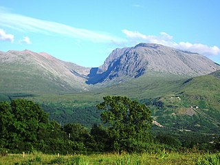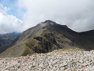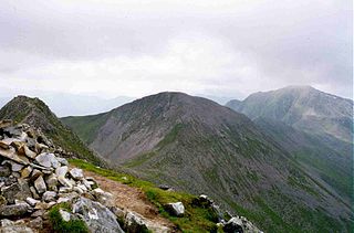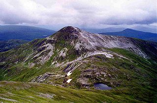
A Munro is defined as a mountain in Scotland with a height over 3,000 feet (914.4 m), and which is on the Scottish Mountaineering Club (SMC) official list of Munros; there is no explicit topographical prominence requirement. The best known Munro is Ben Nevis, the highest mountain in the British Isles at 4,413 feet (1,345 m).

Buachaille Etive Mòr, generally known to climbers simply as The Buachaille, is a mountain at the head of Glen Etive in the Highlands of Scotland. Its pyramidal form, as seen from the A82 road when travelling towards Glen Coe, makes it one of the most recognisable mountains in Scotland, and one of the most depicted on postcards and calendars.

Ben More is a mountain in the southern Highlands of Scotland, near Crianlarich. It is the highest of the so-called Crianlarich Hills to the south-east of the village, and there is no higher land in the British Isles south of Ben More. It is separated from Stob Binnein by the Bealach-eadar-dha Beinn, meaning "col between two hills". It is the highest peak in the Loch Lomond and The Trossachs National Park.

Bidean nam Bian, lying to the south of Glen Coe, Highland, Scotland, is the highest point in the former county of Argyll. It is a complex mountain, with many ridges and subsidiary peaks, one of which, Stob Coire Sgreamhach, is classified as a separate Munro.

Stob Binnein is a mountain in the southern Highlands of Scotland, near Crianlarich. It forms a twin-peak with Ben More 3,852 ft, from which it is separated by the Bealach-eadar-dha Beinn, meaning pass between two hills.

Meall a' Bhùiridh (IPA:[ˈmauɫ̪ˈaˈvuːɾʲɪʝ]) is a mountain on the edge of Rannoch Moor in the Highlands of Scotland. It lies near the top of Glen Coe and Glen Etive, overlooking the Kings House Hotel inn and the A82 road. The Glencoe Ski area is located on the northern slopes of the peak.

Ladhar Bheinn is the highest mountain in the Knoydart region of the Highlands of Scotland. It is the most westerly Munro on the Scottish mainland.

Binnein an Fhidhleir, one of the Arrochar Alps, is a mountain in southern Scotland. It is located above Butterbridge on the north side the A83 road facing Beinn an Lochain to the south. The mountain has several tops, including Creag Bhrosgan (711 m); Stob Coire Creagach, which replaced Binnein an Fhidhleir as the Marilyn in April 2006 at 817 m; one without any name at all at 748 metre; and Binnein an Fhidhleir itself, further to the west, at 811 m. Although Stob Coire Creagach is the highest summit, the name Binnein an Fhidhleir is generally used for the whole mountain.

Mullach nan Coirean is a Scottish mountain situated in the Mamores group of hills. It reaches a height of 939 metres (3081 feet) and is located eight kilometres north-west of Kinlochleven. It is the most westerly of the ten Munros in the Mamores and it is connected to the adjoining mountain of Stob Bàn by a bealach with a height of 846 metres; these two Munros are often climbed together from Glen Nevis. The mountain's name translates from the Gaelic as Summit of the Corries or Top of the Corries and this is quite fitting as Mullach nan Coirean has four corries on its slopes. Mullach can also mean a "roof". However it is unusual that the name does not include reference to the mountain's distinct red tinge cause by its red granite rock.

Stob Coire a’ Chàirn is a Scottish mountain situated in the Mamores range, 3.5 kilometres north of Kinlochleven. The mountain reaches a height of 981 metres (3218 feet) and is regarded as one of the more modest peaks of the ten Munros in the Mamores, indeed for many years it was not named on OS maps. Despite this, it is situated at a strategically important point and could be said to be the most central of the group with three ridges radiating out to other Munros. The mountains name translates from Gaelic as “Peak of the Corrie of the Cairn”.

Stob Bàn is a mountain situated in the Lochaber region of Highland, Scotland, 16 kilometres east of Fort William. It reaches a height of 977 metres (3205 feet) and lies in a group of hills known as the Grey Corries which includes three other Munros and nine Munro "Tops" along an eight kilometre ridge. The mountain's name translate as “White Peak”, while other sources give the translation as Light Coloured Peak with the hill being covered in light coloured schist scree, in contrast to the rest of the Grey Corries which are made up of grey quartzite scree. The mountain is a prominent conical shape, isolated from the rest of the group and distant from any main roads. It should not be confused with another Munro named Stob Bàn situated in the Mamores.

Stob Coire Easain is a Scottish Munro mountain which reaches a height of 1115 metres (3658 feet), situated 18 kilometres east of Fort William. It stands on the western side of Loch Treig, along with its "twin", the Munro Stob a' Choire Mheadhoin. Collectively the pair are called "The Easains" or the "Stob Corries" and stand just one kilometre apart connected by a high col with an approximate height of 965 metres. The fine corrie of Coire Easain Beag lies in between the two mountains facing north west. Stob Coire Easain’s name translates from the Gaelic as “Peak of the Corrie of the Little Waterfall”. This mountain should not be confused with another Stob Coire Easain, a Munro “Top” on the Munro Stob Coire an Laoigh

Stob Ghabhar is a Scottish mountain nine kilometres (5.6 mi) north west of Bridge of Orchy. It is part of the Black Mount group of mountains and stands on the border of the Argyll and Bute and Highland council areas.

Stob a' Choire Odhair is a Scottish mountain situated eight kilometres north west of Bridge of Orchy on the border of the Argyll and Bute and Highland council areas.

Chno Dearg is a Scottish mountain situated 25 km east of Fort William, Highland in the Lochaber area of the Highland council area.

Stob a' Choire Mheadhoin is a mountain in the Scottish Highlands, it is situated 19 km east of Fort William in the Lochaber area of the Highland council area.

The 2009 Buachaille Etive Mòr avalanche happened on Buachaille Etive Mòr in Glen Coe in the Scottish Highlands, UK, on 24 January 2009. Three mountain climbers were killed and one sustained a serious shoulder injury. Two of the dead were from Northern Ireland and the other was from Scotland. Nine people from at least three countries in at least two parties were involved in the incident on a mountain that is well recognised by tourists to Scotland. While avalanches are not uncommon in the area, very few deaths are reported—this incident has been described as "one of the worst disasters in the Scottish mountains for decades".

Beinn a' Chrùlaiste is a mountain to the north of Glen Coe, in the Highlands of Scotland. The Mountain is rectangular, and can be seen from the A82 road and the Old Military Road. Also, when passing the A82, it is possible to see the summit of Stob Dearg. Beinn a' Chrulaiste stands at 857 m (2811 ft), making it a Corbett.

Stob Coir' an Albannaich is a mountain in the Grampian Mountains of Scotland. It lies on the border of Argyll and Bute and the Highlands area, south of Glen Etive.


