Taunton Municipal Airport, also known as King Field, is a public use airport located three nautical miles (6 km) east of the central business district of Taunton, a city in Bristol County, Massachusetts, United States. It is located in the East Taunton neighborhood of the city. The city-owned airport is maintained and operated by the Taunton Airport Commission. According to the FAA's National Plan of Integrated Airport Systems for 2009–2013, it is categorized as a general aviation airport.
Hugoton Municipal Airport is a county-owned public-use airport located two nautical miles southwest of the central business district of Hugoton, a city in Stevens County, Kansas, United States.
Plant City Airport is a public-use airport located two nautical miles (4 km) southwest of the central business district of Plant City in Hillsborough County, Florida, United States. The airport is publicly owned by the Hillsborough County Aviation Authority, which also operates Tampa International Airport. It was formerly known as Plant City Municipal Airport. It supports a 400-acre (1.6 km2) industrial park located about one mile (1.6 km) east of the airport.

Palatka Municipal Airport, also known as Lieutenant Kay Larkin Field, is a city-owned, public-use airport located two nautical miles (4 km) northwest of the central business district of Palatka, a city in Putnam County, Florida, United States. It is included in the National Plan of Integrated Airport Systems for 2011–2015, which categorized it as a general aviation facility.

Abbeville Municipal Airport is a city-owned, public-use airport located three nautical miles north of the central business district of Abbeville, a city in Henry County, Alabama, United States. It is the only airport that serves the city of Abbeville.

Fremont Municipal Airport is a city-owned public-use airport located three nautical miles (6 km) southwest of the central business district of Fremont, a city in Newaygo County, Michigan, United States. The airport in uncontrolled, and is used for general aviation purposes. Additionally, skydiving and ultralight activity is conducted at the field. It is included in the Federal Aviation Administration (FAA) National Plan of Integrated Airport Systems for 2017–2021, in which it is categorized as a local general aviation facility.

Florala Municipal Airport is a city-owned public-use airport located three nautical miles northeast of the central business district of Florala, a city in Covington County, Alabama, United States.
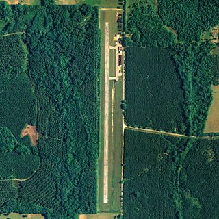
Greensboro Municipal Airport is a city-owned public-use airport located three nautical miles southwest of the central business district of Greensboro, a city in Hale County, Alabama, United States.

Grove Hill Municipal Airport is a city-owned public-use airport located two nautical miles southeast of the central business district of Grove Hill, a city in Clarke County, Alabama, United States. According to the FAA's National Plan of Integrated Airport Systems for 2009–2013, it is categorized as a general aviation facility.

Headland Municipal Airport is a city-owned, public-use airport located two nautical miles northeast of the central business district of Headland, a city in Henry County, Alabama, United States.

Russellville Municipal Airport, also known as Bill Pugh Field, is a city-owned public-use airport located three nautical miles southeast of the central business district of Russellville, a city in Franklin County, Alabama, United States. It is included in the FAA's National Plan of Integrated Airport Systems for 2011–2015, which categorized it as a general aviation facility.

Atkinson Municipal Airport is a city-owned, public-use airport located three nautical miles (6 km) northwest of the central business district of Pittsburg, a city in Crawford County, Kansas, United States. It is included in the National Plan of Integrated Airport Systems for 2011–2015, which categorized it as a general aviation facility.

Humboldt Municipal Airport is a city-owned public-use airport located one nautical mile (1.85 km) west of the central business district of Humboldt, a city in Humboldt County, Iowa, United States. According to the FAA's National Plan of Integrated Airport Systems for 2009–2013, it is classified as a general aviation airport.
Centerville Municipal Airport is a city-owned public-use airport located three nautical miles (6 km) southwest of the central business district of Centerville, a city in Appanoose County, Iowa, United States. According to the FAA's National Plan of Integrated Airport Systems for 2009–2013, it is categorized as a general aviation airport.
Caldwell Municipal Airport is a city-owned public-use airport located one nautical mile east of the central business district of Caldwell, a city in Sumner County, Kansas, United States.

Eureka Municipal Airport, also known as Lt. William M. Milliken Airport, is a city-owned, public-use airport located two nautical miles (4 km) north of the central business district of Eureka, a city in Greenwood County, Kansas, United States. It is included in the National Plan of Integrated Airport Systems for 2011–2015, which categorized it as a general aviation facility.
Stanton County Municipal Airport is a county-owned, public-use airport in Stanton County, Kansas, United States. It is located two nautical miles (4 km) northeast of the central business district of Johnson, Kansas, which is also known as Johnson City. This airport included in the National Plan of Integrated Airport Systems for 2011–2015, which categorized it as a general aviation facility.
Sublette Municipal Airport is a city-owned, public-use airport located one nautical mile (2 km) northeast of the central business district of Sublette, a city in Haskell County, Kansas, United States. It was formerly known as Sublette Flying Club Airport.

Stockton Municipal Airport is a city-owned, public-use airport located three nautical miles (6 km) southwest of the central business district of Stockton, a city in Cedar County, Missouri, United States.
Marion Municipal Airport is a city-owned, public-use airport located two nautical miles (4 km) southeast of the central business district of Marion, a city in Marion County, Kansas, United States.


